100% satisfaction guarantee Immediately available after payment Both online and in PDF No strings attached
logo-home
Summary A* Pearson Edexcel A level Geography Unit 1 Topic 2B Coastal Landscapes and Change Revision Notes $13.38
Add to cart

Summary

Summary A* Pearson Edexcel A level Geography Unit 1 Topic 2B Coastal Landscapes and Change Revision Notes

 1 purchase
  • Course
  • Institution
  • Book

This got me an A* for A level Edexcel Geography. It's my revision notes for Topic 2B Coasts which, like the rest of my geography notes, are filled with case studies, facts, diagrams, and explanations. I only used this for my revision for all my mocks and actual exam and got A*s in all. It's also go...

[Show more]

Preview 4 out of 35  pages

  • No
  • Topic 2b
  • August 27, 2022
  • 35
  • 2021/2022
  • Summary
avatar-seller
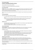
COASTS


2B.1A: The littoral zone consists of backshore, nearshore and offshore zones, includes a wide variety of coastal
types, and is a dynamic zone of rapid change.

Littoral Zone

The littoral zone is the area of shoreline where land is subject to wave action. This region is subdivided into:
 Offshore and subtidal zone – where water depths are greater than half the wavelength of incoming waves,
with limited sediment transfer by waves and where tidal currents are most effective. Examples of
geographical landmarks here include: continental shelf, coral reefs and estuaries
 Intertidal and nearshore zone – the area of shallow water beyond the low tide mark, within which friction
between the seabed and waves distorts the wave sufficiently to cause it to break. In addition, sediment
movement can occur. This zone can be further divided into:
o Breaker zone – where waves break. This zone varies in width depending upon the type of wave
approaching the shores. Geographical landmarks include: shore platforms
o Surf zone – broken waves travel towards the shore. Sediment movement may be onshore/offshore
or along the shore. Geographical landmarks include: wetlands, and bars which can occur on the
boundaries of the nearshore zone
o Swash zone – water travels up the shore as swash and moves back down as backwash. Geographical
landmarks include: a berm right at the boundary of the swash zone and backshore
 Foreshore zone – the area between the high tide and the low tide mark. Geographical landmarks include:
sand runnels and ridges
 Backshore zone – the area above the high tide mark, affected by wave action only under major storm
conditions. Cliffs, beaches and sand dunes may or may not be present.
 Onshore zone – regular land, which may have coastal towns or reclaimed land

Variety of coastal types

Rocky cliff coastline:
 Areas of high relief varying from a few metres to hundreds of metres in height
 Usually form in areas with resistant geology, in a high energy environment where erosion is greater than
deposition and big stormy destructive waves are frequent.
 E.g. Flamborough Head in Yorkshire

Sandy coastline:
 Areas of low relief with sand dunes and beaches, that are much flatter and shallower
 Usually form in areas with less resistant geology, low energy environment, where deposition is greater than
erosion and generally constructive waves

Estuarine coastline:
 Areas of low relief with salt marshes and mudflats (estuaries)
 They form in river mouths where deposition is greater than erosion in a low energy environment, usually in
areas of less resistant rock
 Lymington estuary in Hampshire

Dynamic zone of rapid change

There are constantly changing inputs, flows and outputs of energy and material which are classed as short-term
fluctuations such as varying degrees and rates of long-shore drift, evaporation, precipitation or erosion. Other
changes can also be considered short term such as high and low tide variation over the lunar month or wave energy
variation due to weather conditions.
However, these short-term changes can accumulate into long term changes, in accordance with other more global
factors such as more significant ENSO cycles, sea level variation due to climate change etc.

,2B.1B Coasts can be classified by using longer term criteria such as geology and changes of sea level or shorter-
term processes such as inputs from rivers, waves and tides.


Long Term Criteria

Geology is all the characteristics of land, including lithology (rock type) and structure (arrangement of rock units).
It can be used to classify coasts as rocky, sandy or estuarine or concordant and discordant.

Sea Level Change can be used to classify coasts as emergent or submergent.
This can be caused by:
 Tectonic processes can lift sections of land up, causing local sea fall, or lead sections of land to subside,
causing local sea rise.
 Climate change causes sea levels to rise and fall in a 100,000-year cycle due to the change in the Earth's orbit
shape.
o Sea levels fall for 90,000 years during glacial periods as ice sheets expand and rise for 10,000 during
interglacial periods
o Sea levels rise even more when the Earth emerges from an ice age and all surface ice melts

Short Term Criteria

Coasts receive energy inputs from waves (main input), tides (ebb and flow over a 12.5 hour cycle), currents. rivers,
atmospheric processes, gravity and tectonics. Can be used to classify coasts as high energy and low energy.

Coasts receive sediment inputs from waves and wind (vary constantly with weather), tides (ebb and flow over 12.5
hour cycle), currents, mass movement and tectonic processes. Sediment is then added to a coastline through
deposition and removed by erosion.
 Where erosion > deposition there is a net loss of sediment and the coastline retreats is an eroding coastline.
 Where deposition > erosion there is a net gain of sediment and the coastline advances is an outbuilding
coastline.

Long and short term classification

Coastlines are also classified as advancing or retreating due to long-term processes (emergent/submergent) and
short-term processes (outbuilding/eroding).

Classifications include:
 Straight vs. sinuous
 Hard resistant geology vs. soft less resistant geology
 Atlantic vs. Pacific
 Natural vs modified
 Advancing vs. Retreating
 Aquatic environments (estuaries) vs. Terrestrial (sand dunes)
 High energy vs. Low energy


2B.1C Rocky coasts (high and low relief) result from resistant geology (to the erosive forces of sea, rain and wind),
often in a high-energy environment, whereas coastal plain landscapes (sandy and estuarine coasts) are found near
areas of low relief and result from supply of sediment from direct terrestrial and offshore sources, often in a low-
energy environment.


Rocky coasts

,  Western and Northern Britain have rocky coastlines of igneous granite/basalt, which can withstand frequent
storms with little erosion. It also has compacted older sedimentary rocks like old sandstone and
metamorphic rocks (slates and schists)
 Resistant geology with generally igneous and metamorphic rocks
 High energy environment i.e. storms – marine erosion by wave action dominates
 Rate of erosion exceeds rate of deposition as a result
 Cliffs tend to be unvegetated, steep and with little rock debris at cliff foot due to high marine erosion
(however cliffs can be both high and low relief e.g. 427m Conachair Cliff on the Isle of Hirta in the Outer
Hebrides all the way to 3m at Chapel Porth in Cornwall)
 Exposed coasts facing prevailing winds with long wave fetches for most of the year (e.g. stretches of the
Atlantic-facing coasts like Cornwall and North West Scotland)
 Landforms include headlands, cliffs, shoreline platforms, cave-arch-stack-stump (e.g. Old Harry Rocks)

Coastal Plains (sandy and estuarine coastlines)

 Eastern and Southern Britain have coastal plain landscapes which consist of sedimentary rocks (chalks, clays,
sand and sandstone) – younger and weaker geology
 Coastal plains may be: sandy coasts composed of sands, shingles and cobbles or estuarine (alluvial) coasts
composed of muds (clays and silts)
 Relatively flat, low relief areas adjacent to the sea, with shallower, curved cliff profiles that may be vegetated
 Often in low energy environments
 Rate of deposition exceeds rate of erosion so coastal plans tend to form via coastal accretion, which is a
continuous net deposition of sediment that comes from offshore sources (transported by waves, tides or
current) and terrestrial sources (transported by rivers, glaciers, wind or mass movement). This can cause the
coastline to extend seawards. This is often extended biologically as plants colonise shallow water, trapping
sediment and forming organic deposits when they die.
 Sub-aerial processes (weathering and mass movement) as well as surface run-off erosion slowly move rock
and sediment downslope; but the limited marine wave erosion means there’s a lot of rock debris at cliff foot
 Sheltered coasts with limited fetch and low wind speeds (e.g. stretches of eastern UK coasts like Lincolnshire
and Norfolk)
 Landforms and features include tidal creeks, mud flats, salt marshes, lagoons, freshwater wetlands (due to
poor drainage of flat landscape)


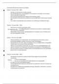
2B.2A Geological Structure is responsible for the formation of concordant and discordant coasts.


Concordant Coasts

Form when rock strata or folds (the different layers of rock within an area and how they relate to each other) run
parallel to the coast. The more resistant outer rock (e.g. granite) provides a protective barrier to the erosion of the
softer rocks (e.g. clays) further inland. Sometimes the outer hard rock is punctured, allowing the sea to erode the
softer rock. This can form a cove, a circular area of water with a relatively narrow entrance from the sea.

Discordant Coastline

Form when rock strata are aligned at an angle or perpendicular to the coastline, which can create successions and
crenelated pattern of projecting headlands and indented bays; less resistant rocks are eroded faster than more
resistant rocks, which leads to the formation of bays. Headlands and bays have an effect on incoming waves and can
cause wave refraction which is the process by which waves turn and lose energy around a headland on uneven
coastlines. The wave energy is focussed on the headlands, creating erosive features in these areas. The energy is
dissipated in bays, leading to the formation of features associated with lower energy environments such as beaches.

E.g. Cork coastline in the Republic of Ireland, or Swanage Bay in the Jurassic Coast of Devon, England.

, 2B.2B Geological Structure influences coastal morphology: Dalmatian and Haff type concordant coasts and
headlands and bays on Discordant coasts.


Morphology is the shape of landscape features and is influenced by geological structure (headlands and bays for
discordant, Dalmatian and Haff for concordant).

Concordant Coasts

Concordant coasts form where geological structure is such that different rock strata or folds are aligned parallel to
the coastline. A combination of geological structure and sea level rise produces the morphology of landforms aligned
parallel to the coastline.

South Dorset Coast
 A concordant coastline with resistant Portland Limestone forming a protective stratum parallel to the sea.
 Less resistant Purbeck limestone and Wealden Clay lie behind the Portland, with resistant chalk further
north.
 Portland limestone erodes very slowly, retreating landwards by marine undercutting and collapse to form a
straight W-E coastline.
 At points where the Portland is weaker, erosion has broken through and then rapidly eroded out the softer
strata laterally, creating a series of coves, e.g. Lulworth Cove and Stair Hole, with narrow openings, widening
laterally parallel to the coast.
 In places such as Worbarrow Bay and St Oswald's Bay, lateral widening of coves led to them joining into a
single bay, with remnants of the outer Portland left as a line of stumps parallel to the coast, e.g. Bull's Head
in St Oswald's Bay.
 Straight coastline now formed by a concordant band of constant chalk.

Dalmatian Coast of Croatia
 On the Adriatic Sea
 A concordant coastline produced by the geological structure of folds parallel to the coast.
 Tectonic forces produced by the collision of African and Eurasian plates compressed Carboniferous
Limestone during the Alpine Orogeny 50 million years ago.
 Created up folded ridges (anticlines) and down folded valleys (synclines) aligned parallel to the coast.
 Sea level rise at the end of the Devensian Glacial overtopped the low points of the anticlines and the sea
flooded synclines.
 This produces lines of narrow islands parallel to the coast formed by projecting sections of anticlines.
 Lines of islands separated by narrow sea channels parallel to the coast (sounds)

Haff Coastlines
 These form where deposition produces unconsolidated geological structures parallel to the coastline.
 During the Devensian glacial the sea level was about 100 m lower than today as water was retained in huge
ice sheets.
 Meltwater rivers on land beyond the ice front deposited thick layers of sand and gravels onto outwash plains
(sandurs)
 In the Holocene Interglacial constructive waves pushed the ride of sands and gravel landwards as sea levels
rose.
 Sand ridge formed bars across some bays and river mouths, with trapped river water forming a lagoon
behind (called haffs in Poland on the Baltic Sea)
 For example the Neman Haff behind the bar running from the Kaliningrad in Russia to the Lithuanian coast at
the mouth of the river Neman.
 Chesil Beach in Dorset was formed this way. Shingle ridge reconnected island of Portland Bill to land (a
tombolo)

Extra

Spits were formed in river mouths where the river was powerful enough to break through the sand ridge to the sea.
Paired spits formed parallel to the coast with haff lagoon behind at the mouth of the River Vistula in Gdansk.

The benefits of buying summaries with Stuvia:

Guaranteed quality through customer reviews

Guaranteed quality through customer reviews

Stuvia customers have reviewed more than 700,000 summaries. This how you know that you are buying the best documents.

Quick and easy check-out

Quick and easy check-out

You can quickly pay through credit card or Stuvia-credit for the summaries. There is no membership needed.

Focus on what matters

Focus on what matters

Your fellow students write the study notes themselves, which is why the documents are always reliable and up-to-date. This ensures you quickly get to the core!

Frequently asked questions

What do I get when I buy this document?

You get a PDF, available immediately after your purchase. The purchased document is accessible anytime, anywhere and indefinitely through your profile.

Satisfaction guarantee: how does it work?

Our satisfaction guarantee ensures that you always find a study document that suits you well. You fill out a form, and our customer service team takes care of the rest.

Who am I buying these notes from?

Stuvia is a marketplace, so you are not buying this document from us, but from seller himaniiyer. Stuvia facilitates payment to the seller.

Will I be stuck with a subscription?

No, you only buy these notes for $13.38. You're not tied to anything after your purchase.

Can Stuvia be trusted?

4.6 stars on Google & Trustpilot (+1000 reviews)

65507 documents were sold in the last 30 days

Founded in 2010, the go-to place to buy study notes for 15 years now

Start selling
$13.38  1x  sold
  • (0)
Add to cart
Added