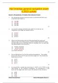
3. What is the final position after the following rhumb line tracks and
distances have been followed from position 60°00'N 030°00'W? South
for 3600 NM, East for 3600 NM, North for 3600NM, West for 3600 NM.
The final position of the aircraft is:
4. You are flying from A to B in the northern hemisphere. Your initial
great circle track is 273°T and conversion angle is 6°. The rhumb line
track from A to B is:
(a) 279°T
(b) 276°T
(c) 270°T
(d) 267°T
(1)
5. An aircraft flies a rhumb line track from A (160°E) to B (170°W) at the
same latitude in the Northern hemisphere. Its groundspeed is 300
knots and the flight takes three hours. The latitude of the aircraft is:
, 6. What is the approximate date of perihelion, when the Earth is nearest
to the Sun ?
(a) beginning of July
(b) end of December
(c) beginning of January
(d) end of March (1)
7. The highest latitude at which the sun will be visible above the horizon
every day is:
(a) 62°
(b) 64°
(c) 66°
(d) 68° (1)
8. An aircraft plans to depart San Juan, Puerto Rico (18°N 066°W) 30
minutes before sunrise on 28th March and will arrive four hours and
fifteen minutes later at Santa Maria, Azores (37°N 025°W). If the
difference between standard time and UTC is four hours in San Juan
and one hour in the Azores and Summer Time is not applicable the
local mean time of arrival at Santa Maria will be:
(a) 1202
(b) 1208
(c) 1227
(d) 1245
(2)
9. When is the magnetic compass most effective?
(a) On the geographic equator
(b) In the region of the magnetic North Pole.
(c) About midway between the magnetic poles
(d) In the region of the magnetic South Pole.
(1)
10. The main advantage of a remote indicating compass over a
direct reading compass is that it:
(a) has less moving parts
(b) senses, rather than seeks, the magnetic meridian
(c) requires less maintenance
(d) is able to magnify the earth's magnetic field in order to attain
greater accuracy
(1)
11. Scale on a Lambert's conformal chart is:
(a) constant over the whole chart
(b) constant along a meridian of longitude
(c) constant along a parallel of latitude
(d) varies with latitude and longitude (1)
Bristol Groundschool General Navigation Exam 4.3
The benefits of buying summaries with Stuvia:
Guaranteed quality through customer reviews
Stuvia customers have reviewed more than 700,000 summaries. This how you know that you are buying the best documents.
Quick and easy check-out
You can quickly pay through credit card or Stuvia-credit for the summaries. There is no membership needed.
Focus on what matters
Your fellow students write the study notes themselves, which is why the documents are always reliable and up-to-date. This ensures you quickly get to the core!
Frequently asked questions
What do I get when I buy this document?
You get a PDF, available immediately after your purchase. The purchased document is accessible anytime, anywhere and indefinitely through your profile.
Satisfaction guarantee: how does it work?
Our satisfaction guarantee ensures that you always find a study document that suits you well. You fill out a form, and our customer service team takes care of the rest.
Who am I buying these notes from?
Stuvia is a marketplace, so you are not buying this document from us, but from seller TestGen. Stuvia facilitates payment to the seller.
Will I be stuck with a subscription?
No, you only buy these notes for $16.49. You're not tied to anything after your purchase.