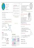
Summary GEOGRAPHY MAP WORK - Calculations, Analysis and More
24 views 0 purchase
Course
Geography
Institution
12th Grade
Map work skills in just three pages with a practice map too!
Includes answering tips and example questions
Covers: co-ordinates, reference number, distance, bearing, magnetic bearing, magnetic declination, gradient, cross-section, vertical exaggeration and how to read a map
LATITUDE – is “flat” E BEARING
move north & south 1. Find the points bearing TO (End) and FROM (Start)
2. Create a line between the two points
LONGITUDE 3. Draw a cross on your starting point
move east & west 4. CENTER protractor over FROM (Start) and zero degrees aligned with north
CO-ORDINATES 5. Measure the value reading clockwise
*if it passes 180° … flip your protractor, measure from zero to the new point
measured in degrees, minutes and seconds… always SE for South Africa and add 180°
Start with latitude first Always read on the outside of your protractor!
S
Step 1: Find the degree MAGNETIC BEARING
33°15’ S and 25°45’ E
Step 2: Find the minutes 1. Find the points bearing TO and FROM
2. Create a line between the two points
Step 3: Find the seconds = (Measurement x Block Length) ÷ 60 3. Draw a cross on your starting point
4. Centre protractor over FROM and zero degrees aligned with north
DISTANCE When doing distance ….NB the map scale!!! 5. Measure the value reading clockwise
Use “King Henry” method or short cut MAP SKILLS 6. ADD the angle of magnetic declination
KING HENRY METHOD From South Africa, magnetic north always lies west of true north.
MAGNETIC DECLINATION
1. Find Magnetic Declination (MD) and year of map
2. Find the difference between year on map & in exam questions
3. Multiply year by annual change
4. Add answer of step 3 to Magnetic Declination
!!! NB: 60 minutes in 1 degree
REFERENCE NUMBER
SHORT CUT Will find on the map near key + mag declination
2018-2002 = 16 years
16 x 8’ = 128° = 2°08’
16°52 + 2°08’ = 18°60’ …. = 19°
There is an ABC in every degree
, VERTICAL EXAGGERATION
CROSS SECTION is a profile or a side view of a relief feature.
refers to the proportion by which the vertical scale of a cross-section is
1. Draw a line on the map, joining starting point to ending point for EG. A–B increased to allow us to see physical features better
2. Place a rough piece of paper along this line, & mark off each contour line on
the paper, with its corresponding height NB: mark off significant features
3. Draw a set of axis on graph paper. Start the y-axis one interval lower than the
lowest value of the cross-section and end it one value above the highest value.
4. Place the piece of paper onto the X axis and mark off corresponding lines.
5. Join the dots if asked to label features on the cross-section, place an arrow
pointing to their locations, and label the arrow.
6. Name your cross section and label your axis
GRADIENT
1. Find your highest and lowest point
2. (Highest – lowest) = Vertical Diff.
3. Measure horizontal distance and convert
4. Vertical diff ÷ Horizontal Distance
Intervisibility is the ability to see one point
from another point on the landscape
Place B is intervisible from place A. Place C
is not intervisible from Place A. TYPES OF SLOPES
Vertical scale will affect how it looks
, TYPICAL ANALYSIS QUESTIONS:
1. Suggest why farm here OR Identify x reasons using map to farm here.
Flat land/ River/ Climate/ Slope aspect
2. Suggest why x industry s here?
Transport/ Kind of people living nearby/ Minerals or resources available
3. State a reason for sewage/airport here?
MAP ANALYSIS
Disturbance
4. Explain location of small town outside of city?
Apartheid
5. Identify x types of recreation/tourism
6. Identify features labelled M, P, T
These will be using key e.g. Recreation/ Cemetery/ Industry A NOTE ON RIVERS
Rivers do NOT always flow north or up the map!
OTHER TIPS:
MORE TIPS: Some tips for finding flow direction:
Know how to apply microclimate theory to map work
Know your provinces, ocean currents and oceans Rivers always flow into dams… look for the dam wall
- Valley climates/ Radiation fog/ Slope Aspect/ Thermal belt
These are easy marks often asked in Que 1 Rivers flow downhill…contour readings get smaller
Know how to apply rivers theory to map work
The source = start of river… follow the flow
- River stage/ River flow/Fluvial features/ Type of river
The benefits of buying summaries with Stuvia:
Guaranteed quality through customer reviews
Stuvia customers have reviewed more than 700,000 summaries. This how you know that you are buying the best documents.
Quick and easy check-out
You can quickly pay through credit card or Stuvia-credit for the summaries. There is no membership needed.
Focus on what matters
Your fellow students write the study notes themselves, which is why the documents are always reliable and up-to-date. This ensures you quickly get to the core!
Frequently asked questions
What do I get when I buy this document?
You get a PDF, available immediately after your purchase. The purchased document is accessible anytime, anywhere and indefinitely through your profile.
Satisfaction guarantee: how does it work?
Our satisfaction guarantee ensures that you always find a study document that suits you well. You fill out a form, and our customer service team takes care of the rest.
Who am I buying these notes from?
Stuvia is a marketplace, so you are not buying this document from us, but from seller kirstenms. Stuvia facilitates payment to the seller.
Will I be stuck with a subscription?
No, you only buy these notes for $5.43. You're not tied to anything after your purchase.