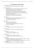
Summary ON Curriculum - Course Notes Gr 9 CAN Geography
5 views 0 purchase
Course
Canadian geography
Institution
9th Grade
Document contains detailed notes of three units, academic level Canadian geography course notes. Includes: branches of geography, spacial significancem FNMI, remote sensing, parts of the earth, geologic history, continental drift, plate technonics, plate movement, canadian landforms, climate change...
Unit 1: Introduction to Canadian Geography
What is Geography?
- The study of the interaction between humans and their environment
Branches of Geography
- Population (standard of living, income level, birth/death rate, graphs, age, density…)
- Cultural (religion immigration, customs, beliefs, language, food…)
- Political (type of government, political parties, laws, trades…)
- Economic (GDP-gross domestic product, currency, inflation, export, import…)
- Natural Resources (uranium, oil, lumber, diamond, seafood, meat, minerals…)
- Urban (infrastructure, urban sprawl, number of major cities, pollution traffic, public
transportation, crowded, crime rates…)
- Regional (GTA, southern ontario, west, east, north coast…)
- Spatial (maps, locations, landforms, provinces and territories…)
3 Key Questions
- What is Where? Need to know the location of feature before further analysis
- Why There? Reasons why things are located why they are
- Why Care? Investigates the importance
Sense of Place
- It’s what makes a certain place unique
- Ivolves basic/prior knowledge of the place
- Involves the understanding of how humans interact with the place
- It related to spatial significance
Absolute Location
- When something is located using longitude and latitude coordinates
Relative Location
- When something is located in relation of another geological feature
Primary Source
- Created during the time of an event
- E.g. surveys, census data, photographs, interviews
Secondary Source
- Created after all the data/research has been collected
- E.g. documentaries, reference books, websites, articles, textbooks
Interrelationships
- Identifying the relationships that exist within and between natural and humans environments
- Can easily see how things affect each other (cause and effect)
- Nunavut food prices are expensive due to limited ways to transport it. There is a lack of roads
and the food must be flown in which makes shipping more expensive
Spatial Significance
- Location of something can be very important (Why There, Why Care)
, - The importance of location can be different for different being such as people, animals and
plants
- Helps explore connections between natural and humans environments
- E.g. Landing a plane in the middle of a road, stopping traffic due to limited space for an
airport runway
Patterns and Trends
- Identifying patterns and trends can help you understand the world around you and why a
feature is where it is and why it matters
- Can help make predictions in the future
- E.g. Birth rate has gone down therefore there are less to support seniors (ratios)
Geographic Perspective
- Considers multiple perspectives while studying an issue in geography
- Can help solve problems, make judgements, and is the central to all geographical analysis
- E.g. Environmental, economical, industrial, political
FIrst Nations, Metis, and Inuit
- Aboriginals’ ancestors have lived on Canada for thousands of years and they’ve learned how
to survive
- Where and how to catch animals and fish
- Where to search for plants and animals in each season
- Prepare food and clothing to survive in winters
- How to travel across land and water
- Learned ecology and natural rhythms
- Saw interrelationships between all living things
- The ancestors’ lifestyles became intimately connected with certain locations in Canada
- They names towns after the culture their ancestors’ created
TEK
- Stand for Traditional Ecological Knowledge
Inquiry Model
1. Formulate Questions - Narrow all your questions to one “big question” to focus you research
2. Gather and Organize Information - Keep track of your research (flag and bookmark) so you
can go back to it later. There are different ways to collect data (primary and secondary
sources)
3. Interpret and Analyze - Review data to check if there are any errors or bias
4. Evaluate and Draw Conclusions - Use data to answer the “big question”
5. Communicate with Others - Publish your study through essays, blogs, posters, videos
GPS (Global Positioning System)
- (what it is) A satellite based system that provides location data/a machine that uses satellites
to pinpoint locations
- (purpose) to find location
- (how it works) Triangulation:
1. Satellites send radio signals to a GPS unit
, 2. The signals contains information the GPS unit will use to calculate location (exact
time, distance, longitude and latitude coordinates)
3. Signals from at least 3 different satellites
- Uses
- Agriculture: tractors are steered by GPS because it make harvesting and planting
more efficient. It can mow in straight lines more accurately with no human error.
- Forestry: plan forest cuts because it ensures the the minimum trees are cut for its
purpose (minimal environmental damage) and plans best routes or areas
- Weather Forecasting: a GPS unit is put into the sky into storms with a weather
balloon to tell where and how the storm is moving. It can also observe the weather
such as air pressure and temperature
- Military: can help the army to drop off supplies, find camps. It provides precision
from dropping bombs and attacking enemies
GIS (Geographic Information System)
- (what it is) A computer system that manages and analyzes geographic information/is a
mapping technology that has revolutionized
- (purpose) Mapmaking and map analysis
- (how it works) A software called ArcView
- Uses
- Can link geographic location to descriptive information
- Create maps with different pieces of spatial information arranged in layers which can
be manipulated to show how data can be interrelated
- Manipulates spatial data to answer important questions and reach conclusions about
geographical issues and created data sets
- Getting 911 emergency or pizza delivery to your house
- Planning sewage for new residential area
- Deciding of there are enough children to start a school
- Showing movements of air masses
Remote Sensing
- (what is it) Seeing or measuring something from a considerable distance/any picture from a
far distance such as satellites, aircrafts, drones
- (how it works) 2 different types of photos:
- Aerial - a photo taken from a fast moving aircraft
- Stereo - two overlapping aerial photos
- Uses false colours
- Remote sensing is in grayscale so scientists add false colours to make features more
visible
- Canada’s satellite is RADARSAT
- Uses
- Study of weather: can help monitor movement of something (e.g. storm)
- Manage agriculture: can examine development of crops and observe damage from
pests and predict the yield
- Make and update maps: over time, legal boundaries or city names night change.
Observes urban expansion and manages natural resources
- Geology and mineral: explored by relation faults and folds in mineral deposits
- Maps sea ice patterns: make safe shipping routes and prevent oil spills
, Telematics
- Any technology that involves long-distance transmission of digital information (e.g. social
media, email, texting…)
The benefits of buying summaries with Stuvia:
Guaranteed quality through customer reviews
Stuvia customers have reviewed more than 700,000 summaries. This how you know that you are buying the best documents.
Quick and easy check-out
You can quickly pay through credit card or Stuvia-credit for the summaries. There is no membership needed.
Focus on what matters
Your fellow students write the study notes themselves, which is why the documents are always reliable and up-to-date. This ensures you quickly get to the core!
Frequently asked questions
What do I get when I buy this document?
You get a PDF, available immediately after your purchase. The purchased document is accessible anytime, anywhere and indefinitely through your profile.
Satisfaction guarantee: how does it work?
Our satisfaction guarantee ensures that you always find a study document that suits you well. You fill out a form, and our customer service team takes care of the rest.
Who am I buying these notes from?
Stuvia is a marketplace, so you are not buying this document from us, but from seller tliew356. Stuvia facilitates payment to the seller.
Will I be stuck with a subscription?
No, you only buy these notes for $3.49. You're not tied to anything after your purchase.