CNS Systems
Introduction block 8
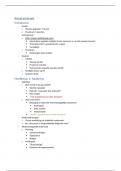
CNS:
- C = Communication (COM)
- N = Navigation (NAV)
- S = Surveillance (SUR)
Communication
- VHF/ HF/ SATCOM
- ACARS/ CPDLC
- Data link
- AIP
- ATS FP
- SWIM
- Etcetera
Navigation
- Basic navigation
- IRS/ Radio NAV
- DGPS
- SBAS
- Etcetera
Surveillance
- ATM
- Radar PRS/ SRS
- Ground moving Radar
- Transponder
- Wx Radar/ Wind shear warning
- ADS-B/C
- WAM
- TCAS/ EGPWS
- Etcetera
Documentation
Global Air Navigation plan voor CNS/ ATM System ICAO Doc 9750 AN/ 963.
Procedures for Air Navigation Services Air Traffic Management Systems ICAO Doc 4444
, Week 1: Basic Navigation
Part I: Basic Navigation
- Position
- Direction
- Triangle of Velocities
- Distance
Part II: CNS Systems
- CNS system overview
- Inertial Navigation
- Global Positioning
System
- Height/ altitude
- Time
- Radio navigation
Figure 1: The Cardinal Points
Figure 2: The Earth Graticule Figure 3: Coordinates
Coordinates
- Latitude (f): is a geographic coordinate that specifies the north-south (N-S) position of a point
on the Earth’s surface. Latitude is an angle which ranges from 0° at the Equator to 90° (North
or South) at the poles.
- Longitude (l): is a geographic
coordinate that specifies the
east-west (E-W) position of a
point on the Earth’s surface. It
is an angular measurement,
expressed in degrees. The
longitude is the angle east or
west from the Greenwich
Meridian (0°), ranging from 0°
to +180° eastward and -180°
westward.
, WGS84 Position Notations
Basic Format (1):
52° 20’44” N 004° 54’56” E
FMS Format (2):
N52 20.7 E004 54.9
Mathematica Format (3):
52.3456° N 004.9156° E
Calculating from Basic into FMS into Mathematica:
- Basic = hours, minutes, seconds.
- FMS = hours, minutes and seconds in 1/60
minute. So, 44 seconds/ 60 seconds = 0,733
minutes.
- Math = hours, minutes in 1/60 hours. So,
20,733 minutes/ 60 minutes = 0,3456 hours.
Format 1
Degrees, minutes and seconds. (00°00’00” N/S 00°00’00”
W/E)
Format 2
Degrees, minutes and 1/10 minutes
(N/S 00°00.0’ W/E 000°00.0’)
Format 3
Degrees (00.0000 N/S 000.0000 W/E)
Jeppesen Map (this coordinate is
important)
Schiphol = Radar wheel
N52°18,5’ E 004°45,8’
Figure 3: Nautical Miles on the Earth
Distance (nm E/W) = d’long (in minutes) ×
Cosine latitude (Cos l)
Figure 4: E/W Distance between Meridians
, 52°18’31” N 4°45,50” E
𝐷𝑖𝑠𝑡𝑎𝑛𝑐𝑒 = 𝑟 ∙ arccos(𝑠𝑖𝑛(𝜙1) ∙ 𝑠𝑖𝑛(𝜙2) + 𝑐𝑜𝑠(𝜙1) ∙ 𝑐𝑜𝑠(𝜙2) ∙ 𝑐𝑜𝑠(𝜆2 − 𝜆1))
r = the radius of the sphere = 6371 km = 3440 nm. Use radians!
Three predominant standard units of measurement
The kilometer [km] = 0.539 nm = 0.621 st m
The Statue mile [st m] = 1.61 km = 0,539 nm
The Nautical Mile [nm] = 1.852 km = 1.152 st m
1 nm = 1 minute.
North = 000° (or 360°)
East = 090°
South = 180°
West = 270°
Figure 5: 360° Notation

