100% satisfaction guarantee Immediately available after payment Both online and in PDF No strings attached
logo-home
GEOINT Fundamentals Course GPC-F Lesson 1 Exam 100% Accurate!! $14.99   Add to cart

Exam (elaborations)

GEOINT Fundamentals Course GPC-F Lesson 1 Exam 100% Accurate!!

 1 view  0 purchase
  • Course
  • GEOINT Fundamentals Course GPC-F Lesson 1
  • Institution
  • GEOINT Fundamentals Course GPC-F Lesson 1

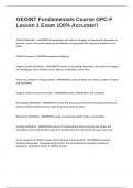
GEOINT (Definition) - ANSWERSThe exploitation and analysis of imagery and geospatial information to describe, assess, and visually depict physical features and geographically referenced activities on the Earth. GEOINT (Acronym) - ANSWERSGeospatial Intelligence Imagery Analysis (definition) - ...

[Show more]
Preview 1 out of 4  pages

  • November 3, 2024
  • 4
  • 2024/2025
  • Exam (elaborations)
  • Questions & answers
  • GEOINT Fundamentals Course GPC-F Lesson 1
  • GEOINT Fundamentals Course GPC-F Lesson 1
avatar-seller
papersmaster01
GEOINT Fundamentals Course GPC-F
Lesson 1 Exam 100% Accurate!!

GEOINT (Definition) - ANSWERSThe exploitation and analysis of imagery and geospatial information to
describe, assess, and visually depict physical features and geographically referenced activities on the
Earth.


GEOINT (Acronym) - ANSWERSGeospatial Intelligence


Imagery Analysis (definition) - ANSWERSThe science of converting information, extracted from imagery,
into intelligence about activities, issues, objects, installations, and/or AOIs.


Visual clue categories of image analysis - ANSWERSSize, shape, shadow, tone, texture, pattern, location,
and association


Imagery analysis processes (in order) - ANSWERSDetection, identification, and evaluation


Hydrography (definition) - ANSWERSThe science that measures and describes the physical features of
bodies of water and the land areas adjacent to those bodies of water.


Bathymetry (definition) - ANSWERSThe study of underwater depth of lake or ocean floors.


Geodesy (definition) - ANSWERSThe science of mathematically determining the size, shape, and
orientation of the Earth, and the nature of its gravity field in four dimensions (in space over time).


Seven categories of GEOINT products (both standard and specialized): - ANSWERSAeronautical,
Nautical/Hydrographic, Topographical/Terrestrial, Precise Positioning & Targeting, Geodesy &
Geophysics, Geographic Names, & GEOINT Analysis.

The benefits of buying summaries with Stuvia:

Guaranteed quality through customer reviews

Guaranteed quality through customer reviews

Stuvia customers have reviewed more than 700,000 summaries. This how you know that you are buying the best documents.

Quick and easy check-out

Quick and easy check-out

You can quickly pay through credit card or Stuvia-credit for the summaries. There is no membership needed.

Focus on what matters

Focus on what matters

Your fellow students write the study notes themselves, which is why the documents are always reliable and up-to-date. This ensures you quickly get to the core!

Frequently asked questions

What do I get when I buy this document?

You get a PDF, available immediately after your purchase. The purchased document is accessible anytime, anywhere and indefinitely through your profile.

Satisfaction guarantee: how does it work?

Our satisfaction guarantee ensures that you always find a study document that suits you well. You fill out a form, and our customer service team takes care of the rest.

Who am I buying these notes from?

Stuvia is a marketplace, so you are not buying this document from us, but from seller papersmaster01. Stuvia facilitates payment to the seller.

Will I be stuck with a subscription?

No, you only buy these notes for $14.99. You're not tied to anything after your purchase.

Can Stuvia be trusted?

4.6 stars on Google & Trustpilot (+1000 reviews)

85169 documents were sold in the last 30 days

Founded in 2010, the go-to place to buy study notes for 14 years now

Start selling
$14.99
  • (0)
  Add to cart