100% satisfaction guarantee Immediately available after payment Both online and in PDF No strings attached
logo-home
GEOG 360 Midterm Exam | Questions with Verified Answers $17.99   Add to cart

Exam (elaborations)

GEOG 360 Midterm Exam | Questions with Verified Answers

 7 views  0 purchase
  • Course
  • GEOG 360
  • Institution
  • GEOG 360

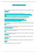
GEOG 360 Midterm Exam | Questions with Verified Answers Which of the following topological relationships describe the arc-node relationship in the coverage model? Connectivity Which of the following is true about the vector data model? -The model uses points, lines, and polygons to represent sim...

[Show more]

Preview 2 out of 14  pages

  • October 16, 2024
  • 14
  • 2024/2025
  • Exam (elaborations)
  • Questions & answers
  • GEOG 360
  • GEOG 360
avatar-seller
Jumuja
GEOG 360 Midterm Exam


Which of the following topological relationships describe the arc-node relationship in the
coverage model?
Connectivity

Which of the following is true about the vector data model?
-The model uses points, lines, and polygons to represent simple spatial features.
-The representation of spatial features using the vector data model depends on map
scale.
-The model uses x-, y-coordinates to store the geometry of spatial features.

Select the following statements that are true about a GIS database:
-Real world data is represented as separate thematic layers
-Data from different thematic layers are combined through analysis
-Thematic layers organize spatial and attribute data

Multipart features are used to represent multiple geographic objects that represent parts
of the same entity
True

A geological map showing bore holes, faults, and rock outcrops that emit radon (in that
order) could be captured into the GIS as:
Points, lines, and areas.

Topological data layers often ease data processing and maintain spatial integrity, at the
cost of more complex data structures.
True

What type of data (nominal, ordinal, or interval/ratio) would an attribute be if it recorded
height of the tallest tree in a city?
Interval/ratio

What type of attribute is human population (the number of people in a state) in a data
layer for the U.S.?
Interval/ratio

What type of attribute is political party of the current governor for a states data layer for
the U.S.?
Nominal

Which of the following is true about a line feature?

, - A line feature is made of line segments (arcs).
- A line connects two end points (nodes).
- The shape of a line is defined by arcs connected by vertices.

Choose all of the statements that are true about attribute tables:
-An attribute table is associated with each thematic layer in a vector data model.
-A single row in the attribute table corresponds to each feature
-Each feature is given a unique numeric identifier within the attribute table.

A line digitized in a vector GIS is considered a ___ object.
one dimensional

Match the topological characteristic to the most appropriate answer: Adjacency
Connected polygons

Match the topological characteristic to the most appropriate answer: Connectivity
Line network

Match the topological characteristic to the most appropriate answer: Planar topology
Non-overlapping polygons

Match the topological characteristic to the most appropriate answer: Polygon topology
Right and left sides

You have a spatial data layer for country life expectancy rates, with boundaries and an
attribute table. What type of data (nominal, ordinal, interval/ratio) are rankings for life
expectancy contained in the data table?
Ordinal

In the vector data model, starting and ending points of a line are referred to as nodes,
with vertices representing the intermediate X,Y coordinates in a linear feature.
True

Topology is:
The spatial relationship between features on a map

You have a spatial data layer for Minnesota school districts, with boundaries and an
attribute table. What type of data (nominal, ordinal, interval/ratio) are rankings for
graduation rate, contained in the data table?
Ordinal

The cell coordinate of a raster cell is usually defined as a point at the center of the cell.
True

If a raster has the cell dimension of 30 meters, then the area of a cell in this raster
measures:

The benefits of buying summaries with Stuvia:

Guaranteed quality through customer reviews

Guaranteed quality through customer reviews

Stuvia customers have reviewed more than 700,000 summaries. This how you know that you are buying the best documents.

Quick and easy check-out

Quick and easy check-out

You can quickly pay through credit card or Stuvia-credit for the summaries. There is no membership needed.

Focus on what matters

Focus on what matters

Your fellow students write the study notes themselves, which is why the documents are always reliable and up-to-date. This ensures you quickly get to the core!

Frequently asked questions

What do I get when I buy this document?

You get a PDF, available immediately after your purchase. The purchased document is accessible anytime, anywhere and indefinitely through your profile.

Satisfaction guarantee: how does it work?

Our satisfaction guarantee ensures that you always find a study document that suits you well. You fill out a form, and our customer service team takes care of the rest.

Who am I buying these notes from?

Stuvia is a marketplace, so you are not buying this document from us, but from seller Jumuja. Stuvia facilitates payment to the seller.

Will I be stuck with a subscription?

No, you only buy these notes for $17.99. You're not tied to anything after your purchase.

Can Stuvia be trusted?

4.6 stars on Google & Trustpilot (+1000 reviews)

81311 documents were sold in the last 30 days

Founded in 2010, the go-to place to buy study notes for 14 years now

Start selling
$17.99
  • (0)
  Add to cart