Aerial photographs - Study guides, Class notes & Summaries
Looking for the best study guides, study notes and summaries about Aerial photographs? On this page you'll find 155 study documents about Aerial photographs.
Popular textbooks 'Aerial photographs'

All 155 results
Sort by
 Popular
-
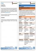
GGH2603 Exam pack 2024 (The interpretations of maps and aerial photographs)
- Exam (elaborations) • 43 pages • 2024
- $2.60
- 4x sold
- + learn more
GGH2603 Exam pack 2024 (The interpretations of maps and aerial photographs) With accurate answers and assurance that they are in the exam.
-
Summary - GGH2603 - The Interpretation Of Maps, Aerial Photographs And Satellite Images
- Summary • 273 pages • 2023
- $7.84
- + learn more
Summary - GGH2603 - The Interpretation Of Maps, Aerial Photographs And Satellite Images
-
Grade 8 Social Sciences (SS) (Geography & History) Term 3 (Via Africa)
- Summary • 20 pages • 2024
- $8.78
- + learn more
This product contains all the work for Social Sciences (Geography & History) Grade 8, term 3 – based on the “Via Africa” textbook in English. Geography – Settlement Unit 1: Settlement and land use Unit 2: Land use on aerial photographs & large-scale maps Unit 3: Urbanisation History – The Scramble for Africa Unit 1: European colonisation of Africa in the late 19th century Case study: The Ashanti Kingdom Packages usually include the following but may differ fro...
-
Grade 12 Geography Summaries Topic 1 & 2 (Term 1) - Via Afrika
- Summary • 78 pages • 2024
- $8.84
- + learn more
Grade 12 Geography Summaries Topic 1 & 2 (Term 1). This summaries are composed using the Via Afrika textbooks' work with examples and supplementary notes. This product also contains the summaries for Geographic skills and Techniques (Terms 1 - 4). Contents: Geographical Skills and Techniques: * Mapwork techniques. * Topographic maps. * Aerial photographs and orthophoto maps. * Geographic Information Systems (GIS). * Using atlases. Topic 1: Climate and W...
-
FE CIVIL EXAM QUESTIONS AND ANSWERS
- Other • 31 pages • 2024
- $13.49
- + learn more
Plane Surveys - Answer-Type of survey that disregards the curvature of the earth. Appropriate if the area is small. Geodetic Surveys - Answer-Type of survey that considers the curvature of the earth. Zoned Surveys - Answer-Type of survey that allows computations to be performed as if on a plane will accommodating larger areas. State Plane Coordinate System - Answer-Rectangular systems that use a partial latitude/longitude system for baseline references Stadia Survey - Answer-Requires...

Want to regain your expenses?

-
Gr 11 Geography Prelim &Final 2024
- Summary • 32 pages • 2024
- $7.07
- + learn more
Gr 11 Geography Prelim &Final 2024 Previous exam papers were used to compile these notes, @ SACAI 2020- NE04-07.2, @SACAI_Geo JUN 2021, Gr 11 Nov SACAI 2021, @SACAI NOV 2022, © Via Afrika Publishers » G eography 11 Study Guide eBook. • Topographic map – 2627 CD Parys • Orthophoto map – 2627 CD 19 Paris CONTENTS 1. Geographical skills and techniques (Mapmaking): Mapmaking skills The questions are based on the 1:50 000 topographic map 2627CD PARYS as well as the 1:10 000 ortho...
-
Grade 12 Geography Summaries Skills & Techniques plus Topic 1 & 2 (Term 1) - Via Afrika
- Summary • 72 pages • 2024
- $8.84
- + learn more
Grade 12 Geography Summaries Topic 1 & 2 (Term 1). This summaries are composed using and combining the Via Afrika textbooks' work with examples and supplementary notes. This product also contains the summaries for Geographic skills and Techniques (Terms 1 - 4). Contents: Geographical Skills and Techniques: Mapwork techniques. Topographic maps. Aerial photographs and orthophoto maps. Geographic Information Systems (GIS). Using atlases. Topic 1: Climate and Weather Mid-latit...
-
ALC Tactics Exam Questions with correct Answers | Verified & Updated 2024
- Exam (elaborations) • 23 pages • 2024
- $12.49
- + learn more
ALC Tactics Exam Questions with correct Answers | Verified & Updated 2024 What are Graphic Military Symbols? - Answer ️️ -- Graphic Representation of: Units Equipment Installations Control Measures Tactical Tasks Other Elements - Common Visual Language What is the purpose of Graphic Military Symbols? - Answer ️️ -* Allow Commanders and Staffs to display certain elements of the Operational Picture. Used on: - Situational Maps - Overlays - Annotated Aerial Photographs - Use...

-
Tort Law UPDATED Exam Questions and CORRECT Answers
- Exam (elaborations) • 18 pages • 2024
- $9.49
- + learn more
Bernstein of Leigh (Baron) v Skyviews & General Ltd [1978] QB 479 D was a business which used aircraft to take aerial photographs of people's homes without their permission. D then offered to sell those photographs to the homeowners. Liable to the homeowners in the tort of trespass to land? Held: rights of an owner to the airspace above their property are restricted to such height as is necessary for the ordinary use and enjoyment of their land. Adams v Ursell [1913] 1 Ch 269 A fish ...
-
ALC Tactics Exam || with Complete Solutions.
- Exam (elaborations) • 17 pages • 2024
- $11.99
- + learn more
What are Graphic Military Symbols, and what do they provide? correct answers - Graphic Representation of: Units Equipment Installations Control Measures Tactical Tasks Other Elements - And they provide a Common Visual Language What is the purpose of Graphic Military Symbols? correct answers * Allow Commanders and Staffs to display certain elements of the Operational Picture. Used on: - Situational Maps - Overlays - Annotated Aerial Photographs - Used to Express - Operational Plan...
