Gisp verified solutions - Study guides, Class notes & Summaries
Looking for the best study guides, study notes and summaries about Gisp verified solutions? On this page you'll find 9 study documents about Gisp verified solutions.
All 9 results
Sort by
-
GISP Verified Solutions
- Exam (elaborations) • 28 pages • 2024
- Available in package deal
-
- $9.89
- + learn more
GISP Verified Solutions Data Models - Data Exploration: A data-centered query and analysis process to explore and understand data. - Dynamic Segmentations: A data model that employs linearly measured data on a coordinate system for analysis. - Georelational Data Model: A vector data model that uses a split system to store geometries and their attributes separately. - GeoSpatial Data: Data describing both the locations and characteristics of spatial features on the Earth's surface. - Obj...
-
GISP Study Guide Exam – 220 Questions with Verified Solutions 2024
- Exam (elaborations) • 15 pages • 2024
- Available in package deal
-
- $12.49
- + learn more
GISP Study Guide Exam – 220 Questions with Verified Solutions 2024
-
GISP Exam Questions and Verified Solutions 2024
- Exam (elaborations) • 16 pages • 2024
-
- $11.99
- + learn more
GISP Exam Questions and Verified Solutions 2024 The property of area for a parcel polygon may be considered (choose best answer) A. Precise B. Accurate C. Legally correct D. Both A and B - Answer -Both A and B A vector data model uses which of the following coordinate pairs to build curvature within a line? (best answer) A. Verticies B. Points C. Floating points D. Nodes - Answer -A. Verticies GIS differs from surveying and mapping by introducing (best answer) A. Attribute descript...
-
GISP Questions and Answers Latest 2023 with Verified Solutions
- Exam (elaborations) • 49 pages • 2023
- Available in package deal
-
- $10.99
- + learn more
GISP Questions and Answers Latest 2023 with Verified Solutions Data exploration Data-centered query and analysis Dynamic Segmentations A data model that allows the use of linearly measured data on a coordinate system Georelational data model A vector data model that uses a split system to store geometries and attributes GeoSpatial data Data that describes both the locations and characteristics of spatial features on the earth surface Object-based data model A data model that uses objects to ...
GISP Bundled Exams Questions and Answers (2022/2023) (Verified Solutions)
-
FINAL GISP SET: ALL KSAs (2022/2023) (Verified Solutions)
- Exam (elaborations) • 27 pages • 2023
- Available in package deal
-
- $9.99
- + learn more
FINAL GISP SET: ALL KSAs (2022/2023) (Verified Solutions) Federal Geographic Data Committee (FGDC) A United States government committee which promotes the coordinated development, use, sharing, and dissemination of geospatial data on a national basis. ISO 19115-2 Content standard that adds elements to describe imagery and gridded data as well as data collected using instruments (monitoring stations and measurement devices) Quality control This is product-oriented and focuses on defect identif...
-
GISP Exam Questions and Answers with Verified Solutions
- Exam (elaborations) • 30 pages • 2023
- Available in package deal
-
- $10.49
- + learn more
GISP Exam Questions and Answers with Verified Solutions The property of area for a parcel polygon may be considered (choose best answer) A. Precise B. Accurate C. Legally correct D. Both A and B Both A and B A vector data model uses which of the following coordinate pairs to build curvature within a line? (best answer) A. Verticies B. Points C. Floating points D. Nodes A. Verticies GIS differs from surveying and mapping by introducing (best answer) A. Attribute description B. Spatial ...
-
GISP Exam Questions and Verified Solutions 2024
- Exam (elaborations) • 16 pages • 2024
-
- $11.99
- + learn more
GISP Exam Questions and Verified Solutions 2024 The property of area for a parcel polygon may be considered (choose best answer) A. Precise B. Accurate C. Legally correct D. Both A and B - Answer -Both A and B A vector data model uses which of the following coordinate pairs to build curvature within a line? (best answer) A. Verticies B. Points C. Floating points D. Nodes - Answer -A. Verticies GIS differs from surveying and mapping by introducing (best answer) A. Attribute descript...
-
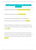
GISP General Questions with Verified Solutions
- Exam (elaborations) • 4 pages • 2023
- Available in package deal
-
- $8.99
- + learn more
GISP General Questions with Verified Solutions An example of analog-to-digital conversion Scanning a map document to JPG format Components of the OGC geometry object model Curve, point, surface Most effective method for maintaining data quality to ensure that no line features of a stream center line layer intersect the polygon feature of a land cover layer Topology According to National Map Accuracy Standards, what percentage of features must be within 1/30 of an inch or less from their inten...

Study stress? For sellers on Stuvia, these are actually golden times. KA-CHING! Earn from your study resources too and start uploading now. Discover all about earning on Stuvia

