Magnetic declination - Study guides, Study notes & Summaries
Looking for the best study guides, study notes and summaries about Magnetic declination? On this page you'll find 66 study documents about Magnetic declination.
Page 4 out of 66 results
Sort by
-
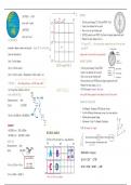
GEOGRAPHY MAP WORK - Calculations, Analysis and More
- Summary • 4 pages • 2023
- Available in package deal
-
- R100,00
- + learn more
Map work skills in just three pages with a practice map too! Includes answering tips and example questions Covers: co-ordinates, reference number, distance, bearing, magnetic bearing, magnetic declination, gradient, cross-section, vertical exaggeration and how to read a map
-
RPL 218 - Map and Compass Exam(updated&verified)
- Exam (elaborations) • 3 pages • 2023
- Available in package deal
-
- R255,18
- + learn more
What is the degree for North? 0/360 Degrees What is the degree for East? 90 Degrees What is the degree for South? 180 Degrees What is the degree for West? 270 Degrees What is the degree for Northeast? 45 Degrees What is the degree fro Southeast? 135 Degrees What is the degree for Northwest? 315 Degrees What is the degree for Southwest? 225 Degrees What is the definition for "declination"? The difference between magnetic North and...
![Physical Science Chapter 6 Review Questions and answers, graded A+/ [Exam Prediction paper Updated 2024/25]](/docpics/4486296/65ca59b206e23_4486296_121_171.jpeg)
-
Physical Science Chapter 6 Review Questions and answers, graded A+/ [Exam Prediction paper Updated 2024/25]
- Exam (elaborations) • 3 pages • 2024
-
- R140,71
- + learn more
Physical Science Chapter 6 Review Questions and answers, graded A+ The attractive force between two unlike charges has the same strength as the repulsive force between two like charges: - -True An object becomes positively charged by gaining protons: - -False If you double the distance between two charged objects, you reduce the electrical force by a factor of four: - -True The volt is a measure of the difference in electrical potential energy between two points: - -True Because of mag...
-
Measuring Instruments
- Exam (elaborations) • 7 pages • 2023
-
- R149,52
- + learn more
Accelerometer - physical, accelerations Actinometer - heating power of sunlight Alcoholmeter - alcoholic strength of liquids Altimeter - altitude Ammeter - electric current Anemometer - windspeed Audiometer - hearing Barkometer - tanning liquors used in tanning leather Barometer - air pressure Bettsometer - integrity of fabric coverings on aircraft Bevameter - mechanical properties of soil Bolometer - electromagnetic radiation ...
-
Earth Science Questions and Answers Already Passed
- Exam (elaborations) • 14 pages • 2023
- Available in package deal
-
- R175,93
- + learn more
Earth Science Questions and Answers Already Passed science A way of learning about the natural world through observations and logical reasoning; leads to a body of knowledge. Using empirical evidence to generate explanations of how the natural world works is an important part of science. observing The process of using one or more of the senses to gather information. The biologist used both sight and sound when observing the behavior of birds. inferring The process of making an inference; an in...
-
Land Navigation/Map Reading (Army Board Study Guide) 100% Pass
- Exam (elaborations) • 14 pages • 2023
- Available in package deal
-
- R175,93
- + learn more
Land Navigation/Map Reading (Army Board Study Guide) 100% Pass What is the Field Manual for map reading and land navigation? FM 3-25.26 What are the basic colors of a map, and what does each color represent? Black - Indicates cultural (man-made) features such as buildings and roads, surveyed spot elevations, and all labels. Red-Brown - The colors red and brown are combined to identify cultural features, all relief features, non-surveyed spot elevations, and elevation, such as contour lines on ...
-
AERONAUTICS STUDY GUIDE EXAM 2 QUESTIONS WITH CORRECT ANSWERS 100% 2024
- Exam (elaborations) • 17 pages • 2024
- Available in package deal
-
- R299,21
- + learn more
AERONAUTICS STUDY GUIDE EXAM 2 QUESTIONS WITH CORRECT ANSWERS 100% 2024
-
Earth & Space Science EHS Final Exam
- Exam (elaborations) • 9 pages • 2024
-
- R202,53
- + learn more
Earth & Space Science EHS Final Exam Which of the following diagrams best shows the revolution of a planet? The following diagram shows the Moon at one position in its orbit around Earth. (The diagram is not drawn to scale.) Based on this diagram, which of the following statements is true? Locations A and C are experiencing high tides; locations B and D are experiencing low tides. What advantage does a reflecting telescope have over a refracting telescope? Each of the following diagrams ...
-
IEB/NSC - Geo - Mapwork
- Summary • 17 pages • 2023
-
- R99,00
- + learn more
Map work Techniques • applying map skills and techniques: scale, contours, cross-sections, position, distance, area • direction: magnetic north, true north, bearing and concept of magnetic declination • grid referencing • map and photo interpretation, including: reading and analysis of physical and constructed features • using maps and other graphical representations: synoptic weather maps and graphs. Topographic Maps • 1: 50 000 maps: conventional signs and symbols • conto...
-
MS Directional Test Questions and Answers 2023 with complete solution
- Exam (elaborations) • 3 pages • 2023
-
- R184,74
- + learn more
MS Directional Test Questions and Answers 2023 with complete solution What are the three parameters actually measured in a survey Inclination Azimuth Measured Depth What is the aproximate inclination of a horizontal well 90 degrees If the well is drilling due west, how would this be expressed as an Azimuth and what are the units? 270 west Which town does the 0 degree of longitude pass? Which country is that in? What is it called? Greenwich England Prime Meridian What defines the in...

Study stress? For sellers on Stuvia, these are actually golden times. KA-CHING! Earn from your study notes too and start uploading now. Discover all about earning on Stuvia


