100% de satisfacción garantizada Inmediatamente disponible después del pago Tanto en línea como en PDF No estas atado a nada
logo-home
Test Bank For Contemporary Human Geography 5th Edition by James Rubenstein. Full chapters. 23,05 €   Añadir al carrito

Examen

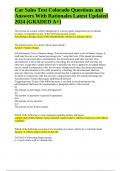
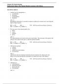
Test Bank For Contemporary Human Geography 5th Edition by James Rubenstein. Full chapters.

 10 vistas  1 veces vendidas
  • Grado
  • Human Geography
  • Institución
  • Human Geography

Test Bank For Contemporary Human Geography 5th Edition by James Rubenstein. ISBN: 9780137631513. Contemporary Human Geography 5e test bank. James Rubenstein 5e test bank for Contemporary Human Geography.

Vista previa 4 fuera de 682  páginas

  • 24 de febrero de 2024
  • 682
  • 2023/2024
  • Examen
  • Preguntas y respuestas
  • Human Geography
  • Human Geography
avatar-seller
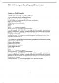
TEST BANK Contemporary Human Geography 5/E James Rubenstein


Chapter 1: This Is Geography

1) Which of the following do geographers NOT do?
A) They identify the location of important places.
B) They organize material chronologically.
C) They explain why one human activity is found near another.
D) They ask where and why.
E) They organize material spatially.
Answer: B
Diff: 1
Section: 1.1 Welcome to Geography
Bloom's Taxonomy: Remembering/Understanding
National Geography Std.: NGS1 How to use maps and other geographic representations,
geospatial technologies, and spatial thinking to understand and communicate information
Global Science Standard: GSLO7 Demonstrate the ability to make connections between
concepts across Geography
Learning Outcome: 1.1 Compare and contrast geography and history in terms of what
geographers and historians do.

2) To explain why different places are interrelated, geographers have three basic concepts
A) place, region, and connection.
B) place, region, and space.
C) place, scale, and space.
D) scale, space, and connection.
E) scale, space, and region.
Answer: D
Diff: 1
Section: 1.1 Welcome to Geography
Bloom's Taxonomy: Remembering/Understanding
National Geography Std.: NGS1 How to use maps and other geographic representations,
geospatial technologies, and spatial thinking to understand and communicate information
Global Science Standard: GSLO7 Demonstrate the ability to make connections between
concepts across Geography
Learning Outcome: 1.2 Summarize geography's five most basic concepts.


1

,3) History and geography differ in one especially important matter.
A) History is a much older discipline than geography.
B) A geographer can travel to a different place, but a historian cannot travel back in time.
C) A geographer is limited because most places are inaccessible.
D) History is constantly changing, but geography remains static.
E) Geography studies from a temporal perspective while history examines events from a spatial
perspective.
Answer: B
Diff: 1
Section: 1.1 Welcome to Geography
Bloom's Taxonomy: Remembering/Understanding
National Geography Std.: NGS17 How to apply geography to interpret the past
Global Science Standard: GSLO7 Demonstrate the ability to make connections between
concepts across Geography
Learning Outcome: 1.1 Compare and contrast geography and history in terms of what
geographers and historians do.

4) The first person to use the word geography was
A) Aristotle.
B) Eratosthenes.
C) Strabo.
D) Thales of Miletus.
E) Thucydides.
Answer: B
Diff: 1
Section: 1.3 Making Maps
Bloom's Taxonomy: Remembering/Understanding
National Geography Std.: NGS17 How to apply geography to interpret the past
Global Science Standard: GSLO7 Demonstrate the ability to make connections between
concepts across Geography
Learning Outcome: 1.3 Trace the development of geography in the ancient world through the
Middle Ages to the Age of Exploration.


2

,5) Who was the first to conclude the Earth was spherical based upon empirical evidence?
A) Aristotle
B) Anaximander
C) Strabo
D) Ptolemy
E) Pei Xiu
Answer: A
Diff: 1
Section: 1.3 Making Maps
Bloom's Taxonomy: Remembering/Understanding
National Geography Std.: NGS17 How to apply geography to interpret the past
Global Science Standard: GSLO7 Demonstrate the ability to make connections between
concepts across Geography
Learning Outcome: 1.3 Trace the development of geography in the ancient world through the
Middle Ages to the Age of Exploration.

6) The science of taking measurements of the Earth's surface is known as
A) demography.
B) photogrammetry.
C) topography.
D) geotagging.
E) meteorology.
Answer: B
Diff: 1
Section: 1.2 Contemporary Geographic Tools
Bloom's Taxonomy: Remembering/Understanding
National Geography Std.: NGS1 How to use maps and other geographic representations,
geospatial technologies, and spatial thinking to understand and communicate information
Global Science Standard: GSLO7 Demonstrate the ability to make connections between
concepts across Geography
Learning Outcome: 1.4 Identify contemporary analytic tools of geographers, including remote
sensing, GPS, and GIS.


3

, 7) GIS stands for
A) General Information System.
B) Geocoded Information Satellite.
C) Geographic Information System.
D) Geographic Intended Science.
E) Geotagged Informative Situation.
Answer: C
Diff: 1
Section: 1.2 Contemporary Geographic Tools
Bloom's Taxonomy: Remembering/Understanding
National Geography Std.: NGS1 How to use maps and other geographic representations,
geospatial technologies, and spatial thinking to understand and communicate information
Global Science Standard: GSLO7 Demonstrate the ability to make connections between
concepts across Geography
Learning Outcome: 1.4 Identify contemporary analytic tools of geographers, including remote
sensing, GPS, and GIS.

8) A map that overlays data from one source on top of a map provided by a mapping service
(such as Google Maps) is known as a
A) mashup.
B) VGI.
C) GPS.
D) GIS.
E) citizen science project.
Answer: A
Diff: 1
Section: 1.2 Contemporary Geographic Tools
Bloom's Taxonomy: Remembering/Understanding
National Geography Std.: NGS1 How to use maps and other geographic representations,
geospatial technologies, and spatial thinking to understand and communicate information
Global Science Standard: GSLO7 Demonstrate the ability to make connections between
concepts across Geography
Learning Outcome: 1.5 Describe the role of Volunteered Geographic Information (VGI) and
mashups in contemporary geography.


4

Los beneficios de comprar resúmenes en Stuvia estan en línea:

Garantiza la calidad de los comentarios

Garantiza la calidad de los comentarios

Compradores de Stuvia evaluaron más de 700.000 resúmenes. Así estas seguro que compras los mejores documentos!

Compra fácil y rápido

Compra fácil y rápido

Puedes pagar rápidamente y en una vez con iDeal, tarjeta de crédito o con tu crédito de Stuvia. Sin tener que hacerte miembro.

Enfócate en lo más importante

Enfócate en lo más importante

Tus compañeros escriben los resúmenes. Por eso tienes la seguridad que tienes un resumen actual y confiable. Así llegas a la conclusión rapidamente!

Preguntas frecuentes

What do I get when I buy this document?

You get a PDF, available immediately after your purchase. The purchased document is accessible anytime, anywhere and indefinitely through your profile.

100% de satisfacción garantizada: ¿Cómo funciona?

Nuestra garantía de satisfacción le asegura que siempre encontrará un documento de estudio a tu medida. Tu rellenas un formulario y nuestro equipo de atención al cliente se encarga del resto.

Who am I buying this summary from?

Stuvia is a marketplace, so you are not buying this document from us, but from seller docusity. Stuvia facilitates payment to the seller.

Will I be stuck with a subscription?

No, you only buy this summary for 23,05 €. You're not tied to anything after your purchase.

Can Stuvia be trusted?

4.6 stars on Google & Trustpilot (+1000 reviews)

45,681 summaries were sold in the last 30 days

Founded in 2010, the go-to place to buy summaries for 14 years now

Empieza a vender

Vistos recientemente


23,05 €  1x  vendido
  • (0)
  Añadir