ESRI
Looking for study notes at ESRI? On Stuvia you will find more than 54 summaries, study notes and other study resources for all courses at ESRI.
-
54
- 0
-
9
Courses at ESRI
Notes available for the following courses at ESRI
Majors at ESRI
Notes available for the following studies at ESRI
-
Esri 54
Latest content ESRI
ESRI CERTIFICATION ARCGIS PRO ASSOCIATE 2101 EXAM LATEST WITH 106 ACTUAL QUESTIONS AND CORRECT VERIFIED ANSWERS ALREADY GRADED A+. ESRI CERTIFICATION ARCGIS PRO ASSOCIATE 2101 EXAM LATEST WITH 106 ACTUAL QUESTIONS AND CORRECT VERIFIED ANSWERS ALREADY GRADED A+.
- Exam (elaborations)
- • 11 pages's •
-
ESRI•ESRI
Preview 2 out of 11 pages
ESRI CERTIFICATION ARCGIS PRO ASSOCIATE 2101 EXAM LATEST WITH 106 ACTUAL QUESTIONS AND CORRECT VERIFIED ANSWERS ALREADY GRADED A+. ESRI CERTIFICATION ARCGIS PRO ASSOCIATE 2101 EXAM LATEST WITH 106 ACTUAL QUESTIONS AND CORRECT VERIFIED ANSWERS ALREADY GRADED A+.
ESRI ARCGIS PRO FOUNDATION CERTIFICATION 2101 LEARNING PLAN EXAM QUESTIONS AND ANSWERS WITH COMPLETE SOLUTIONS VERIFIED GRADED A++ Which capability is available to users with public access to ArcGIS Online? 1. Share content within an organization 2. Unlimited storage space 3. Access additional ArcGIS apps 4. Create web maps 4. Create web maps Which phrase best describes an ArcGIS Online organization? 1. A method for organizing or arranging maps, scenes, apps, layers, and other con...
- Package deal
- Exam (elaborations)
- • 45 pages's •
-
ESRI•ESRI
-
BUNDLE FOR ESRI ARCGIS PRO FOUNDATION CERTIFICATION• ByNurseAdvocate
Preview 4 out of 45 pages
ESRI ARCGIS PRO FOUNDATION CERTIFICATION 2101 LEARNING PLAN EXAM QUESTIONS AND ANSWERS WITH COMPLETE SOLUTIONS VERIFIED GRADED A++ Which capability is available to users with public access to ArcGIS Online? 1. Share content within an organization 2. Unlimited storage space 3. Access additional ArcGIS apps 4. Create web maps 4. Create web maps Which phrase best describes an ArcGIS Online organization? 1. A method for organizing or arranging maps, scenes, apps, layers, and other con...

ESRI: GETTING STARTED WITH GEODATABASE TOPOLOGY EXAM QUESTIONS AND ANSWERS WITH COMPLETE SOLUTIONS VERIFIED LATEST UPDATE cluster tolerance The minimum tolerated distance between vertices in a topology. Vertices that fall within the set cluster tolerance are snapped together during the topology validation process. cracking In ArcGIS, a part of the topology validation process in which vertices are created at the intersection of feature edges. dirty areas Regions surrounding features that ...
- Package deal
- Exam (elaborations)
- • 6 pages's •
-
ESRI•ESRI
-
BUNDLE OF ESRI EXAM QUESTIONS AND ANSWERS WITH COMPLETE SOLUTIONS VERIFIED LATEST UPDATE• ByAcademicSuperScores
Preview 2 out of 6 pages
ESRI: GETTING STARTED WITH GEODATABASE TOPOLOGY EXAM QUESTIONS AND ANSWERS WITH COMPLETE SOLUTIONS VERIFIED LATEST UPDATE cluster tolerance The minimum tolerated distance between vertices in a topology. Vertices that fall within the set cluster tolerance are snapped together during the topology validation process. cracking In ArcGIS, a part of the topology validation process in which vertices are created at the intersection of feature edges. dirty areas Regions surrounding features that ...
GEODESY - WEEK 4 - ESRI ONLINE COURSE EXAM QUESTIONS AND ANSWERS WITH COMPLETE SOLUTIONS VERIFIED The Earth's Shape is an Ellipsoid - mid 18th century, a french survey expedition took measurements at the equator in Peru and at the Arctic Circle in Lapland - determined the earth was bulging at the equator - the earth rotates about its shortest axis, or minor axis, and is therefore described as an oblate ellipsoid Two Common Definitions for a Spheroid 1. An ellipsoid that approximates ...
- Package deal
- Exam (elaborations)
- • 3 pages's •
-
ESRI•ESRI
-
BUNDLE OF ESRI EXAM QUESTIONS AND ANSWERS WITH COMPLETE SOLUTIONS VERIFIED LATEST UPDATE• ByAcademicSuperScores
Preview 1 out of 3 pages
GEODESY - WEEK 4 - ESRI ONLINE COURSE EXAM QUESTIONS AND ANSWERS WITH COMPLETE SOLUTIONS VERIFIED The Earth's Shape is an Ellipsoid - mid 18th century, a french survey expedition took measurements at the equator in Peru and at the Arctic Circle in Lapland - determined the earth was bulging at the equator - the earth rotates about its shortest axis, or minor axis, and is therefore described as an oblate ellipsoid Two Common Definitions for a Spheroid 1. An ellipsoid that approximates ...
ESRI: DISTANCE ANALYSIS USING ARCGIS EXAM QUESTIONS AND ANSWERS WITH COMPLETE SOLUTIONS VERIFIED LATEST UPDATE The backlink raster is a cost direction surface created when you run the Cost Path tool. False What are the units of measure for cell values in a Euclidean (straight-line) distance surface? X The units you specify If you want the software to reclassify your raster values into new values based on a standard classification method, which of the following options would you use? X Re...
- Package deal
- Exam (elaborations)
- • 4 pages's •
-
ESRI•ESRI
-
BUNDLE OF ESRI EXAM QUESTIONS AND ANSWERS WITH COMPLETE SOLUTIONS VERIFIED LATEST UPDATE• ByAcademicSuperScores
Preview 1 out of 4 pages
ESRI: DISTANCE ANALYSIS USING ARCGIS EXAM QUESTIONS AND ANSWERS WITH COMPLETE SOLUTIONS VERIFIED LATEST UPDATE The backlink raster is a cost direction surface created when you run the Cost Path tool. False What are the units of measure for cell values in a Euclidean (straight-line) distance surface? X The units you specify If you want the software to reclassify your raster values into new values based on a standard classification method, which of the following options would you use? X Re...

TYPES OF POLITICAL BOUNDARIES - ESRI STORY MAP EXAM QUESTIONS AND ANSWERS WITH COMPLETE SOLUTIONS VERIFIED LATEST UPDATE 1. Identify a relic boundary other than the Berlin Wall. An example of a relic boundary other than the Berlin Wall is the Great Wall of China. It is an old and nonfunctional boundary, but it still exists today. 2. Identify another state that has a mountain range as a boundary. France is a country that has a mountain ranges as a boundaries. The border between France and S...
- Package deal
- Exam (elaborations)
- • 3 pages's •
-
ESRI•ESRI
-
BUNDLE OF ESRI EXAM QUESTIONS AND ANSWERS WITH COMPLETE SOLUTIONS VERIFIED LATEST UPDATE• ByAcademicSuperScores
Preview 1 out of 3 pages
TYPES OF POLITICAL BOUNDARIES - ESRI STORY MAP EXAM QUESTIONS AND ANSWERS WITH COMPLETE SOLUTIONS VERIFIED LATEST UPDATE 1. Identify a relic boundary other than the Berlin Wall. An example of a relic boundary other than the Berlin Wall is the Great Wall of China. It is an old and nonfunctional boundary, but it still exists today. 2. Identify another state that has a mountain range as a boundary. France is a country that has a mountain ranges as a boundaries. The border between France and S...

ESRI: 3D VISUALIZATION TECHNIQUES EXAM QUESTIONS AND ANSWERS WITH COMPLETE SOLUTIONS VERIFIED Your study area is the Alaskan tundra (a vast, flat expanse). What is the best way to emphasize slight elevation changes in the landscape? Set a vertical exaggeration TRUE or FALSE: You can tell whether a shapefile contains 3D data by previewing its table. True One purpose of vertical exaggeration is to emphasize small elevation changes on a flat surface. What is another purpose? To bring z-valu...
- Package deal
- Exam (elaborations)
- • 14 pages's •
-
ESRI•ESRI
-
BUNDLE OF ESRI EXAM QUESTIONS AND ANSWERS WITH COMPLETE SOLUTIONS VERIFIED LATEST UPDATE• ByAcademicSuperScores
Preview 2 out of 14 pages
ESRI: 3D VISUALIZATION TECHNIQUES EXAM QUESTIONS AND ANSWERS WITH COMPLETE SOLUTIONS VERIFIED Your study area is the Alaskan tundra (a vast, flat expanse). What is the best way to emphasize slight elevation changes in the landscape? Set a vertical exaggeration TRUE or FALSE: You can tell whether a shapefile contains 3D data by previewing its table. True One purpose of vertical exaggeration is to emphasize small elevation changes on a flat surface. What is another purpose? To bring z-valu...

ESRI PYTHON FOR EVERYONE EXAM QUESTIONS AND ANSWERS WITH COMPLETE SOLUTIONS VERIFIED syntax The structural rules for using data types, statements, and functions in Python. data types The ingredients of a script. Data types are the objects that are created, deleted, and manipulated in a script. statement A script instruction that performs an action that typically does not return a value. function A script instruction that performs an action that typically returns
- Package deal
- Exam (elaborations)
- • 2 pages's •
-
ESRI•ESRI
-
BUNDLE FOR ESRI ARCGIS PRO FOUNDATION CERTIFICATION• ByNurseAdvocate
Preview 1 out of 2 pages
ESRI PYTHON FOR EVERYONE EXAM QUESTIONS AND ANSWERS WITH COMPLETE SOLUTIONS VERIFIED syntax The structural rules for using data types, statements, and functions in Python. data types The ingredients of a script. Data types are the objects that are created, deleted, and manipulated in a script. statement A script instruction that performs an action that typically does not return a value. function A script instruction that performs an action that typically returns

ESRI CERTIFICATE EXAM QUESTIONS AND ANSWERS WITH COMPLETE SOLUTIONS VERIFIED LATEST UPDATE Named User Accounts -Assigned to members of AGOL or Enterprise org. - Sign into any machine pro is on - Up to 3 machines at the same time logged in Single Use Licence - Only on one machine - Sign in not required, only if accessing AGOL content Concurrent Use License - Multiple users share desktop from any comp. - License manger manages pool of licenses - When pro is started, license is checked...
- Package deal
- Exam (elaborations)
- • 11 pages's •
-
ESRI•ESRI
-
BUNDLE FOR ESRI ARCGIS PRO FOUNDATION CERTIFICATION• ByNurseAdvocate
Preview 2 out of 11 pages
ESRI CERTIFICATE EXAM QUESTIONS AND ANSWERS WITH COMPLETE SOLUTIONS VERIFIED LATEST UPDATE Named User Accounts -Assigned to members of AGOL or Enterprise org. - Sign into any machine pro is on - Up to 3 machines at the same time logged in Single Use Licence - Only on one machine - Sign in not required, only if accessing AGOL content Concurrent Use License - Multiple users share desktop from any comp. - License manger manages pool of licenses - When pro is started, license is checked...
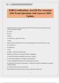
©THESTAR 2024/2025 ALL RIGHTS RESERVED 12:54PM. 1 ESRI Certification: ArcGIS Pro Associate 2101 Exam Questions And Answers 2025 Update. A spatial analyst has created a project in ArcGIS Pro. Which two items can be stored in the project to use when needed? A. Layouts B. Script C. Maps D. Data Frames - AnswerA. Layouts C. Maps Which element of the ArcGIS Pro user interface displays the contents of the active view? A. Contents Pane B. Catalog Pane C. View D. Ribbon - AnswerA. Conte...
- Exam (elaborations)
- • 12 pages's •
-
ESRI•ESRI
Preview 2 out of 12 pages
©THESTAR 2024/2025 ALL RIGHTS RESERVED 12:54PM. 1 ESRI Certification: ArcGIS Pro Associate 2101 Exam Questions And Answers 2025 Update. A spatial analyst has created a project in ArcGIS Pro. Which two items can be stored in the project to use when needed? A. Layouts B. Script C. Maps D. Data Frames - AnswerA. Layouts C. Maps Which element of the ArcGIS Pro user interface displays the contents of the active view? A. Contents Pane B. Catalog Pane C. View D. Ribbon - AnswerA. Conte...

©FYNDLAY 2024/2025 ALL RIGHTS RESERVED 12:27AM. A+ 1 ESRI Certification: ArcGIS Pro Associate 2101 Exam Questions And Answers| Already Graded A+| Latest Update. A spatial analyst has created a project in ArcGIS Pro. Which two items can be stored in the project to use when needed? A. Layouts B. Script C. Maps D. Data Frames - AnswerA. Layouts C. Maps Which element of the ArcGIS Pro user interface displays the contents of the active view? A. Contents Pane B. Catalog Pane C. View D...
- Exam (elaborations)
- • 46 pages's •
-
ESRI•ESRI
Preview 4 out of 46 pages
©FYNDLAY 2024/2025 ALL RIGHTS RESERVED 12:27AM. A+ 1 ESRI Certification: ArcGIS Pro Associate 2101 Exam Questions And Answers| Already Graded A+| Latest Update. A spatial analyst has created a project in ArcGIS Pro. Which two items can be stored in the project to use when needed? A. Layouts B. Script C. Maps D. Data Frames - AnswerA. Layouts C. Maps Which element of the ArcGIS Pro user interface displays the contents of the active view? A. Contents Pane B. Catalog Pane C. View D...
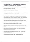
1. Which three statements describe common editing tasks with spatial data? - Answer Create a new feature, Modify an existing feature, Delete a feature. 2. How is location identified in a GIS? - Answer x, y coordinates 3. You are creating a streets dataset. You want to constrain the Types field to local roads, highways, and off-ramps. Which data behavior would you use? - Answer Domains 4. You are creating a map for a report on a controversial topic. The report and map will face ...
- Exam (elaborations)
- • 1 pages's •
-
Esri•Esri
Preview 1 out of 1 pages
1. Which three statements describe common editing tasks with spatial data? - Answer Create a new feature, Modify an existing feature, Delete a feature. 2. How is location identified in a GIS? - Answer x, y coordinates 3. You are creating a streets dataset. You want to constrain the Types field to local roads, highways, and off-ramps. Which data behavior would you use? - Answer Domains 4. You are creating a map for a report on a controversial topic. The report and map will face ...

Which capability is available to users with public access to ArcGIS Online? A. Having unlimited storage space B. Creating web maps C. Sharing content within an organization D. Accessing additional ArcGIS apps B. Creating web maps 12/15/24, 2:24 PM ESRI CERTIFICATION:ARCGIS PRO ASSOCIATE 2101 EXAM LATEST WITH 106 ACTUAL QUESTIONS AND COR… Which phrase best describes an ArcGIS Online organization? A. A discrete virtual space within the ArcGIS Online cloud that enables an org...
- Exam (elaborations)
- • 23 pages's •
-
ESRI•ESRI
Preview 3 out of 23 pages
Which capability is available to users with public access to ArcGIS Online? A. Having unlimited storage space B. Creating web maps C. Sharing content within an organization D. Accessing additional ArcGIS apps B. Creating web maps 12/15/24, 2:24 PM ESRI CERTIFICATION:ARCGIS PRO ASSOCIATE 2101 EXAM LATEST WITH 106 ACTUAL QUESTIONS AND COR… Which phrase best describes an ArcGIS Online organization? A. A discrete virtual space within the ArcGIS Online cloud that enables an org...
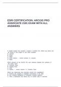
ESRI CERTIFICATION ARCGIS PRO ASSOCIATE 2101 EXAM WITH ALL ANSWERS.
- Exam (elaborations)
- • 11 pages's •
-
ESRI•ESRI
Preview 2 out of 11 pages
ESRI CERTIFICATION ARCGIS PRO ASSOCIATE 2101 EXAM WITH ALL ANSWERS.
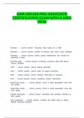
ESRI ARCGIS PRO ASSOCIATE CERTIFICATION EXAM WITH A 100- PASS
- Exam (elaborations)
- • 5 pages's •
-
ESRI•ESRI
Preview 2 out of 5 pages
ESRI ARCGIS PRO ASSOCIATE CERTIFICATION EXAM WITH A 100- PASS
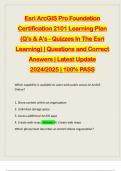
Esri ArcGIS Pro Foundation Certification 2101 Learning Plan (Q’s & A’s - Quizzes In The Esri Learning) | Questions and Correct Answers | Latest Update 2024/2025 | 100% PASS Which capability is available to users with public access to ArcGIS Online? 1. Share content within an organization 2. Unlimited storage space 3. Access additional ArcGIS apps 4. Create web maps - Answer -4. Create web maps Which phrase best describes an ArcGIS Online organization?1. A method for organizing or...
- Package deal
- Exam (elaborations)
- • 46 pages's •
-
Esri•Esri
-
ESRI ArcGIS CERTIFICATION BUNDLED EXAMS::::: QUESTIONS AND CORRECT ANSWERS | LATEST UPDATE 2024/2025• ByAdelineJean
Preview 4 out of 46 pages
Esri ArcGIS Pro Foundation Certification 2101 Learning Plan (Q’s & A’s - Quizzes In The Esri Learning) | Questions and Correct Answers | Latest Update 2024/2025 | 100% PASS Which capability is available to users with public access to ArcGIS Online? 1. Share content within an organization 2. Unlimited storage space 3. Access additional ArcGIS apps 4. Create web maps - Answer -4. Create web maps Which phrase best describes an ArcGIS Online organization?1. A method for organizing or...
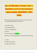
Esri Certification Practice Test 1 | Questions and Correct Answers | Latest Update 2024/2025 | 100% PASS Which two spatial query operators will select point features that are surrounded by polygon features? (Select two) A. Completely Contain B. Are Completely Within C. Share a Line Segment With D. Intersect E. Touch the Boundary Of - Answer -a,d Which limit is set for file geodatabase name length for ArcGIS Desktop? A. no limit B. limited to 32 characters C. limited to 255 characte...
- Package deal
- Exam (elaborations)
- • 20 pages's •
-
Esri•Esri
-
ESRI ArcGIS CERTIFICATION BUNDLED EXAMS::::: QUESTIONS AND CORRECT ANSWERS | LATEST UPDATE 2024/2025• ByAdelineJean
Preview 3 out of 20 pages
Esri Certification Practice Test 1 | Questions and Correct Answers | Latest Update 2024/2025 | 100% PASS Which two spatial query operators will select point features that are surrounded by polygon features? (Select two) A. Completely Contain B. Are Completely Within C. Share a Line Segment With D. Intersect E. Touch the Boundary Of - Answer -a,d Which limit is set for file geodatabase name length for ArcGIS Desktop? A. no limit B. limited to 32 characters C. limited to 255 characte...
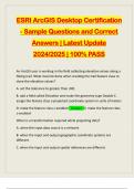
ESRI ArcGIS Desktop Certification - Sample Questions and Correct Answers | Latest Update 2024/2025 | 100% PASS An ArcGIS user is working in the field collecting elevation values along a hiking trail. What must be done when creating the trail feature class to store the elevation values? A. set the tolerance to greater than .001 B. add a field called Elevation and make the geometry type Double C. assign the feature class a projected coordinate system in units of meters D. make the featur...
- Package deal
- Exam (elaborations)
- • 100 pages's •
-
ESRI•ESRI
-
ESRI ArcGIS CERTIFICATION BUNDLED EXAMS::::: QUESTIONS AND CORRECT ANSWERS | LATEST UPDATE 2024/2025• ByAdelineJean
Preview 4 out of 100 pages
ESRI ArcGIS Desktop Certification - Sample Questions and Correct Answers | Latest Update 2024/2025 | 100% PASS An ArcGIS user is working in the field collecting elevation values along a hiking trail. What must be done when creating the trail feature class to store the elevation values? A. set the tolerance to greater than .001 B. add a field called Elevation and make the geometry type Double C. assign the feature class a projected coordinate system in units of meters D. make the featur...
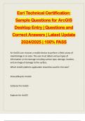
Esri Technical Certification: Sample Questions for ArcGIS Desktop Entry | Questions and Correct Answers | Latest Update 2024/2025 | 100% PASS An ArcGIS user chooses a mobile device to perform a field survey of road damage in an area. The user must obtain various types of information on the damage including surface type, damage, location, and an image of damage to the surface. Which ArcGIS platform application should be used for this task? Drone2Map for ArcGIS Collector for ArcGIS Exp...
- Package deal
- Exam (elaborations)
- • 20 pages's •
-
Esri•Esri
-
ESRI ArcGIS CERTIFICATION BUNDLED EXAMS::::: QUESTIONS AND CORRECT ANSWERS | LATEST UPDATE 2024/2025• ByAdelineJean
Preview 3 out of 20 pages
Esri Technical Certification: Sample Questions for ArcGIS Desktop Entry | Questions and Correct Answers | Latest Update 2024/2025 | 100% PASS An ArcGIS user chooses a mobile device to perform a field survey of road damage in an area. The user must obtain various types of information on the damage including surface type, damage, location, and an image of damage to the surface. Which ArcGIS platform application should be used for this task? Drone2Map for ArcGIS Collector for ArcGIS Exp...
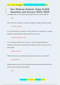
The backlink raster is a cost direction surface created when you run the Cost Path tool. False What are the units of measure for cell values in a Euclidean (straight-line) distance surface? X The units you specify If you want the software to reclassify your raster values into new values based on a standard classification method, which of the following options would you use? X Reclassify based on a table If you were trying to allocate cells in a raster to a source and determin...
- Exam (elaborations)
- • 4 pages's •
-
Esri•Esri
Preview 1 out of 4 pages
The backlink raster is a cost direction surface created when you run the Cost Path tool. False What are the units of measure for cell values in a Euclidean (straight-line) distance surface? X The units you specify If you want the software to reclassify your raster values into new values based on a standard classification method, which of the following options would you use? X Reclassify based on a table If you were trying to allocate cells in a raster to a source and determin...
