Advanced gis - Study guides, Class notes & Summaries
Looking for the best study guides, study notes and summaries about Advanced gis? On this page you'll find 77 study documents about Advanced gis.
Page 2 out of 77 results
Sort by
Advanced GIS Exam 2024 | GIS Advanced Exam Latest Update 2024 Questions and Correct Answers Rated A+
Advanced GIS Exam 2024 | GIS Advanced Exam Latest Update 2024 Questions and Correct Answers Rated A+
-
Advanced GIS Exam 1 Study Guide Solutions
- Exam (elaborations) • 11 pages • 2024
-
 OliviaWest
-
- $12.49
- + learn more
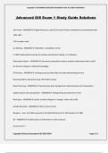
Advanced GIS Exam 1 Study Guide Solutions John Snow - ANSWER-English Physician, used GIS to locate Cholera outbreaks by contaminated wells -GIS on paper maps Ian McHarg - ANSWER- - Grandfather of GIS in 1969 made popular overlays for analysis and decision making- no computers Information System - ANSWER-set process, executed on data to produce information that is useful for decision making or adding to knowledge GIS Process - ANSWER-Looking at process flow helps to build understanding o...
Advanced GIS Exam | GIS Advanced Exam Latest Update Questions and Correct Answers Rated A+
-
Advanced GIS Exam 1 Questions and Answers 2024 Update
- Exam (elaborations) • 33 pages • 2024
-
 KatelynWhitman
-
- $12.49
- + learn more
Advanced GIS Exam 1 Questions and Answers 2024 Update The coordinate system is a property of the geodatabase, so all feature classes and feature datasets within the geodatabase must share the same coordinate system ToF - Answer ️️ -F You have two feature classes: Parcels and Roads. If you want to use a geodatabase topology to help protect spatial relationships between them, you must store them in a feature dataset in the geodatabase. torf - Answer ️️ -t Schema refers to the structu...
-
Advanced GIS Exam 1 Study Guide Solutions
- Exam (elaborations) • 6 pages • 2024
-
 OliviaWest
-
- $11.49
- + learn more
Advanced GIS Exam 1 Study Guide Solutions Geographic data model - ANSWER-structure for organizing geospatial data Object Class - ANSWER-collection of objects in tabular format Feature Class - ANSWER-collection of Geographic Objects in tabular format that have the same behavior and attributes and geometry relationship - ANSWER-association between two objects in a database network - ANSWER-set of edges and junctions that are topologically connected edge - ANSWER-lines that end in junctions ...
-
Advanced GIS Exam 1 Questions and Answers 2024 Update
- Exam (elaborations) • 33 pages • 2024
- Available in package deal
-
 BrittieDonald
-
- $12.49
- + learn more
Advanced GIS Exam 1 Questions and Answers 2024 Update The coordinate system is a property of the geodatabase, so all feature classes and feature datasets within the geodatabase must share the same coordinate system ToF - Answer ️️ -F You have two feature classes: Parcels and Roads. If you want to use a geodatabase topology to help protect spatial relationships between them, you must store them in a feature dataset in the geodatabase. torf - Answer ️️ -t Schema refers to the structu...
-
Exam Bank for Advanced GIS- Questions and Answers Solved 100%
- Exam (elaborations) • 8 pages • 2024
-
 TutorJosh
-
- $7.99
- + learn more
Exam Bank for Advanced GIS- Questions and Answers Solved 100% A raster with a larger cell size has a higher resolution than a raster with a smaller cell size. - Answers False A vegetation raster is most likely a(n)_________ raster - Answers integer Which type of raster typically does not have an attribute table associated with it? - Answers floating-point raster Which of the following data sources can produce elevation data with the highest level of vertical accuracy? - Answers 1/9 arc-secon...
-
GIS Questions and Answers 2024/2025
- Exam (elaborations) • 26 pages • 2024
-
 TestTrackers
-
- $13.49
- + learn more
GIS geographic information system software - allows you to envision the geographic aspects of a body of data. ESRI is Environmental Systems Research Institute - the developer and supplier of GIS how does computer hardware performance change the performance doubles every 18 months. ArcReader allows one to view and query maps created with other ArcGIS products ArcGIS the name that ESRI uses to refer to its suite of GIS software product. Desktop ArcGIS computer ...
-
GIS Exam 1 Questions and Answers 2024/2025
- Exam (elaborations) • 16 pages • 2024
-
 TestTrackers
-
- $12.49
- + learn more
Geospatial Technology Geospatial technology is a collective term used to describe the integrated use of geographic information systems,remote sensing, global navigation satellite systems, digital cartography and Internet mapping. What is GIS? -definition: A geographic information system is a computer system* designed to manage and analyze spatial data, where spatial data can be any data that are tied to places or geographic coordinates. *the five components of a computer syste...

$6.50 for your textbook summary multiplied by 100 fellow students... Do the math: that's a lot of money! Don't be a thief of your own wallet and start uploading yours now. Discover all about earning on Stuvia

