Analytical mapping - Study guides, Class notes & Summaries
Looking for the best study guides, study notes and summaries about Analytical mapping? On this page you'll find 236 study documents about Analytical mapping.
Page 2 out of 236 results
Sort by
-
2024 NFPA Questions and Answers 100% Pass
- Exam (elaborations) • 37 pages • 2024
-
 BESTSTUDYGURU
-
- $11.99
- + learn more
NFPA 1033 Standard for Professional Qualifications for Fire Investigator Facilitates safe, accurate investigations by specifying the job performance requirements (JPRs) necessary to perform as a fire investigator in both the private and public sectors. NFPA 921: Guide for Fire and Explosion Investigations Guide for Fire and Explosion Investigations", is a peer reviewed document that is published by the National Fire Protection Association (NFPA). Its purpose is "to establish guidelines an...
-
Praxis 5002 Practice Test 1-TeachersTestPrep (Answered 100% Correctly)
- Exam (elaborations) • 33 pages • 2024
-
 Thepassword
-
- $15.49
- + learn more
Praxis 5002 Practice Test 1-TeachersTestPrep (Answered 100% Correctly) 1) The idea that, in English, words are made up of letters that approximate the sounds heard when we speak these words is called_____ a) The alphabetic principle b) phonics c) pragmatics d) fast mapping A 2) A teacher shows a class cards with various words and reads them aloud, pronouncing certain written units distinctly. For example: nobody = "no/bo/dy" saxophone = "sax/o/phone" elementary = "el/em/en/ta/...
-
GISP Study Already Graded A+
- Exam (elaborations) • 32 pages • 2024
-
Available in package deal
-
 CertifiedGrades
-
- $9.89
- + learn more
GISP Study Already Graded A+ Georeferencing and Control Points - Georeferencing: The process of associating a map or image with spatial coordinates to accurately represent its geographic location. - Control Points: Specific points that correspond in pairs, matching known spatial locations to points on an unreferenced image or map. Spatial Reference Systems - Spatial Reference System (SRS): A coordinate-based system—local, regional, or global—used to locate geographical entities, al...
-
MGSC 300 CH 11 REVIEW PRACTICE TEST.
- Exam (elaborations) • 10 pages • 2024
-
Available in package deal
-
 ROSEGRADES
-
- $12.49
- + learn more
MGSC 300 CH 11 REVIEW PRACTICE TEST. In an effort to improve ________, the grocery chain Safeway implemented data-sharing programs with PepsiCo and other key vendors. a. Data analysis b. Product quality c. Supply chain visibility d. Manufacturing visualization - CORRECT ANSWER c. Supply chain visibility _________________ are the single best way our brain processes information. a. Configurations b. Pattern mapping c. Spreadsheets d. Visuals - CORRECT ANSWER d. Visuals ____...
-
THE BUSINESS MANAGEMENT + ADMINISTRATION CAREER CLUSTER EXAM DECA WITH COMPLETE SOLUTIONS!!
- Exam (elaborations) • 38 pages • 2024
-
Available in package deal
-
 papersbyjol
-
- $13.99
- + learn more
Limited liability is a characteristic of what form of business ownership? A. Sole proprietorship B. Joint proprietorship C. Partnership D. Corporation - ANSWER-D Corporation. Stockholders in corporations have limited liability; that is, their losses are limited to the amount of money that they have invested in the business. Partnerships and sole proprietorships have unlimited liability, meaning that the business owners are personally liable for debts incurred by the business. Joint pr...
-
D199 Practice Test Questions with Correct Answers
- Exam (elaborations) • 12 pages • 2024
-
Available in package deal
-
 Perfectscorer
-
- $12.99
- + learn more
D199 Practice Test Questions with Correct Answers reference maps - Answer-maps used to display important physical elements of a specific geographic area, such as countries, rivers, mountains, etc. thematic maps - Answer-specialized maps used to understand one particular attribute or characteristic of a specific geographic area; examples are population maps, weather maps, and maps illustrating the spread of disease literal maps - Answer-maps that strive to display the objective truth about...
-
Introduction to Physcial and Human Geography D199 Questions & Answers(scored A)
- Exam (elaborations) • 15 pages • 2024
-
 nursingismylife
-
- $11.99
- + learn more
Introduction to Physcial and Human Geography D199 Questions & Answers(scored A)What are maps used for? -ANSWER - show an area larger than a person can see - present information concisely, especially the features of most interest to the user - demonstrate spatial relationships - show things people cannot see directly, such as minerals below ground or records of daily temperatures. Reference map -ANSWER - store data and show a variety of features for a variety of uses. - general storehouses...
-
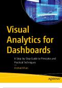
Visual Analytics for Dashboards A Step-by-Step Guide to Principles and Practical Techniques 2024 with complete solution;Chapter 1-11
- Exam (elaborations) • 191 pages • 2024
-
 Wiseman
-
- $30.49
- + learn more
Visual Analytics for Dashboards A Step-by-Step Guide to Principles and Practical Techniques 2024 with complete solution Table of Contents Chapter 1: Dashboards Business Intelligence Objective and Technologies Defining Business Intelligence Business Intelligence Tools Convergence of Disciplines Background Business Dashboard Predecessor Change in User Needs Major Changes Since the 1990s Dashboards Car Dashboard Business Dashboard Definition Objective Key Features Process Suppor...
-
WGU D199 Physical Geography and Migration NOTES and question and answers verified to pass
- Exam (elaborations) • 6 pages • 2024
-
Available in package deal
-
 Academia199
-
- $13.99
- + learn more
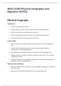
WGU D199 Physical Geography and Migration NOTES and question and answers verified to pass WGU D199 Physical Geography and Migration NOTES Physical Geography Introduction • Focuses on natural features of earth • Studies landforms, climate, bodies of water, biomes, soils, natural vegetation • Studies human impact on environment and ecosystems • Seeks to understand how physical processes drive change in the environment • Studies how humans are interacting with those processe...
-
IFPC Questions and Answers 100% Pass
- Exam (elaborations) • 16 pages • 2023
-
Available in package deal
-
 ExcellentScores
-
- $9.99
- 1x sold
- + learn more
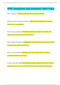
IFPC Questions and Answers 100% Pass What is Intelligence? Processed Information that provides an assessment What is the primary role of joint intelligence? To provide information and assessments to facilitate mission accomplishment What is Strategic Intelligence Intelligence needed by policymakers to make policy and military decision at the national and international level What is Operational Intelligence Intelligence used by military leaders to plan and accomplish strategic objectives with ...

Did you know that on average a seller on Stuvia earns $82 per month selling study resources? Hmm, hint, hint. Discover all about earning on Stuvia


