Coordinate plane - Study guides, Class notes & Summaries
Looking for the best study guides, study notes and summaries about Coordinate plane? On this page you'll find 744 study documents about Coordinate plane.
Page 3 out of 744 results
Sort by
-
GIS Test 1 Questions and Answers 100% Passs
- Exam (elaborations) • 73 pages • 2025
- Available in package deal
-
 BrittieDonald
-
- $13.49
- + learn more
GIS Test 1 Questions and Answers 100% Passs Briefly discuss the decisions that the GIS user must make when creating maps of the following areas: Local and regional maps - Any region that fits inside a single UTM or State Plane zone can use either. The United States uses the State Plane Coordinate System. Similarly, other nations have their own specifically designed state or province coordinate system for better projection. The preferred system would place the region to be mapped close to...
-
WGU C784 - APPLIED HEALTHCARE STATISTICS OBJECTIVE ASSESSMENT #1| 100 QUESTIONS AND ANSWERS
- Exam (elaborations) • 13 pages • 2024
- Available in package deal
-
 Ascorers
-
- $11.99
- + learn more
WGU C784 - APPLIED HEALTHCARE STATISTICS OBJECTIVE ASSESSMENT #1| 100 QUESTIONS AND ANSWERS Given the following set of numbers: 3.3, -2.3, -16, 25. What are the square roots of the whole number? A. +/- 2.3 B. +/- 3.3 C. +/- 4 D. +/- 5 ANS: - D. +/- 5 Composite Number ANS: - A number with more factors that just one and itself. Equivalent Fractions ANS: - Different fractions that represent the same value. X-Axis ANS: - The horizontal line that passes...

-
Accuplacer Math Terms | Questions and Correct Answers | Latest Update 2024/2025
- Exam (elaborations) • 28 pages • 2024
- Available in package deal
-
 AdelineJean
-
- $11.99
- + learn more
Accuplacer Math Terms | Questions and Correct Answers | Latest Update 2024/2025 Define - "ordered pairs" - Answer -= (x, y) = a single point on a coordinate plane Define - "origin" - Answer -= (0,0) = the point where two axes meet Explain - "quadrants" - Answer -= when the two axes (x and y) cross they form 4 quadrants Explain what - "the distance" means Define - "distance formula" for a line(s) - Answer -= "distance" - the length between two points on a plane - (x1, y1),...
-
Figures in the Coordinate Plane Exam Question with Verified Correct Answers
- Exam (elaborations) • 2 pages • 2024
-
Available in package deal
-
 lectknancy
-
- $7.99
- + learn more
In the diagram, AB = 10 and AC = 2√10. What is the perimeter of ABC? - Answers-d. 20 + 2√10 units HIJK is a parallelogram because the midpoint of both diagonals is _________ 2)7,) means the diagonals bisect each other. - Answers-1, 0 In the diagram, ZY = WX = 2√10. What is the perimeter of rectangle WXYZ? - Answers-c. 6√10 units Which statement proves that quadrilateral JKLM is a kite? - Answers-b. LM = JM = 3 and JK = LK = √17 The perimeter of kite WXYZ is 2√53 + 10 unit...
-
MMET 181 (Hung and Obeidat) Exam 1 || Questions and 100% Verified Answers.
- Exam (elaborations) • 12 pages • 2025
-
Available in package deal
-
 FullyFocus
-
- $11.69
- + learn more
chain for production correct answers needs -> design -> materials -> manufacture -> product -> customers manufacture correct answers changes shape, property and surface product correct answers production system materials correct answers polymer, steel, ceramic, natural etc. customers correct answers meets needs (sales and marketing) coordinate system correct answers all lines parallel to x,y,z axes common language between engineers correct answers drawings pro...
-
D127 Mathematics for Elementary Educators Questions and answers 2022/2023 completed 100%
- Exam (elaborations) • 13 pages • 2023
-
 Scholarsstudyguide
-
- $9.99
- 2x sold
- + learn more
D127 Mathematics for Elementary Educators Questions and answers 2022/2023 completed 100% Vertical line - CORRECT ANSWERS A line that runs up and down on the coordinate plane, parallel to the y-axis. It has no run, or change in x-value. Complementary angles - CORRECT ANSWERS Two angles whose sum is equal to 90°. Line - CORRECT ANSWERS A straight one-dimensional figure that extends infinitely in both directions. Origin - CORRECT ANSWERS Th...
-
GISP Verified Solutions
- Exam (elaborations) • 28 pages • 2024
-
Available in package deal
-
 CertifiedGrades
-
- $9.89
- + learn more
GISP Verified Solutions Data Models - Data Exploration: A data-centered query and analysis process to explore and understand data. - Dynamic Segmentations: A data model that employs linearly measured data on a coordinate system for analysis. - Georelational Data Model: A vector data model that uses a split system to store geometries and their attributes separately. - GeoSpatial Data: Data describing both the locations and characteristics of spatial features on the Earth's surface. - Obj...
-
Accuplacer Math Terms Test with Questions Solved 100% Correct| Verified Answers
- Exam (elaborations) • 24 pages • 2024
- Available in package deal
-
 Examsplug
-
- $12.89
- + learn more
Define - "ordered pairs" - ANSWER = (x, y) = a single point on a coordinate plane Define - "origin" - ANSWER = (0,0) = the point where two axes meet Explain - "quadrants" - ANSWER = when the two axes (x and y) cross they form 4 quadrants Explain what - "the distance" means Define - "distance formula" for a line(s) - ANSWER = "distance" - the length between two points on a plane - (x1, y1), (x2, y2) * does not have to be forming a line *distance is ALWAYS positive
-
ANAT 100 Block Theory Test 1 || A+ Verified Solutions.
- Exam (elaborations) • 19 pages • 2024
-
Available in package deal
-
 FullyFocus
-
- $13.49
- + learn more
Anatomy correct answers The study of structure 4 areas of Anatomy correct answers Histology, Gross Anatomy, Neuroanatomy, and Embryology. What is "inextricably linked in Anatomy?" correct answers Form and function What is a molecule? correct answers Group of atoms bonded together A molecule is on what level? correct answers Chemical level cells correct answers smallest living structures and are formed from atoms and molecules cells are found at which level? correct answer...
-
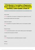
C784 Module 6: Correlation & Regression Exam | Questions & 100% Correct Answers (Verified) | Latest Update | Grade A+
- Exam (elaborations) • 24 pages • 2024
-
 ExamArsenal
-
- $13.49
- + learn more
lurking variable : A variable that is not included in an analysis but that is related to two (or more) other associated variables which were analyzed. simple linear regression : the prediction of one response variable's value from one explanatory variable's value Simpson's Paradox : A counterintuitive situation in which a trend in different groups of data disappears or reverses when the groups are combined. degree : The largest exponent in a mathematical expression or equation. ...

Study stress? For sellers on Stuvia, these are actually golden times. KA-CHING! Earn from your study resources too and start uploading now. Discover all about earning on Stuvia


