Arcgis by - Study guides, Class notes & Summaries
Looking for the best study guides, study notes and summaries about Arcgis by? On this page you'll find 145 study documents about Arcgis by.
All 145 results
Sort by
 Popular
-
Esri ArcGIS Pro Foundation Certification 2101 Learning Plan Exam Practice Questions and Answers 100% Pass
- Exam (elaborations) • 51 pages • 2024
-
 SophiaBennett
-
- $13.49
- 1x sold
- + learn more
Esri ArcGIS Pro Foundation Certification 2101 Learning Plan Exam Practice Questions and Answers 100% Pass Which capability is available to users with public access to ArcGIS Online? 1. Share content within an organization 2. Unlimited storage space 3. Access additional ArcGIS apps 4. Create web maps - ANSWER-4. Create web maps Which phrase best describes an ArcGIS Online organization? 1. A method for organizing or arranging maps, scenes, apps, layers, and other content in ArcGIS Online...
Managing Raster Data Using ArcGIS by Esri Exam Questions and Answers
-
MANAGING RASTER DATA USING ArcGIS BY ESRI EXAM
- Exam (elaborations) • 6 pages • 2024
- Available in package deal
-
 luzlinkuz
-
- $10.49
- + learn more
MANAGING RASTER DATA USING ArcGIS BY ESRI EXAM...

-
CLASSIFYING IMAGERY USING ArcGIS BY ESRI TEST
- Exam (elaborations) • 5 pages • 2024
- Available in package deal
-
 luzlinkuz
-
- $9.89
- + learn more
CLASSIFYING IMAGERY USING ArcGIS BY ESRI TEST...
-
3D Analysis of Surfaces and Features Using ArcGIS by Esri. Exam Questions With Correct Answers 100% Guaranteed Pass.
- Exam (elaborations) • 5 pages • 2025
-
 Brightstars
-
- $10.49
- + learn more
3D Analysis of Surfaces and Features Using ArcGIS by Esri. Exam Questions With Correct Answers 100% Guaranteed Pass. A functional surface can model and store multiple z-values per x,y coordinate. False - Answer A skyline barrier is a 3D polyline representing the line that divides the sky from the surface or from features that touch the sky, based on the perspective of the observer location. False - Answer - Answer If you create a profile graph from a line that was drawn in an east-to-we...
-
Esri Desktop Associate Exam Questions and Answers 100% Pass
- Exam (elaborations) • 69 pages • 2025
- Available in package deal
-
 BrittieDonald
-
- $12.49
- + learn more
Esri Desktop Associate Exam Questions and Answers 100% Pass You can use ModelBuilder in ArcGIS Pro. (T/F) - True Raster functions are performed by only using geoprocessing tools. (T/F) - False You can have only one layout associated with your project at a time. (T/F) - False The default output location for geoprocessing tools in ArcGIS is in the project geodatabase. (T/F) - True To edit a feature class in ArcGIS Pro, start an editing session on the Edit tab. (T/F) - False You must set u...
-
ArcGIS Pro Foundation 2101 Esri Certification All questions are pulled directly from Esri Training Course Quizzes. Latest Update 2024-2025 Actual Exam from Credible Source with 110 Questions and 100% Verified Detailed Correct Answers Guaranteed A+ Approve
- Exam (elaborations) • 20 pages • 2024
-
 Tutordiligent
-
- $20.49
- + learn more
ArcGIS Pro Foundation 2101 Esri Certification All questions are pulled directly from Esri Training Course Quizzes. Latest Update Actual Exam from Credible Source with 110 Questions and 100% Verified Detailed Correct Answers Guaranteed A+ Approved by Professor
-
ESRI Certification ArcGIS Pro Associate 2101 Latest Update 2024-2025 Actual Exam from Credible Source with 110 Questions and 100% Verified Detailed Correct Answers Guaranteed A+ Approved by Professor
- Exam (elaborations) • 16 pages • 2024
-
 Tutordiligent
-
- $20.49
- + learn more
ESRI Certification ArcGIS Pro Associate 2101 Latest Update Actual Exam from Credible Source with 110 Questions and 100% Verified Detailed Correct Answers Guaranteed A+ Approved by Professor
-
ArcGIS - ESRI, GIS Test one, Geodesy - Week 4 - ESRI Online Course, Geospatial Test 1 and CORRECT Answer
- Exam (elaborations) • 149 pages • 2025
- Available in package deal
-
 MGRADES
-
- $12.99
- + learn more
ArcGIS - ESRI, GIS Test one, Geodesy - Week 4 - ESRI Online Course, Geospatial Test 1 and CORRECT Answers 1) SQL is a data sublanguage, not a complete programming language. - CORRECT ANSWER - Answer: TRUE 2) When using SQL to create a table, a column is defined by declaring, in this order: data type, column name, and optional constraints. - CORRECT ANSWER - Answer: FALSE
-
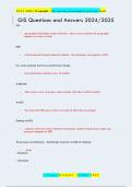
GIS Questions and Answers 2024/2025
- Exam (elaborations) • 26 pages • 2024
-
 TestTrackers
-
- $13.49
- + learn more
GIS geographic information system software - allows you to envision the geographic aspects of a body of data. ESRI is Environmental Systems Research Institute - the developer and supplier of GIS how does computer hardware performance change the performance doubles every 18 months. ArcReader allows one to view and query maps created with other ArcGIS products ArcGIS the name that ESRI uses to refer to its suite of GIS software product. Desktop ArcGIS computer ...

That summary you just bought made someone very happy. Also get paid weekly? Sell your study resources on Stuvia! Discover all about earning on Stuvia

