Topographic maps - Study guides, Class notes & Summaries
Looking for the best study guides, study notes and summaries about Topographic maps? On this page you'll find 139 study documents about Topographic maps.
Popular textbooks 'Topographic maps'
All 139 results
Sort by
 Popular
-
2024_AQA-GCSE Geography Paper 3: Geographical Applications (Merged Question Paper and Marking Scheme) Friday 14 June 2024
- Exam (elaborations) • 49 pages • 2024
-
 Cate001
- $7.99
- 1x sold
- + learn more
2024_AQA-GCSE Geography Paper 3: Geographical Applications (Merged Question Paper and Marking Scheme) Friday 14 June 2024 Candidate number I declare this is my own work. GCSE GEOGRAPHY Paper 3 Geographical applications Friday 14 June 2024 Morning Time allowed: 1 hour 30 minutes Materials For Examiner’s Use For this paper you must have: • the Pre-release resources booklet (enclosed) Question Mark • the OS...
-
Tactical Tools (Corporal's Course) questions and answers 2023
- Exam (elaborations) • 39 pages • 2023
-
Dreamer252
- $30.49
- 3x sold
- + learn more
A map is defined as a graphic representation of a portion of the Earth's surface drawn to scale, as seen from above. It uses colors, symbols, and labels to represent features found on the ground. -The ideal representation would be realized if every feature of the area being mapped could be shown in true shape. -The purpose of a map is to provide information on the existence, location, and distance between ground features, such as populated places and routes of travel and communication. I...
-
Topographic Maps Exam Questions with Correct Answers
- Exam (elaborations) • 3 pages • 2023
-
 Scholarsstudyguide
- $12.99
- + learn more
Topographic Maps Exam Questions with Correct Answers Topographic Map - Answer-shows the surface features, or topography of Earth or a certain area. What does a topographic map show? - Answer-it shows natural features such as rivers and lakes. They also show some features made by people such as brodges. They also show elevation. Elevation - Answer-The height of an object above the surface of the sea. What is the elevation at sea level? - Answer-The elevation at sea level is zero mete...
-
Topographic Maps Test Questions with Correct Answers
- Exam (elaborations) • 2 pages • 2023
-
Scholarsstudyguide
- $11.49
- + learn more
Topographic Maps Test Questions with Correct Answers Mapmakers use contour lines to represent what three things on topographic maps? - Answer-elevation, relief, and slope contour line - Answer-A contour line on a topographic map connects points of equal elevation. contour interval - Answer-The change in elevation from contour line to contour line is called the contour interval. index contours - Answer-Every fifth line, known as the index contour, is darker and heavier than the other...
-
Indiana Generalist Social Studies and Fine Arts Exam || A+ Guaranteed.
- Exam (elaborations) • 33 pages • 2024
-
 FullyFocus
- $13.39
- + learn more
three types of basic maps correct answers base map, topographic map, and thematic map base maps correct answers created from aerial and field surveys serve as the starting point for topographic and thematic maps topographic maps correct answers show the natural and human-made features of the earth, including mountain elevations, river courses, roads, names of lakes and towns, and county and state lines thematic maps correct answers use a base or topographic map as the foundation for sh...

Get paid weekly? You can!

-
CMP 305 Final Exam Questions with Correct Answers
- Exam (elaborations) • 18 pages • 2024
-
Scholarsstudyguide
- $12.49
- + learn more
CMP 305 Final Exam Questions with Correct Answers What info needs to be collected for surface evaluation? - Answer-- Soil maps - Topographic maps - Aerial photos - USGS topographic quadrangle maps - USDA soil conservation maps What features can be observed from bird's eye view of maps? - Answer-- Land patterns - Sink holes - Drainage patterns (low areas) What things should you check when visiting a site? - Answer-- Water level - Existing wells - Water marks - Underground utilit...
-
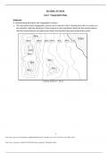
Sketching Assignment - Topographic Maps - Already Graded A+
- Exam (elaborations) • 6 pages • 2023
-
ExamsConnoisseur
- $9.99
- + learn more
ESC1000L, GLY1010L Lab 2: Topographic Maps Elaborate A: Understanding Elevations and Topographic Contours 1. The map below shows topographic contours at an interval of 20 m. Starting from the 0 m contour at the shoreline, label the elevations of the contours on the map below. Note that the closed contours with the inward hatches are depressions where the elevation decreases towards the center.
-
Topographic Maps Exam Questions with Correct Answers
- Exam (elaborations) • 3 pages • 2024
-
ApassExams
- $7.99
- + learn more
Topographic Maps Exam Questions with Correct Answers Topographic Map - Answer-shows the surface features, or topography of Earth or a certain area. What does a topographic map show? - Answer-it shows natural features such as rivers and lakes. They also show some features made by people such as brodges. They also show elevation. Elevation - Answer-The height of an object above the surface of the sea. What is the elevation at sea level? - Answer-The elevation at sea level is zero meters...

-
Topographic Maps Exam Questions with Correct Answers
- Exam (elaborations) • 3 pages • 2024
-
PerfectAPass
- $7.69
- + learn more
Topographic Maps Exam Questions with Correct Answers Topographic Map - Answer-shows the surface features, or topography of Earth or a certain area. What does a topographic map show? - Answer-it shows natural features such as rivers and lakes. They also show some features made by people such as brodges. They also show elevation. Elevation - Answer-The height of an object above the surface of the sea. What is the elevation at sea level? - Answer-The elevation at sea level is zero meters...
-
PRAXIS 5004 EXAM WITH COMPLETE SOLUTIONS GRADED A+
- Exam (elaborations) • 21 pages • 2024
-
Scholarsstudyguide
- $11.99
- + learn more
PRAXIS 5004 EXAM WITH COMPLETE SOLUTIONS GRADED A+ Mesopotamia - Answer-Ancient civilization that flourished between the Tigris and Euphrates Rivers. Irrigation systems were done resulting in the surplus of food and the beginning of civilization Sumerians - Answer-helped develop the area in Mesopotamia Cuneiform - Answer-Worlds first handwriting system May have also been the first to invent the wheel and plow- mesopotamia Rosetta Stone - Answer-Found in Egypt. Information was written...
