Caitlynnapier
On this page, you find all documents, package deals, and flashcards offered by seller caitlynnapier.
- 49
- 0
- 4
Community
- Followers
- Following
53 items

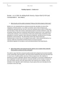
Analysis of Donlan et al. (2005)
An analysis of Donlan et al. (2005), who discuss the conservation strategy re-wilding. Includes a brief analysis of two correspondance letters (sources used referenced below). 1. Donlan, J. et al. 2005. Re-wilding North America. Nature 436:913-914 (and Correspondence – two letters)
- Class notes
- • 2 pages •
An analysis of Donlan et al. (2005), who discuss the conservation strategy re-wilding. Includes a brief analysis of two correspondance letters (sources used referenced below). 1. Donlan, J. et al. 2005. Re-wilding North America. Nature 436:913-914 (and Correspondence – two letters)

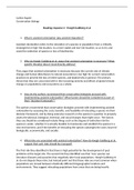
Analysis of Hoegh-Guldberg et al. (2008)
An analysis of the article written by Hoegh-Guldberg et al. (2008) on assisted colonisation. Includes a brief analysis of the response letter written by Davidson and Simkanin (sources used in analysis referenced below). SOURCES USED 1. Hoegh-Guldberg, O. et al. 2008. Assisted colonization and rapid climate change. Science 321:345-346. 2. Letter by Davidson, I. and C. Simkanin. 2008. Skeptical of assisted colonization. Science 322:1048-1050.
- Class notes
- • 2 pages •
An analysis of the article written by Hoegh-Guldberg et al. (2008) on assisted colonisation. Includes a brief analysis of the response letter written by Davidson and Simkanin (sources used in analysis referenced below). SOURCES USED 1. Hoegh-Guldberg, O. et al. 2008. Assisted colonization and rapid climate change. Science 321:345-346. 2. Letter by Davidson, I. and C. Simkanin. 2008. Skeptical of assisted colonization. Science 322:1048-1050.

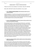
Thomas et al. (2013) and Brand (2013) analysis
An analysis of the article posted in Nature by Thomas et al. (2013) and the TED Talk given by Brand (2013). Eight questions that look into facilitated adaptation and de-extinction, including risks, approaches and candidate species.
- Class notes
- • 3 pages •
An analysis of the article posted in Nature by Thomas et al. (2013) and the TED Talk given by Brand (2013). Eight questions that look into facilitated adaptation and de-extinction, including risks, approaches and candidate species.

Adding data to your map in ArcGIS (protocol)
Powerpoint presentation detailing how to add data to your map in ArcGIS.
- Package deal
- Presentation
- • 13 pages •
Powerpoint presentation detailing how to add data to your map in ArcGIS.

Adding data to the attribute table in ArcGIS (protocol)
Powerpoint presentation detailing how to add data to the attribute table of a feature layer in ArcGIS.
- Package deal
- Presentation
- • 6 pages •
Powerpoint presentation detailing how to add data to the attribute table of a feature layer in ArcGIS.

Checking the feature layer projection in ArcGIS (protocol)
Powerpoint presentation detailing how to check the projected GPS coordinate system of a feature layer in ArcGIS.
- Package deal
- Presentation
- • 20 pages •
Powerpoint presentation detailing how to check the projected GPS coordinate system of a feature layer in ArcGIS.

Cleaning up the map legend in ArcGIS (protocol)
Powerpoint presentation detailing how to clean up the legend of a map in ArcGIS. Includes changing column numbers, sizes etc.
- Package deal
- Presentation
- • 14 pages •
Powerpoint presentation detailing how to clean up the legend of a map in ArcGIS. Includes changing column numbers, sizes etc.

Adding a table to a feature layer in ArcGIS (protocol)
Powerpoint presentation detailing how to join a table from an external data source (ie excel) to a feature layer in ArcGIS.
- Package deal
- Presentation
- • 7 pages •
Powerpoint presentation detailing how to join a table from an external data source (ie excel) to a feature layer in ArcGIS.

Headsup digitizing in ArcGIS. (protocol)
Powerpoint presentation detailing how to headsup digitize (create polygons etc) in ArcGIS.
- Package deal
- Presentation
- • 27 pages •
Powerpoint presentation detailing how to headsup digitize (create polygons etc) in ArcGIS.

ArcGIS Protocols
Protocols of all major actions to be taken in ArcGIS to build a successful and well-structured map.
- Package deal
- • 13 items •
- Displaying GPS coordinates from a table to a map • Presentation
- Using the buffer tool in ArcGIS (protocol) • Presentation
- Downloading and extracting shape files for ArcGIS (protocol) • Presentation
- Selecting features by attributes in ArcGIS (protocol) • Presentation
- How to make an effective map in ArcGIS (protocol) • Presentation
- And more ….
Protocols of all major actions to be taken in ArcGIS to build a successful and well-structured map.
