Geodatabase - Study guides, Class notes & Summaries
Looking for the best study guides, study notes and summaries about Geodatabase? On this page you'll find 93 study documents about Geodatabase.
Page 2 out of 93 results
Sort by

-
GIST 8132 FINAL EXAM | QUESTIONS & ANSWERS (VERIFIED) | LATEST UPDATE | GRADED A+ | PASSED
- Exam (elaborations) • 19 pages • 2024
- Available in package deal
-
- $11.49
- + learn more
When would you use an Enterprise Enabled Multi-user Geodatabase? ANSWER: - when you need a multi-user GDB that can be edited and used simultaneously by many users - when you need to manage long transactions and versioned-based workflows - when you need extremely large, continuous GIS DBs Describe an Enterprise Multi-user GDB ANSWER: *What it does:* - translate spatial/non-spatial queries from ArcGIS to RDBMS format - interacts w/RDBMS server for data storage/retrieval - performs GIS op...
-
GISP Exam Prep Study Guide with Actual Questions and Answers Solved Correctly
- Exam (elaborations) • 13 pages • 2024
- Available in package deal
-
- $11.49
- + learn more
GISP Exam Prep Study Guide with Actual Questions and Answers Solved Correctly Geodatabase - answerobject oriented spatial model, native data structure for ArcGIS, and is the primary data format used for storing, editing, and managing geographic data. Types of Geodatabases - answerPersonal, File, Enterprise, workgroup Types of Geodatabase datasets - answerGeometric network, network dataset, parcel fabric, terrain dataset, LAS dataset Distance relations - answerspecifies how far is the obje...
-
GISP Exam Prep Study Guide with Actual Questions and Answers Solved Correctly
- Exam (elaborations) • 13 pages • 2024
- Available in package deal
-
- $11.49
- + learn more
GISP Exam Prep Study Guide with Actual Questions and Answers Solved Correctly Geodatabase - answerobject oriented spatial model, native data structure for ArcGIS, and is the primary data format used for storing, editing, and managing geographic data. Types of Geodatabases - answerPersonal, File, Enterprise, workgroup Types of Geodatabase datasets - answerGeometric network, network dataset, parcel fabric, terrain dataset, LAS dataset Distance relations - answerspecifies how far is the obje...
-
Esri Pro Associate Certification Exam Questions With 100% Correct Answers
- Exam (elaborations) • 44 pages • 2024
-
- $10.49
- + learn more
Esri Pro Associate Certification Exam Questions With 100% Correct Answers When is it appropriate to manage your raster datasets using a mosaic dataset? You want to use small to large collections of your raster data for managing, visualizing, performing many geoprocessing analyses, and querying. List the advantages of organizing raster data in a mosaic dataset. -Store, manage, view, query, and share small to vast collections of lidar data -Perform raster-level operations on lidar data -...
-
GISP 1 conceptual foundations questions with correct answers|100% verified|15 pages
- Exam (elaborations) • 15 pages • 2024
-
- $12.99
- + learn more
GISP 1 conceptual foundations questions with correct answers Euclidean distance the "ordinary" straight-line distance between two points in Euclidean space; the square root of ((x1-x2)squared + (y1-y2)squared)) Manhattan distance AKA taxi-cab geometry, vertical plus horizontal distance - abs(x1-x2) + abs(y1-y2) cardinal direction AKA cardinal point = NESW names of NE SE SW & NW directions intermediate, intercardinal or ordinal directions devices to navigate magnetic c...
-
GISP practice test questions with correct answers
- Exam (elaborations) • 9 pages • 2023
- Available in package deal
-
- $14.99
- + learn more
# 25 322 When a GIS dataset for a given project is constantly revised, accessed, and manipulated by multiple users the best practice approach for storing the data is (Choose the best answer) A. Shapefiles B. Personal Geodatabase C. KML files D. Enterprise Geodatabase Correct Answer-D # 26 323 What technology allows for multiple server instances on a single piece of hardware/single server? (Choose the best answer) A. Open Source B. Remote Desktop C. Virtualization D. Network Attached S...
-
GIS 138 Questions with 100% Correct Answers | Updated & Verified
- Exam (elaborations) • 14 pages • 2024
- Available in package deal
-
- $7.99
- + learn more
-
GIS Final Exam 2024
- Exam (elaborations) • 11 pages • 2024
- Available in package deal
-
- $11.49
- + learn more
GIS Final Exam 2024 The field used to join or relate two tables is called a(n) _____. A)feature ID B)shape ID C)object ID D)key - Answer ️️ -D If you are joining states to counties, with counties as the target table, the cardinality is ____. A)many to one B)one to one C)many to many D)one to many - Answer ️️ -A A relate MUST be used when the cardinality between two tables is ____. A) one-to-one and one-to-many B) many-to-one C) one-to-many D) one-to-one - Answer ️️ -C ...
-
ESRI Certification Guide: Ch 1-4 | Question with 100 % correct answers | Verified
- Exam (elaborations) • 11 pages • 2023
- Available in package deal
-
- $5.49
- + learn more
What is a Geodatabase schema? - the structure or design of the geodatabase (eg. structure of feature datasets, relations/joins between fields, symbology, labels, etc) Define a layer - it references a datasource and specifies how that dataset is portrayed using symbols and text labels ArcGIS for server is used to...? (3) - Publish info and maps as web services Access services through web apps Manage data in an enterprise geodatabase ArcGIS Online can be used for...? (2) - creating and shar...
-
GISP practice test questions with correct answers|100% verified|9 pages
- Exam (elaborations) • 9 pages • 2024
-
- $10.99
- + learn more
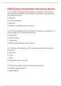
GISP practice test questions with correct answers # 25 322 When a GIS dataset for a given project is constantly revised, accessed, and manipulated by multiple users the best practice approach for storing the data is (Choose the best answer) A. Shapefiles B. Personal Geodatabase C. KML files D. Enterprise Geodatabase Correct Answer-D # 26 323 What technology allows for multiple server instances on a single piece of hardware/single server? (Choose the best answer) A. Open Source B. Remot...

That summary you just bought made someone very happy. Also get paid weekly? Sell your study resources on Stuvia! Discover all about earning on Stuvia


