Grid sea - Study guides, Class notes & Summaries
Looking for the best study guides, study notes and summaries about Grid sea? On this page you'll find 144 study documents about Grid sea.
Page 2 out of 144 results
Sort by

-
BDOC Maritime Warfare Exam Review Questions With Correct Answers!!
- Exam (elaborations) • 11 pages • 2024
- Available in package deal
-
 PatrickKaylian
-
- $7.99
- + learn more
3 principles CWC founded on - Answer-- Centralized planning - Decentralized execution - Command by negation Primary mission of CIC - Answer-Fight the ship Secondary mission of CIC - Answer-Assist the bridge What are the 4 principle warfare commander? - Answer-- air missile defense commander - Information operation warfare commander - Sea combat commander - strike warfare commander AIC - Answer-Air Intercept Controller CSC - Answer-Combat Systems Coordinator - SME who bridges tactical ...
-
MWS CDC ACTUAL EXAM QUESTIONS AND ANSWERS ALREADY PASSED
- Exam (elaborations) • 11 pages • 2025
- Available in package deal
-
 Scholarsstudyguide
-
- $13.59
- + learn more
MWS CDC ACTUAL EXAM QUESTIONS AND ANSWERS ALREADY PASSED when a fire scene is located down in narrow Lane, it is best to locate a dump site: - Answer-at the intersection where the lane meets a through fleur when it becomes necessary for the dump site pumper to operate off its tank because the portable tanks are empty then: - Answer-The attack pumper should be notified that water loss is imminent. when performing a vacuum service test, once the engine is turned on, the column of mercury...

-
Turning Data into Information Using ArcGIS 10 Exam Questions and Answers 100% Pass
- Exam (elaborations) • 23 pages • 2025
- Available in package deal
-
 BrittieDonald
-
- $12.49
- + learn more
Turning Data into Information Using ArcGIS 10 Exam Questions and Answers 100% Pass What is the fundamental problem with representing geographic data? - The world is infinitely complex, so any digital representation of geographic phenomena is inherently incomplete. Name the six types of spatial analysis. - Six types of spatial analysis are queries and reasoning, measurements, transformations, descriptive summaries, optimization, and hypothesis testing. Describe uncertainty associated wit...
-
GISP Study Guide All Answers Correct
- Exam (elaborations) • 20 pages • 2024
- Available in package deal
-
 CertifiedGrades
-
- $9.89
- + learn more
GISP Study Guide All Answers Correct Geodatabase Definition: An object-oriented spatial model representing the native data structure for ArcGIS. It serves as the primary format for storing, editing, and managing geographic data. Types of Geodatabases Personal Geodatabase File Geodatabase Enterprise Geodatabase Workgroup Geodatabase Types of Geodatabase Datasets Geometric Network Network Dataset Parcel Fabric Terrain Dataset LAS Dataset Distance Relations Definitio...

-
Praxis 5047 Middle school english, Praxis 5047 ALL SOLUTION LATEST EDITION 2024 ALL 100% CORRECT GUARANTEED GRADE A+
- Exam (elaborations) • 44 pages • 2024
-
 Allan100
-
- $14.89
- 1x sold
- + learn more
Parable realistic and has a moral Legend exaggerated story about people Myth literary sub genre of a story that involves gods and heroes, usually expressing a cultures ideals Folktale language of the people, does not need a moral, and main purpose is to entertain Fairytales element of magic, usually follows a pattern, and presents an "ideal", may contain "magic 3" or "stereotyping" Fable non-realistic, has a moral, and animals are often the main character Fable Aesop- "The Fo...

-
San Francisco Facts || with 100% Error-free Solutions.
- Exam (elaborations) • 10 pages • 2024
- Available in package deal
-
 FullyFocus
-
- $10.69
- + learn more
Who was the first to "discover" San Francisco? When correct answers Gaspar de Portola in 1769 When did Spain lose control of Mexico? correct answers 1821 What is the oldest building in San Francisco? correct answers The Mission Dolores built in 1791, although the Mission was established in 1776, the current structure that exists today was not built until 1791 Who named San Francisco Yerba Buena correct answers William Richardson, a British Sea Merchant. He named it in the 1830s after ...
-
FAE (Fire Apparatus Engineer) Illinois Questions And Answers Graded A+
- Exam (elaborations) • 8 pages • 2024
- Available in package deal
-
 PatrickKaylian
-
- $7.99
- + learn more
Used primarily on portable pumps where the velocity of exhaust gases passing through a venturi creates a vacuum. Require High engine RPM and is not very efficient. - Exhaust Primers The network of pipes of intermediate size which reinforce the grid within the various loops of the primary feeder system and aid the concentration of the required fire flow at any point. - Secondary Feeders What are all the steps in a Service Test? - 1. 20 minutes: 100% @ 150 psi 2. 10 minutes: 70 % @ 200 psi ...

-
GEG 111 Final Exam (Harper College)
- Exam (elaborations) • 19 pages • 2024
- Available in package deal
-
 shadow251
-
- $11.00
- + learn more
Physical Geography - Looks at the natural processes of the Earth, such as climate and plate tectonics. Human Geography - Looks at the impact and behaviour of people and how they relate to the physical world. Scientific Method - The Scientific Method looks to establish ideas, but also willing to modify, reject of change them when new evidence is found. The Scientific Method: 1. Observe 2. Form a question 3. Create Hypothesis 4. Test Hypothesis 5. Collect Data 6. Draw Conclusion The F...
-
Adobe Photoshop Certification 2023-2024 Questions and Answers 100% Correct
- Exam (elaborations) • 3 pages • 2023
- Available in package deal
-
 NursingTutor1
-
- $9.99
- + learn more
Adobe Photoshop Certification Questions and Answers 100% CorrectAdobe Photoshop Certification Questions and Answers 100% CorrectAdobe Photoshop Certification Questions and Answers 100% CorrectAdobe Photoshop Certification Questions and Answers 100% Correct Change Grid lines to dashed w/ 64 pixels and 1 subdivision, show grid if not showing already - ANSWER-1. command+k s,grid and slices 3. under grid, make dashed 4. gridline set to 64 PIXELS, 1 subdivison 5. OK, then view > show t...
-
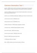
Clemson Geomatics Test 1 | 91 Questions and Answers(A+ Solution guide)
- Exam (elaborations) • 7 pages • 2023
- Available in package deal
-
 PatrickKaylian
-
- $5.49
- + learn more
geomatics - the modern scientific term referring to the integrated approach of measurement, analysis, management, storage, and presentation of the descriptions and locations of spatial data spatial data - data collected using a variety of methods including satellites, air and sea-borne sensors, and ground based instruments cylindrical, conic, azimuthal/planar,longitude grid -four general classes of coordinate systems universal transverse mercator - UTM accronym military grid reference syst...

Did you know that on average a seller on Stuvia earns $82 per month selling study resources? Hmm, hint, hint. Discover all about earning on Stuvia


