Topology and geometry - Study guides, Class notes & Summaries
Looking for the best study guides, study notes and summaries about Topology and geometry? On this page you'll find 41 study documents about Topology and geometry.
Page 2 out of 41 results
Sort by
-
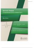
Harmonic Analysis A Comprehensive Course in Analysis, Part 3 Barry Simon
- Summary • 779 pages • 2024
- Available in package deal
-
 Exammate
-
- $14.99
- + learn more
Reed–Simon2 starts with “Mathematics has its roots in numerology, geometry, and physics.” This puts into context the division of mathematics into algebra, geometry/topology, and analysis. There are, of course, other areas of mathematics, and a division between parts of mathematics can be artificial. But almost universally, we require our graduate students to take courses in these three areas.
-
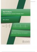
Real Analysis A Comprehensive Course in Analysis, Part 1 Barry Simon
- Summary • 811 pages • 2024
- Available in package deal
-
 Exammate
-
- $14.99
- + learn more
Reed–Simon2 starts with “Mathematics has its roots in numerology, geometry, and physics.” This puts into context the division of mathematics into algebra, geometry/topology, and analysis. There are, of course, other areas of mathematics, and a division between parts of mathematics can be artificial. But almost universally, we require our graduate students to take courses in these three areas
-
Advanced GIS Exam 1 Questions and Answers 2024 Update
- Exam (elaborations) • 33 pages • 2024
-
 KatelynWhitman
-
- $12.49
- + learn more
Advanced GIS Exam 1 Questions and Answers 2024 Update The coordinate system is a property of the geodatabase, so all feature classes and feature datasets within the geodatabase must share the same coordinate system ToF - Answer ️️ -F You have two feature classes: Parcels and Roads. If you want to use a geodatabase topology to help protect spatial relationships between them, you must store them in a feature dataset in the geodatabase. torf - Answer ️️ -t Schema refers to the structu...
-
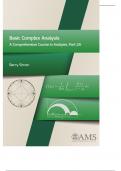
Basic Complex Analysis A Comprehensive Course in Analysis, Part 2A Barry Simon
- Summary • 661 pages • 2024
- Available in package deal
-
 Exammate
-
- $14.99
- + learn more
Reed–Simon2 starts with “Mathematics has its roots in numerology, geometry, and physics.” This puts into context the division of mathematics into algebra, geometry/topology, and analysis. There are, of course, other areas of mathematics, and a division between parts of mathematics can be artificial. But almost universally, we require our graduate students to take courses in these three areas
-
A Comprehensive Course in Analysis Part 2B Barry Simon
- Summary • 339 pages • 2024
- Available in package deal
-
 Exammate
-
- $14.99
- + learn more
Reed–Simon2 starts with “Mathematics has its roots in numerology, geometry, and physics.” This puts into context the division of mathematics into algebra, geometry/topology, and analysis. There are, of course, other areas of mathematics, and a division between parts of mathematics can be artificial. But almost universally, we require our graduate students to take courses in these three areas

-
GISP 1 conceptual foundations questions with correct answers|100% verified|15 pages
- Exam (elaborations) • 15 pages • 2024
-
 TOPSCORE100
-
- $12.99
- + learn more
GISP 1 conceptual foundations questions with correct answers Euclidean distance the "ordinary" straight-line distance between two points in Euclidean space; the square root of ((x1-x2)squared + (y1-y2)squared)) Manhattan distance AKA taxi-cab geometry, vertical plus horizontal distance - abs(x1-x2) + abs(y1-y2) cardinal direction AKA cardinal point = NESW names of NE SE SW & NW directions intermediate, intercardinal or ordinal directions devices to navigate magnetic c...
-
GEOG 360 Midterm Exam | Questions with Verified Answers
- Exam (elaborations) • 14 pages • 2024
-
 Jumuja
-
- $17.99
- + learn more
GEOG 360 Midterm Exam | Questions with Verified Answers Which of the following topological relationships describe the arc-node relationship in the coverage model? Connectivity Which of the following is true about the vector data model? -The model uses points, lines, and polygons to represent simple spatial features. -The representation of spatial features using the vector data model depends on map scale. -The model uses x-, y-coordinates to store the geometry of spatial features. Select the f...
-
GIS Quiz Questions with All Correct Answers
- Exam (elaborations) • 8 pages • 2025
- Available in package deal
-
 Perfectscorer
-
- $12.99
- + learn more
GIS Quiz Questions with All Correct Answers A conformal projection preserves the property of: a. relative size b. Local shapes. c. distances d. None of the above - Answer-b. local shapes Conformal projections preserve local shapes and angles, but distort relative surfaces and distances Which of the following statements is true about North American Datum (NAD)? a. NAD83 is a newer datum than NAD27 b. NAD83 is based on a satellite-determined spheroid. c. Maps based on NAD...
-
Advanced GIS Exam 1 Study Guide Solutions
- Exam (elaborations) • 6 pages • 2024
-
 OliviaWest
-
- $11.49
- + learn more
Advanced GIS Exam 1 Study Guide Solutions Geographic data model - ANSWER-structure for organizing geospatial data Object Class - ANSWER-collection of objects in tabular format Feature Class - ANSWER-collection of Geographic Objects in tabular format that have the same behavior and attributes and geometry relationship - ANSWER-association between two objects in a database network - ANSWER-set of edges and junctions that are topologically connected edge - ANSWER-lines that end in junctions ...

-
ABSTRACT ALGEBRA A FIRST UNDERGRADUATE COURSE 5TH EDITION PDF, EPUB, EBOOK
- Exam (elaborations) • 3 pages • 2024
-
 BRAINBOOSTERS
-
- $13.49
- + learn more
Abraham P Hillman | 9781577660828 | | | | | Abstract Algebra A First Undergraduate Course 5th edition PDF Book This course is an introduction to logic and foundations from both a modern point of view based on type theory and its relations to topology as well as in the traditional formulation based on first-order logic. Janson, S. Sign patterns: The Horn-type necessary conditions are best possible. Viewed times. Dimension computation of certain random fractals derived from Brownian motion range...

Did you know that on average a seller on Stuvia earns $82 per month selling study resources? Hmm, hint, hint. Discover all about earning on Stuvia


