Rasters - Guides d'étude, Notes de cours & Résumés
Vous recherchez les meilleurs guides d'étude, notes d'étude et résumés sur Rasters ? Sur cette page, vous trouverez 34 documents pour vous aider à réviser pour Rasters.
Page 3 sur 34 résultats
Trier par
-
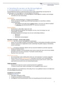
Samenvatting HC 4 Verdelingsvraagstukken (Cijfer 8,0) | Pre-Master Gezondheidswetenschappen | Erasmus Universiteit
- Notes de cours • 5 pages • 2022
-
Disponible en pack
-
 et98
et98
-
- €4,48
- + en savoir plus
De aantekeningen van HC 2 van het vak Verdelingsvraagstukken gegeven in de Pre-Master Gezondheidswetenschappen aan de Erasmus Universiteit Rotterdam. Dit document bevat de stof gegeven in het vierde college over Economie en Rechtvaardigheid. Belangrijke termen zijn dikgedrukt weergegeven in het oranje en andere kernpunten zijn onderstreept.
-
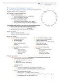
Samenvatting HC 9 Verdelingsvraagstukken (Cijfer 8,0) | Pre-Master Gezondheidswetenschappen | Erasmus Universiteit
- Notes de cours • 3 pages • 2022
-
Disponible en pack
-
 et98
et98
-
- €4,49
- + en savoir plus
De aantekeningen van HC 9 van het vak Verdelingsvraagstukken gegeven in de Pre-Master Gezondheidswetenschappen aan de Erasmus Universiteit Rotterdam. Dit document bevat de stof gegeven in het negende college over de evaluatie van beleidsinstrumenten. Belangrijke termen zijn dikgedrukt weergegeven in het oranje en andere kernpunten zijn onderstreept.
-
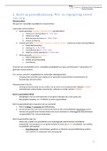
Samenvatting HC 2 Verdelingsvraagstukken (Cijfer 8,0) | Pre-Master Gezondheidswetenschappen | Erasmus Universiteit
- Notes de cours • 3 pages • 2022
-
Disponible en pack
-
 et98
et98
-
- €4,48
- + en savoir plus
De aantekeningen van HC 2 van het vak Verdelingsvraagstukken gegeven in de Pre-Master Gezondheidswetenschappen aan de Erasmus Universiteit Rotterdam. Dit document bevat de stof gegeven in het tweede college over Recht Op Gezondheidszorg. Belangrijke termen zijn dikgedrukt weergegeven in het oranje en andere kernpunten zijn onderstreept.

-
Samenvatting HC 1 Verdelingsvraagstukken (Cijfer 8,0) | Pre-Master Gezondheidswetenschappen | Erasmus Universiteit
- Notes de cours • 3 pages • 2022
-
Disponible en pack
-
 et98
et98
-
- €4,48
- + en savoir plus
De aantekeningen van HC 1 van het vak Verdelingsvraagstukken gegeven in de Pre-Master Gezondheidswetenschappen aan de Erasmus Universiteit Rotterdam. Dit document bevat de stof gegeven in het eerste college "Probleem van belang en framing". Belangrijke termen zijn dikgedrukt weergegeven in het oranje en andere kernpunten zijn onderstreept.
-
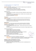
Samenvatting HC 3 Verdelingsvraagstukken (Cijfer 8,0) | Pre-Master Gezondheidswetenschappen | Erasmus Universiteit
- Notes de cours • 3 pages • 2022
-
Disponible en pack
-
 et98
et98
-
- €4,48
- + en savoir plus
De aantekeningen van HC 3 van het vak Verdelingsvraagstukken gegeven in de Pre-Master Gezondheidswetenschappen aan de Erasmus Universiteit Rotterdam. Dit document bevat de stof gegeven in het derde college over Ziektegedrag en Zorggebruik. Belangrijke termen zijn dikgedrukt weergegeven in het oranje en andere kernpunten zijn onderstreept.
-
Premaster Orthopedagogiek Erasmus Universiteit Rotterdam
- Pack • 8 éléments • 2021
-
 roxannederonde
-
- €30,99
- 5x vendu
- + en savoir plus
Met deze bundel heb je alle samenvattingen van de colleges en literatuur die horen bij de Premaster Orthopedagogiek aan de Erasmus Universiteit Rotterdam (blok 1 t/m 7, dus behalve blok 8 die over NVO gaat).
Deze opdracht is beoordeeld met een 8
Notes of Grasple modules for Business Research Techniques, incl. questions and answers.
-
Samenvatting HC 8 Verdelingsvraagstukken (Cijfer 8,0) | Pre-Master Gezondheidswetenschappen | Erasmus Universiteit
- Notes de cours • 6 pages • 2022
-
Disponible en pack
-
 et98
et98
-
- €4,48
- + en savoir plus
De aantekeningen van HC 8 van het vak Verdelingsvraagstukken gegeven in de Pre-Master Gezondheidswetenschappen aan de Erasmus Universiteit Rotterdam. Dit document bevat de stof gegeven in het achtste college over de invloed van EU-recht op het gezondheidszorgstelsel. Belangrijke termen zijn dikgedrukt weergegeven in het oranje en andere kernpunten zijn onderstreept.

Combien avez-vous déjà dépensé pour Stuvia ? Imaginez que vous soyez beaucoup plus nombreux à payer pour des notes d'étude, mais cette fois-ci, c'est VOUS qui vendez. Ka-ching ! Découvrez tout sur gagner de l'argent sur Stuvia


