Spherical coordinates - Study guides, Revision notes & Summaries
Looking for the best study guides, study notes and summaries about Spherical coordinates? On this page you'll find 98 study documents about Spherical coordinates.
All 98 results
Sort by
-
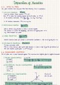
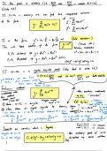
Triple Integrals in Spherical and Cylindrical Coordinates (WTW 258)
- Summary • 10 pages • 2024
-
- £4.54
- + learn more
Theme 2.4 Summary for WTW 258
-
Test Banks For Essential Calculus 2nd Edition by James Stewart, 9781133112297, Chapter 1-13 Complete Guide
- Exam (elaborations) • 298 pages • 2023
-
- £23.78
- 1x sold
- + learn more
Essential Calculus 2nd Edition 
 
2297 
 
0875 
 
0, 3, 4, 0, 2467, 3011, 9067, 6609 
 
1: Functions and Limits 
 
1.1: Functions and Their Representations 
 
1.2: A Catalog of Essential Functions 
 
1.3: The Limit of a Function 
 
1.4: Calculating Limits 
 
1.5: Continuity 
 
1.6: Limits Involving Infinity 
 
2: Derivatives 
 
2.1: Derivatives and Rates of Change 
 
2.2: The Derivative as a Function 
 
2.3: Basic Differentiation Formulas 
 
2.4: The Product and Quotient Rules 
 
2.5: The Chain ...
-
Test Banks For Essential Calculus 2nd Edition by James Stewart, 9781133112297, Chapter 1-13 Complete Guide
- Exam (elaborations) • 298 pages • 2023
-
- £14.17
- 1x sold
- + learn more
Essential Calculus 2nd Edition 
 
2297 
 
0875 
 
0, 3, 4, 0, 2467, 3011, 9067, 6609 
 
1: Functions and Limits 
 
1.1: Functions and Their Representations 
 
1.2: A Catalog of Essential Functions 
 
1.3: The Limit of a Function 
 
1.4: Calculating Limits 
 
1.5: Continuity 
 
1.6: Limits Involving Infinity 
 
2: Derivatives 
 
2.1: Derivatives and Rates of Change 
 
2.2: The Derivative as a Function 
 
2.3: Basic Differentiation Formulas 
 
2.4: The Product and Quotient Rules 
 
2.5: The Chain ...
-
GEO 203|62 MID EXAM 1 FINAL
- Exam (elaborations) • 6 pages • 2024
-
- £5.87
- + learn more
3 types of features on a map - ️️Point, line, and area features. 
3 types of irregular land grants - ️️pueblo grants 
private 
community 
3 types of scales - ️️verbal, graphic, representative fraction 
A Developable Surface - ️️A surface that can be mapped without distortion on a flat medium 
 
Spherical Earth is NOT a developable surface 
Instead we use planes, cones and cylinders which are developable 
Albers Equal Area Conic - ️️A projected coordinate system used for east-...
-
OCR 2023 Biology A H420/03: Unified biology A Level Question Paper & Mark Scheme (Merged)
- Exam (elaborations) • 52 pages • 2024
- Available in package deal
-
- £10.71
- + learn more
(a) A light micrograph of a section through the trachea of a cat is shown in Fig. 1.1. 
Fig. 1.1 
A 
B 
C 
(i) Name the tissues labelled A and B in Fig. 1.1. 
A ........................................................................................................................................ 
B ........................................................................................................................................ 
[2] 
(ii) Name the two types of cell in the box labelled C in...
As you read this, a fellow student has made another £4
-
BDOC NSS Exam Questions And Answers Already Graded A+
- Exam (elaborations) • 16 pages • 2024
- Available in package deal
-
- £6.66
- + learn more
Major Lights - a high intensity and reliable light exhibited from a fixed structure or marine site 
Primary Major Light - Established for making landfall from sea 
Secondary Major Light - Established at harbor entrances 
Minor Lights - Low to moderate intensity light used to mark a specific channel or location 
Two considerations for minor lights - o Care should be taken NOT to confuse minor lights with 
lighted buoys 
o Established in harbors, channels, rivers, and isolated locations 
Sector Li...
-
INSTRUCTOR’S SOLUTIONS MANUAL THOMAS’ CALCULUS TWELFTH EDITION WILLIAM ARDIS Collin County Community College
- Exam (elaborations) • 1022 pages • 2024
- Available in package deal
-
- £11.11
- + learn more
Functions 1 
1.1 Functions and Their Graphs 1 
1.2 Combining Functions; Shifting and Scaling Graphs 8 
1.3 Trigonometric Functions 19 
1.4 Graphing with Calculators and Computers 26 
Practice Exercises 30 
Additional and Advanced Exercises 38 
2 Limits and Continuity 43 
2.1 Rates of Change and Tangents to Curves 43 
2.2 Limit of a Function and Limit Laws 46 
2.3 The Precise Definition of a Limit 55 
2.4 One-Sided Limits 63 
2.5 Continuity 67 
2.6 Limits Involving Infinity; Asymptotes of Graphs ...
-
Intro to GIS (2022/2023) 100% Solved
- Exam (elaborations) • 22 pages • 2023
- Available in package deal
-
- £7.93
- + learn more
Intro to GIS (2022/2023) 100% Solved 3 parts of Geospatial Technology GPS, GIS, and Remote Sensing 
Definition of GIS a computerized database management system for capture, storage, retrieval, manipulation, analysis, and display of spatial data. 
what makes data spatial data is spatial once it is given a place on a map. 
4 types of distortion in Map Projections Area, Shape, Distance, and Direction 
What is GCS? spherical coordinate system of degrees of latitude and longitude that is used to loca...
-
GIS Exam Questions and Answers 2024/2025
- Exam (elaborations) • 31 pages • 2024
-
- £11.19
- + learn more
Why can getting points from a GPS into ArcGIS be problematic? 
 Poor connection - hardware and software issues; different 
companies/products/versions 
Difficult to find the specified datum/projection 
What is remote sensing? Give examples. 
 Collecting information from a distance; ex. photographs or radar/LiDAR. Typically 
satellite or air plane. Offer great detail over a continuous surface 
How is remote sensing imagery stored? 
 Great detail = large file sizes. Stored using raster ...
-
GISP Study Guide All Answers Correct
- Exam (elaborations) • 20 pages • 2024
- Available in package deal
-
- £7.85
- + learn more
GISP Study Guide All Answers Correct 
Geodatabase 
Definition: An object-oriented spatial model representing the native data structure for ArcGIS. It serves 
as the primary format for storing, editing, and managing geographic data. 
Types of Geodatabases 
Personal Geodatabase 
File Geodatabase 
Enterprise Geodatabase 
Workgroup Geodatabase 
Types of Geodatabase Datasets 
Geometric Network 
Network Dataset 
Parcel Fabric 
Terrain Dataset 
LAS Dataset 
Distance Relations 
Definitio...
How did he do that? By selling his revision notes on Stuvia. Try it yourself! Discover all about earning on Stuvia