Declination - Guides d'étude, Notes de cours & Résumés
Vous recherchez les meilleurs guides d'étude, notes d'étude et résumés sur Declination ? Sur cette page, vous trouverez 301 documents pour vous aider à réviser pour Declination.
Page 2 sur 301 résultats
Trier par

-
QMOW Questions and Correct Answers | Latest Update
- Examen • 28 pages • 2024
-
Disponible en pack
-
- 12,20 €
- + en savoir plus
What is the publication for deck logs? ~~>OPNAVINST 3100 What letter is never used for time zones? ~~>Juliet What do buoys with red and black stripes indicate? ~~>Isolated danger buoys What do buoys with red and white indicate? ~~>Safe water marks Ball, ball, ball dayshape ~~>Runs aground Ball diamond ball dayshape ~~>Restricted maneuvering 2 | P a g e | © copyright 2024/2025 | Grade A+ Master01 | September, 2024/2025 | Latest update How many time zones ar...
-
Track & Field Exam Test Questions And Revised Correct Answers
- Examen • 18 pages • 2024
-
- 7,80 €
- + en savoir plus
Track & Field Exam Test Questions And Revised Correct Answers What is the standard placement of Pole Vault - ANSWER : 18" (45.7 cm) ---> 31.5" (120 cm) [p. 59 6-9-13] What is the declination in Pole Vault approach limited to? - ANSWER : 2:100 - 2% [p. 56 Art, 24] The declination in the high jump shall not exceed.. - ANSWER : 1:100 - .1% [p. 56 Art. 18] For an NFHS record recorded in long jump, triple jump or any race not run around oval requires wind gauge recorded as not exc...
-
UCLA EPSS 61 Final Questions And Answers Rated A+ New Update Assured Satisfaction
- Examen • 11 pages • 2024
-
Disponible en pack
-
- 7,80 €
- + en savoir plus
Define Geologic Map - A record of the locations, orientations, and relationships between bodies of rock and geologic structures. List the three things that all maps must convey - 1: The Location of the map 2: The Orientation of the map 3: The Scale of the map Explain how latitude and longitude define a point on Earth's surface - Any point on Earth can be defined by the intersection of its lines of latitude and longitude. Latitude is the flat horizontal lines (flatitude) and longitude are...
-
CETP Exam Prep | 2024 Questions & Answers | 100% Correct | Verified
- Examen • 72 pages • 2024
-
Disponible en pack
-
- 15,13 €
- + en savoir plus
Primary motor innervation to the larynx and velum is provided by which cranial nerve? - Cranial nerve X (Vagus) Fela is a third-grade student in a public school. She is a speaker of African American Vernacular English (AAVE) who has difficulty with the Standard American English (SAE) dialect used in her classroom. Her teacher believes that Fela's language skills are affecting her academic performance and has referred her to the school's speech-language pathologist. Which of the following ...
-
Maine Guides Course Study Guide Accurate 100%
- Examen • 11 pages • 2024
-
Disponible en pack
-
- 11,71 €
- + en savoir plus
Contour Index Line - ANSWER Every fifth line, shows elevation WL - ANSWER Water level above sea level at the average high water mark Contour lines pointing north, which way does the brook flow? - ANSWER South Declination - ANSWER Difference between true north and magnetic north What does WELS stand for? - ANSWER West of the easterly line of the state of Maine What does TRN stand for? - ANSWER Township and range What are brown lines on a map called and what do they represent? - ...
-
Oceanography: EXAM 2 || A+ Graded Already.
- Examen • 21 pages • 2024
-
Disponible en pack
-
- 13,18 €
- + en savoir plus
Angle of of Earth's Tilt on its Axis correct answers ~23.5 degrees Ecliptic correct answers the plane traced by Earth's solar orbit Earth's Seasons: explanation correct answers 1) caused by unequal distribution of solar energy across Earth's surface due to the planet's tilt and rotation on its axis the 4 "Marks" of Earth's Seasons correct answers 1) vernal equinox 2) summer solstice 3) autumnal equinox 4) winter solstice Vernal equinox correct answers 1) starts on March 21...
-
GEG111 Final Exam Review
- Examen • 18 pages • 2023
-
Disponible en pack
-
- 7,81 €
- + en savoir plus
Define Geography - Study of Earth's physical features, inhabitants, and their spatial relationships/interactions Subfields of geographic study - Physical(landforms, water, soil, and animals) and Human(culture, economic and political) The Primary Steps of the Scientific Method - Observation, Hypothesis, Experimentation, Peer view, and Conclusion 4 primary environmental spheres - Atmosphere(air), Lithosphere(stone), Hydrosphere(water), and Biosphere(life) Latitude (parallels) - Lines go e...
-
Track & Field Exam Test Questions And Revised Correct Answers
- Examen • 18 pages • 2024
-
- 9,76 €
- + en savoir plus
Track & Field Exam Test Questions And Revised Correct Answers What is the standard placement of Pole Vault - ANSWER : 18" (45.7 cm) ---> 31.5" (120 cm) [p. 59 6-9-13] What is the declination in Pole Vault approach limited to? - ANSWER : 2:100 - 2% [p. 56 Art, 24] The declination in the high jump shall not exceed.. - ANSWER : 1:100 - .1% [p. 56 Art. 18] For an NFHS record recorded in long jump, triple jump or any race not run around oval requires wind gauge recorded as not exc...
-
Maine Guides Course Study Guide Accurate 100%
- Examen • 11 pages • 2024
-
Disponible en pack
-
- 11,71 €
- + en savoir plus
Contour Index Line - ANSWER Every fifth line, shows elevation WL - ANSWER Water level above sea level at the average high water mark Contour lines pointing north, which way does the brook flow? - ANSWER South Declination - ANSWER Difference between true north and magnetic north What does WELS stand for? - ANSWER West of the easterly line of the state of Maine What does TRN stand for? - ANSWER Township and range What are brown lines on a map called and what do they represent? - ...
-
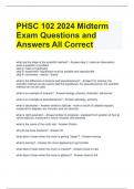
PHSC 102 2024 Midterm Exam Questions and Answers All Correct
- Examen • 16 pages • 2024
-
Disponible en pack
-
- 12,69 €
- + en savoir plus
PHSC 102 2024 Midterm Exam Questions and Answers All Correct what are the steps of the scientific method? - Answer-step 1: make an observation, pose a question or problem step 2: make a hypothesis step 3: experiment- hypothesis must be testable and reproducible step 4: conclusion - results - theory what is the difference of science and pseudoscience? - Answer-For science, the scientific method can be used to test the hypothesis. For pseudoscience, the scientific method can not be used...

Saviez-vous qu'un vendeur sur Stuvia gagne en moyenne 76 € par mois en vendant des ressources d'étude ? Hum, c'est peut-être un indice. Découvrez tout sur gagner de l'argent sur Stuvia


