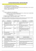
5.5c Storm Hazard Case Study – Hurricane Sandy, 2012
Objective: to learn about the impacts and responses associated with a recent storm hazard
- 2 3rd October (end of the hurricane season)
- Hurricane Sandy began in the Western Caribbean
- Path: Caribbean sea → (1st landfall where the destructive path started) Jamaica → Haiti → Cuba →
Bahamas → (final landfall) Atlantic City in USA
- Hurricane category 3 (at it’s max)
Causes:
1. Began as a depression in the Caribbean Sea.
a. Depression occurs due to the meeting of hot and cold air, creating rising air and generating
low pressure, which encourages cloud formation
i. produced snow
2. Moved over sea → it enhanced in strength → became a category 1 storm
3. Made first landfall in Jamaica with winds of 74mph.
EY FACT: It hit landfall at the same time as a full moon → which meant that any storm surges it created
K
were amplified by 3m due to the gravitational pull produced in this rare, tidal event.
Rank Primary impact S/Ec/En/P Rank Secondary impact S/Ec/En/P
1 Infrastructure Destroyed S, Ec 3 L andslides which cut off roads so S, Ec, En
along the Barrier coast people were unable to reach
(15,000 homes in Cuba) s ervices
3 F ires ignited by ruptured gas S,Ec,En 2 iver floods which closed the
R S , En, Ec,
pipes s econd largest Oil refinery in the P
East Coast
4 80% of crops destroyed S,Ec,En 1 0,000 people had to be rehoused
4
as a result of the snow and low
temperatures following Hurricane
Sandy.
5 233 people died S
2 airports shut down (JFK, La
3 S,Ec
Guardia and Newark)
Rank Immediate response Rank Long-term response
1 N and World Food Programme sent
U 2 S everal agencies in USA, raised money for
relief supplies (food, water, shelter) to victims eg. a telethon concert raised $20mil.
500,000 people in Cuba
3 In USA, electricity companies restored 1 SA government provided $50 bil to aid with
U
electricity recovery in affected areas
2 In USA, Red Cross had 4000 volunteers 3 S tricter building regulations were put in place
helping people affected in storm for future preperations
4 In NYC, the government provided
emergency supplies of petrol
, 1. Describe thespatialandtemporalsetting of the tropicalstorm.
Spatial setting:
● here / when did the event take place?
W
● Where did it affect?
● How large was the area affected?
● Include track of the storm with dates of where was affected.
Temporal setting:
● D o tropical storms occur regularly in this area/country? When was the last one?
● What category are they?
- 2 3rd October (end of the hurricane season)
- Hurricane Sandy began in the Western Caribbean
- Path: Caribbean sea → (1st landfall where the destructive path started) Jamaica → Haiti → Cuba
→ Bahamas → (final landfall) Atlantic City in US
istory of tropical storms
H
The warm and moist conditions, shadowed by a low pressure system, makes areas near the North Atlantic
Ocean extremely susceptible to hazards. However, Hurricane Sandy was considered to be the deadliest
and most destructive hurricane in the 2012 Atlantic hurricane season, showing that there was an
inaccurate perception of its strength and extent (3,200km across).This is similar to Typhoon Haiyan as no
s torm of this magnitude had been experienced previously in the same year, and so its nature or scale
could not be predicted in advance and it was harder to implement suitable methods which would modify
loss and vulnerability.
eather and climate
W
Like any storm hazard, Hurricane Sandy originated as a tropical storm in the Caribbean Sea which formed
on the 22nd October, where the warm temperature oceans, deep water and low pressure systems provided
latent heat energy and strong wind currents for the tropical storm to grow. It formed as a hurricane on the
23rd October.
On the Saffir-Simpson scale, Hurricane Sandy was recorded at a range of categories from 1 (New York) to
3 (Cuba). Eventually ending on 31st October, wind speeds and magnitude progressively decreased due to
landfall, making it weaker along its course. Despite this, the hurricane caused an extensive amount of
damage when it was at its strongest. It’s large-scale, quick-spreading nature made it unpredictable,
further increasing the risks and destructive impacts associated with it.
The enhanced greenhouse effect, where excessive amounts of CO2 in the atmosphere re-emits heat onto
the earth’s surface, causes global surface heating which contributed to the steric effect and increased
ocean temperatures and heights, providing ideal conditions for the formation of the hurricane. If the
disruption to the global carbon cycle continues, the conditions created can increase the frequency of
tropical storms occurring in the future.
Scientists believe that climate change was responsible for the ‘perfect conditions’ that caused Sandy’s
unusual behaviour, and the increased warming in the Arctic led to the wind and pressure patterns in the
Jet Stream.
2. A
ssess theperceptionof the tropical storms, andthe factors affecting those perceptions at a
range ofscales– E.g. magnitude, frequency, populationcharacteristics etc.
Is the populationpreparedfor such events? How?
●
● How can the magnitude of this event change people’s perception of future events?
● How has/will the frequency of earthquakes in this area affect their perceptions?


