Glaciers a level - Study guides, Revision notes & Summaries
Looking for the best study guides, study notes and summaries about Glaciers a level? On this page you'll find 13 study documents about Glaciers a level.
All 13 results
Sort by
-
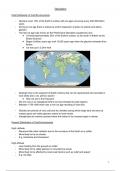
Glaciation Notes - Geography OCR A-Level
- Other • 24 pages • 2024
- Available in package deal
-
 elysiamsanders
-
- £7.99
- 3x sold
- + learn more
These notes helped me get the highest mark in the country for OCR Geography A-Level in June 2022! Detailed notes for all theory and concepts in the Glaciation topic. Does not include detailed analysis of case studies. Please see my other resources and my Quizlet account for that (@elysiasanders).

-
Test Bank for Living in the Environment 18th Edition Miller
- Exam (elaborations) • 448 pages • 2023
-
 ExamsExpert
-
- £24.49
- 1x sold
- + learn more
CHAPTER 3—ECOSYSTEMS: WHAT ARE THEY AND HOW DO THEY WORK? MULTIPLE CHOICE 1. Scientists estimate that tropical rain forests contain up to half of the earth’s land plants and animal species. What percentage of the world’s land surface do tropical rain forests cover? a. 2 b. 4 c. 8 d. 10 e. 12 ANS: A PTS: 1 TOP: 3-0 Core Case Study: Tropical Rain Forests Are Disappearing KEY: Bloom's: Remember NOT: New 2. The disappearance of the tropical rain forests is an import...
-
OCR alevel glaciated landscapes full module summary notes
- Summary • 31 pages • 2022
- Available in package deal
-
 austeja
-
- £8.49
- 7x sold
- + learn more
This document contains all the information and more than you need to get As in your exams. Inside has relevant and up to date facts and figures from the textbook and secondary research. You only need to remember a few facts for the top marks. Use these notes alongside your lessons or use them as a substitute. All the content you need is in here and it is written simply to help you understand and remember. Titles correspond to the specification which is also how the questions are set in your exam...

-
Physical Geology 14th Edition by Plummer - Test Bank
- Exam (elaborations) • 431 pages • 2023
-
 ExamsExpert
-
- £17.49
- + learn more
Chapter 01 Introducing Geology, the Essentials of Plate Tectonics, and Other Important Concepts True / False Questions 1. We depend on geologists for the raw materials we need for survival. TRUE Bloom's Level: 1. Remember 2. Most deaths associated with volcanic eruptions are due to burns of lava flows. FALSE Bloom's Level: 1. Remember 3. A tsunami has a small wave height, travels rapidly, and is not noticed by people in boats. TR...

-
A CONCISE INTRODUCTION TO LOGIC 13TH EDITION PATRICK J. HURLEY - TEST BANK
- Exam (elaborations) • 740 pages • 2023
-
 ExamsExpert
-
- £17.49
- + learn more
INSTRUCTIONS: The following selections relate to distinguishing arguments from nonarguments and identifying conclusions. Select the best answer for each. 1. Incandescent light bulbs eventually burn out because the high temperature of the filament causes tungsten atoms to fly off and collect on the inside of the bulb's glass. This loss of tungsten is slowed, but not prevented, by introducing argon inside the bulb's envelope. As more and more atoms are lost, the filament disintegrates. When t...

-
Natural Hazards and Disasters 5th Edition By Hyndman - Test Bank
- Exam (elaborations) • 190 pages • 2023
-
 ExamsExpert
-
- £17.49
- + learn more
1. Early warning systems provide about 10 minutes’ warning for populations near the epicenter of an earthquake. a. True b. False ANSWER: False REFERENCES: Predictions and Short-term Forecasts KEYWORDS: Bloom's: Remember 2. Changes in groundwater level are an effective predictor of earthquakes. a. True b. False ANSWER: True REFERENCES: Predictions and Short-term Forecasts KEYWORDS: Bloom's: Remember 3. Earthquakes are too unpredictable for the time ...

-
ASTRO 2ND EDITION SHOHINI GHOSE - Test Bank
- Exam (elaborations) • 264 pages • 2023
-
 ExamsExpert
-
- £17.49
- + learn more
1. Which of the following definitions best describes a constellation? a. a region of the sky containing a certain star pattern b. a group of very bright stars c. a group of very faint stars d. the dividing line between the north and south celestial hemispheres ANSWER: a 2. How many official constellations are there? a. 98 b. 88 c. 13 d. 55 ANSWER: b 3. Which of the following best describes the Big Dipper? a. an asterism b. a faint star near...
-
AP Environmental Science Review
- Exam (elaborations) • 95 pages • 2023
-
 YOURVERIFIEDEXAMPLUG
-
- £11.43
- + learn more
1. superposition The principle that any given rock layer is probably older than those above it and younger than those below it 2. continental crust Extends from surface of Earth down to 20-30 miles. Continental crust (granite) is less dense then ocean crust (basalt). 3. oceanic crust Extends down from the surface of the Earth to 7 miles. Crust is layered and very uniform. Com- posed of basalt. 4. mantle Contains most of Earth's mass. Composed of iron, magnesium, aluminum, and silicon-o...
-
AP Environmental Science
- Exam (elaborations) • 83 pages • 2023
-
 YOURVERIFIEDEXAMPLUG
-
- £11.51
- + learn more
1. Anthropogenic derived from human activities 2. Erosion The process by which wind, water, ice, or gravity transports soil and sediment from one location to another 3. Runoff Part of the water cycle where an excess of water runs down and does not sink into the soil and eventually makes it to the rivers, lakes, and oceans. 4. Denitrification process in which fixed nitrogen compounds are con- verted back into nitrogen gas and returned to the atmosphere 5. Nitrification ammonia (NH3) is conv...
-
Glaciated Landscapes and Change
- Summary • 7 pages • 2022
-
suzannateal
-
- £7.49
- + learn more
This document offers a summary of content on glaciers for A level geography (Edexel). It splits the content into the enquiry questions making the document easy to navigate. Most of the content is condensed into bullet points making for an quick and easy glance at perhaps before an exam. It includes the terminology crucial in the course and uses these words in context to help with your understanding of the new vocabulary.

That summary you just bought made someone very happy. Also get paid weekly? Sell your revision notes on Stuvia! Discover all about earning on Stuvia


