1
Tropical Environments (Case Studies)
Advanced Physical Geography Options
Cambridge International AS and A Level Geography
For Syllabus 9696
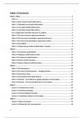
Case Studies
➢ Pakistan's floods, August 2010
➢ The climate of Brunei Darussalam
➢ El Niño Southern Oscillations
➢ Blue holes in the Bahamas
➢ Primary Succession after Krakatoa’s eruption in 1883
➢ Civil War & The Rwandan Rainforest
➢ The Heart of Borneo
Pakistan's floods, August 2010
Location
It is a sovereign country S. Asia or Indian Subcontinent. Population +199 million, 6th populous
country. Has 1,046 km coastline along Arabian Sea + Gulf Oman in S. Bordered by India to East +
Afghanistan to West, Iran to S.W., China to N.
Has 4 provinces with different cultures, languages, geography + climate.
- Punjab = largest pop.
- Balochistan = largest land mass
- Sindh = sea, Indus + Thar deserts
- North West Frontier Province (NWFP) mountains (peaks +25,000 feet)
Rivers burst banks N.W. Pakistan. As a result, first area was the Swat Valley flooded. Everything
along Indus river flooded.
Background Knowledge + Facts
- Pop. = 187 mil.
- Birth rate = 25 births per 1,000 pop.
- Death rate = 7 deaths per 1,000 pop.
,2
The flood was major hydro meteorological disaster. Climate change made severer. 17 million
people affected. 1,600 deaths. 1.2 mil. Houses damaged. 11,000 damaged schools. UN AID =
$168 mil. It continued through Summer (their worst flood since 1920s). Poor infras. didn’t help.
⅕ country along Indus river underwater. Indus river runs from N to S of Pakistan. It affected
more than 2004 Indian Ocean tsunami + Haiti 2010 combined.
27-30th July, 373 mm rain Murree, 394mm at Islamabad, 415 mm at Risalpur.
Peak discharge peaked 1.18 million cusecs compared to 327,000 normal.
Causes
End July 2010, heavier monsoon rains than 2009. Precipitation too intense infiltration occur,
increase overland flow. NW Pakistan rivers burst. Lasted nonstop for a month. At worst ⅕
country along Indus under water. 270 mm rain fell in Peshawar 24 hours. Further flooding in
August meant water flooded in previously damaged banks.
Major Causes
- Monsoon pattern + heavy rainfall
- Climate Change
- Deforestation
- Reduction in UN international disaster help
- Taliban
Pakistan climate varies rainfall ranging less 10 inches to 150 inches per year. Half of Pakistan’s
rainfall = July-Sept. (Monsoon season)
Heavy monsoon rainfall +200 mm recorded 4-day wet spell 27-30th July 2010 in Province
Khyber, Pakhtunkhwa + Punjab.
Unusual weather conditions, fast moving trough Subtropical jet stream combined with annual
monsoon event created record rainfall levels. Warm moist monsoon air from Indian ocean rose
quicker, unusual jet stream conditions. Resulted heavier rainfall.
Deforestation
- Pakistan highest rate deforestation in world
- 5% not occupied by forest as deforestation
, 3
- Lack of interception caused flooding
- Percolation, infiltration, soil saturation hindered, increased storm flow + runoff, increase
flood.
- High level illegal logging in Indus drainage basin caused more runoff from monsoon.
- The Taliban helped illegal loggers to chop down trees.
UN international Strategy + Taliban
- UN focused water supply, food drought, rather than defences against floods
- Taliban threatened hijack foreign aid attempts Pakistan, Fewer aid workers went.
Climate change also seen as possible, warm air hold more moisture so more rain. Indian ocean
increased 2 degrees over last 30 years.
Human factors for flood
- ⅔ pop. dependent farming for income, especially vulnerable to effects of flood hazards.
- Many people live close as good for crops, alluvial soil + irrigation.
- Many live below poverty line. Prior to floods 33% below, now 40 %. Flooded area so
large that poorer south affected
- Poor infrastructure hindered rescue teams, US helicopters helped
- Some places still damaged by 2005 earthquake
- Lack investment water infrastructure, dams built 1960s.
Impacts
Short term
- 1,600 dead,
- 1.2 mil. Houses damaged.
- 11,000 schools destroyed.
- 7 mil. homeless + broke
- Many living temporary shelters
- Agri. resources destroyed
80% fields waterlogged. 3.6 million hectares crops destroyed. 1.2 mil. Livestock + poultry lost.
Total cost of losses = $1 billion. Roads, bridges irrigation canal destroyed, electricity.

