100% tevredenheidsgarantie Direct beschikbaar na betaling Zowel online als in PDF Je zit nergens aan vast
logo-home
ESRI ArcGIS Desktop Certification exam 2024 with 100% correct answers €16,08   In winkelwagen

Tentamen (uitwerkingen)

ESRI ArcGIS Desktop Certification exam 2024 with 100% correct answers

 13 keer bekeken  0 keer verkocht

An ArcGIS user is working in the field collecting elevation values along a hiking trail. What must be done when creating the trail feature class to store the elevation values? A. set the tolerance to greater than .001 B. add a field called Elevation and make the geometry type Double C. assign t...

[Meer zien]
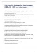
Voorbeeld 4 van de 66  pagina's

  • 15 januari 2024
  • 66
  • 2023/2024
  • Tentamen (uitwerkingen)
  • Vragen en antwoorden
Alle documenten voor dit vak (35)
avatar-seller
YANCHY
ESRI ArcGIS Desktop Certification exam
2024 with 100% correct answers

An ArcGIS user is working in the field collecting elevation values along a hiking trail. What must be done
when creating the trail feature class to store the elevation values?

A. set the tolerance to greater than .001

B. add a field called Elevation and make the geometry type Double C. assign the feature class a projected
coordinate system in units of meters

D. make the feature class z-enabled - correct answer D. make the feature class z-enabled


When is a transformation required while projecting data?

A. when the input data source is a network

B. when the input and output geographic coordinate systems are different

C. when the input and output spatial references are different

D. when the input feature class has an unknown spatial reference - correct answer B. when the input
and output geographic coordinate systems are different


Which effect does applying a join in ArcMap to a layer and a stand-alone table have?

A. It will create a new output feature class containing the layer and associated data

B. It will temporarily append the associated data to the layer's attribute table

C. It will permanently append the associated data to the layer's attribute table

D. It will create a new output layer containing the layer and associated data - correct answer A. It will
create a new output feature class containing the layer and associated data


Under which two circumstances is it appropriate for an ArcGIS user to use Data Driven Pages? (Choose
two)

A. when mapping campsite locations along a river

B. when mapping the different soil types within a single region

C. when mapping study areas in a national park

,D. when creating a map that displays all the countries of the world - correct answer A. when mapping
campsite locations along a river

C. when mapping study areas in a national park


An ArcGIS user is creating a map, and wants the point symbols used in a feature layer to scale as the
user zooms in or out. Which property must the user set in order to enable this functionality?

A. the reference scale for the data frame

B. the reference scale for the layer

C. the reference scale for the map document

D. the reference scale of the Layout view - correct answer A. the reference scale for the data frame


An ArcGIS user is editing a shapefile and wants to modify the boundary between two polygon features,
while ensuring that the boundaries remain coincident. Which tool allows the user to achieve this goal?

A. Reshape Feature tool

B. Reshape Edge tool

C. Cut Polygons tool

D. Edit Vertices tool - correct answer B. Reshape Edge tool


An ArcGIS user creates a model that includes the Clip tool and wants the x.y tolerance set as 500 feet in
the environment setting. What is the minimum environment setting level to override the default
settings?

A. application-level settings

B. tool-level settings

C. model-level settings

D. program-level settings - correct answer C. model-level settings


What are three ways for an ArcGIS user to create a new file geodatabase in ArcGIS Desktop? (Choose 4)

A. Create new file geodatabase in ArcCatalog

B. Use the New File Geodatabase tool from the Editor toolbar

C. Use the Command Line window

,D. Create File GDB tool in ArcToolbox

E. Create file geodatabase in Windows Explorer

F. Use Python to create File GDB - correct answer A. Create new file geodatabase in ArcCatalog

C. Use the Command Line window

D. Create File GDB tool in ArcToolbox

F. Use Python to create File GDB


An ArcGIS user is working with a map document that contains two data frames. How can the user export
a map image that contains data from both data frames?

A. export map from ArcCatalog

B. export map from Data view

C. export map from Layout view

D. export map from a Viewer window - correct answer C. export map from Layout view


An ArcGIS user wants to create a stand-alone table in a geodatabase that will contain additional
information about land parcels. The parcels reside in an existing feature dataset. Where will this table
reside in the geodatabase?

A. within the same feature dataset as the parcel feature class

B. within the geodatabase at the root level

C. within a newly created feature dataset

D. within a new network dataset - correct answer A. within the same feature dataset as the parcel
feature class


An organization manages multiple GIS projects and restricts data access to specific users. Which type of
geodatabase should the organization use?

A. distributed geodatabase

B. versioned geodatabase

C. replica geodatabase

D. modular geodatabase - correct answer B. versioned geodatabase

, An ArcGIS user is tasked with modeling water distribution for a city. Using existing geodatabase; how do
you proceed?

A. import the shapefiles into a feature dataset and create a geometric network

B. import the shapefiles into a feature dataset and create a network data set

C. create a geometric network from the feature dataset

D. create a network dataset from the feature dataset - correct answer C. create a geometric network
from the feature dataset


A coded value domain provides which two benefits for attribute editing? (Choose two)

A. It specifies valid values for an attribute

B. It stores rules for attribute display

C. It displays a user-friendly description

D. It validates all attributes in a given table - correct answer A. It specifies valid values for an attribute

C. It displays a user-friendly description


An ArcGIS user is viewing a feature layer that is being displayed in a projected coordinate system that
uses meters as the units. The user needs to see the map coordinates displayed in the status bar as
nautical miles. How can the units be changed without changing the coordinate system?

A. change the output coordinates in the Environment Settings

B. change the units used for distance in the Measure tool

C. change the display units of the feature layer

D. change the display units of the data frame containing the layer - correct answer D. change the
display units of the data frame containing the layer


What are two possible reasons for the features shifting? (Choose two)

A. ArcMap's on-the-fly projection is introducing random error in the new dataset

B. The new dataset is assigned to the wrong projected coordinate system

C. The wrong geographic transformation is used to protect the new dataset

D. The new datasets geometry is more accurate than the other layers in the map

E. The map projection required to project the new dataset is outdated - correct answer B. The new
dataset is assigned to the wrong projected coordinate system

Voordelen van het kopen van samenvattingen bij Stuvia op een rij:

Verzekerd van kwaliteit door reviews

Verzekerd van kwaliteit door reviews

Stuvia-klanten hebben meer dan 700.000 samenvattingen beoordeeld. Zo weet je zeker dat je de beste documenten koopt!

Snel en makkelijk kopen

Snel en makkelijk kopen

Je betaalt supersnel en eenmalig met iDeal, creditcard of Stuvia-tegoed voor de samenvatting. Zonder lidmaatschap.

Focus op de essentie

Focus op de essentie

Samenvattingen worden geschreven voor en door anderen. Daarom zijn de samenvattingen altijd betrouwbaar en actueel. Zo kom je snel tot de kern!

Veelgestelde vragen

Wat krijg ik als ik dit document koop?

Je krijgt een PDF, die direct beschikbaar is na je aankoop. Het gekochte document is altijd, overal en oneindig toegankelijk via je profiel.

Tevredenheidsgarantie: hoe werkt dat?

Onze tevredenheidsgarantie zorgt ervoor dat je altijd een studiedocument vindt dat goed bij je past. Je vult een formulier in en onze klantenservice regelt de rest.

Van wie koop ik deze samenvatting?

Stuvia is een marktplaats, je koop dit document dus niet van ons, maar van verkoper YANCHY. Stuvia faciliteert de betaling aan de verkoper.

Zit ik meteen vast aan een abonnement?

Nee, je koopt alleen deze samenvatting voor €16,08. Je zit daarna nergens aan vast.

Is Stuvia te vertrouwen?

4,6 sterren op Google & Trustpilot (+1000 reviews)

Afgelopen 30 dagen zijn er 81989 samenvattingen verkocht

Opgericht in 2010, al 14 jaar dé plek om samenvattingen te kopen

Start met verkopen
€16,08
  • (0)
  Kopen