100% tevredenheidsgarantie Direct beschikbaar na betaling Zowel online als in PDF Je zit nergens aan vast
logo-home
WGU D199:All Terms Defined: Introduction to Physical and Human Geography €11,70   In winkelwagen

Tentamen (uitwerkingen)

WGU D199:All Terms Defined: Introduction to Physical and Human Geography

 17 keer bekeken  0 keer verkocht
  • Vak
  • WGU D199
  • Instelling
  • WGU D199

WGU D199:All Terms Defined: Introduction to Physical and Human Geography immigrants people moving into a geographical area emigrants people moving out of a geographical area net migration the difference between the number of immigrants and the number of emigrants for a given geographical...

[Meer zien]
Voorbeeld 3 van de 21  pagina's

  • 22 augustus 2024
  • 21
  • 2024/2025
  • Tentamen (uitwerkingen)
  • Vragen en antwoorden
  • WGU D199
  • WGU D199
avatar-seller
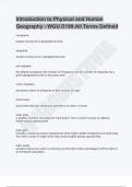
Introduction to Physical and Human
Geography - WGU D199:All Terms Defined
immigrants

people moving into a geographical area


emigrants


A
people moving out of a geographical area


VI
net migration


TU
the difference between the number of immigrants and the number of emigrants for a
given geographical area in any given year
IS
return migration

permanent return of emigrants to their country of origin
OM

travel visas

documents that give temporary permission to enter a country
NA


brain drain
a wealthy country's recruiting the "best brains" from a poorer country by offering
higher-paying opportunities
JP


brain gain
benefits a receiving country experiences when highly skilled immigrants are lured away
from their country of origin when they accept higher-paying opportunities


brain waste
situation that occurs when a receiving country fails to take advantage of all the skills of
an immigrant population

,push factors
conditions that encourage an individual to move from a location


pull factors
conditions that influence migrants to move to a particular location


reference maps
maps used to display important physical elements of a specific geographic area, such
as countries, rivers, mountains, etc.


A
thematic maps


VI
specialized maps used to understand one particular attribute or characteristic of a
specific geographic area; examples are population maps, weather maps, and maps
illustrating the spread of disease


TU
literal maps
maps that strive to display the objective truth about a specific geographic area
IS
figurative maps
maps that use symbols to represent a narrative or point of view; they are much less
concerned with physical accuracy than are literal maps
OM

analytical mapping
the use of cartography techniques to uncover and learn about patterns and trends in a
specific geographic area
NA


map scale
how the measurement of distance on a map corresponds to the distance on the ground
in the real world
JP


representative fraction (RF)
a way of describing the scale of a map by using a ratio


small-scale
a way of describing a map with a relatively small RF, where the various features of the
geography appear relatively small

, large-scale
a way of describing a map with a relatively large RF, where the various features of the
geography appear relatively large


coordinates
the points on a specified reference system that define the location of a particular place


Cartesian coordinate system
a reference system for a plane (a flat surface) based on the work of mathematician


A
Rene Descartes, using x- and y-axes.


VI
geographic coordinate system
the reference system devised to locate particular places on the surface of the earth,
using lines of latitude and longitude


TU
longitude
one of a set of imaginary east-west lines that form part of the geographic coordinate
IS
system


prime meridian
OM

the line of longitude that passes through Greenwich, UK, which is the starting point for
counting the rest of the lines of longitude


latitude
NA


one of a set of imaginary north-south lines that form part of the geographic coordinate
system


graticule
JP


the grid pattern in the geographic coordinate system


projection
a method of "flattening" a globe into a form that can be represented on a flat surface


conformal projections
maps that preserve, in the process of projection, angles, although not necessarily
lengths

Voordelen van het kopen van samenvattingen bij Stuvia op een rij:

Verzekerd van kwaliteit door reviews

Verzekerd van kwaliteit door reviews

Stuvia-klanten hebben meer dan 700.000 samenvattingen beoordeeld. Zo weet je zeker dat je de beste documenten koopt!

Snel en makkelijk kopen

Snel en makkelijk kopen

Je betaalt supersnel en eenmalig met iDeal, creditcard of Stuvia-tegoed voor de samenvatting. Zonder lidmaatschap.

Focus op de essentie

Focus op de essentie

Samenvattingen worden geschreven voor en door anderen. Daarom zijn de samenvattingen altijd betrouwbaar en actueel. Zo kom je snel tot de kern!

Veelgestelde vragen

Wat krijg ik als ik dit document koop?

Je krijgt een PDF, die direct beschikbaar is na je aankoop. Het gekochte document is altijd, overal en oneindig toegankelijk via je profiel.

Tevredenheidsgarantie: hoe werkt dat?

Onze tevredenheidsgarantie zorgt ervoor dat je altijd een studiedocument vindt dat goed bij je past. Je vult een formulier in en onze klantenservice regelt de rest.

Van wie koop ik deze samenvatting?

Stuvia is een marktplaats, je koop dit document dus niet van ons, maar van verkoper JPNAOMISTUVIA. Stuvia faciliteert de betaling aan de verkoper.

Zit ik meteen vast aan een abonnement?

Nee, je koopt alleen deze samenvatting voor €11,70. Je zit daarna nergens aan vast.

Is Stuvia te vertrouwen?

4,6 sterren op Google & Trustpilot (+1000 reviews)

Afgelopen 30 dagen zijn er 62890 samenvattingen verkocht

Opgericht in 2010, al 14 jaar dé plek om samenvattingen te kopen

Start met verkopen

Laatst bekeken door jou


€11,70
  • (0)
  Kopen