GISP - Geographic Information Systems Professional
Tentamen (uitwerkingen)
GISP Study Guide UPDATED Exam Questions and CORRECT Answers
6 keer bekeken 0 keer verkocht
Vak
GISP - Geographic Information Systems Professional
Instelling
GISP - Geographic Information Systems Professional
GISP Study Guide UPDATED Exam
Questions and CORRECT Answers
Geodatabase - Correct Answer- object oriented spatial model, native data structure for
ArcGIS, and is the primary data format used for storing, editing, and managing geographic
data.
Types of Geodatabases - Correct Answer- Personal...
GISP - Geographic Information Systems Professional
Verkoper
Volgen
MGRADES
Ontvangen beoordelingen
Voorbeeld van de inhoud
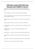
GISP Study Guide UPDATED Exam
Questions and CORRECT Answers
Geodatabase - Correct Answer- object oriented spatial model, native data structure for
ArcGIS, and is the primary data format used for storing, editing, and managing geographic
data.
Types of Geodatabases - Correct Answer- Personal, File, Enterprise, workgroup
Types of Geodatabase datasets - Correct Answer- Geometric network, network dataset, parcel
fabric, terrain dataset, LAS dataset
Distance relations - Correct Answer- specifies how far is the object away from the reference
object.
Examples of distance relations - Correct Answer- at, nearby, in the vicinity;far away
Euclidean Distance - Correct Answer- exact distance between two coordinates sqrt((x1-x2)^2
+ (y1+y2)^2))
Internal Direction - Correct Answer- where an object is located inside the reference object
External Direction - Correct Answer- where the object is located outside of the reference
object
Spatial Model - Correct Answer- basic properties and processes for a set of spatial features
Vector Data - Correct Answer- composed of points, lines, polygons
,Raster - Correct Answer- composed of rectangular arrays of regularly spaced square grid cells
and each cell has a value (attribute)
Pixel - Correct Answer- smallest resolvable piece of scanned image-pixel is always a cell but
a cell is not always a pixel.
Temporal - Correct Answer- the world is constantly changing. A static map can only show
one time period at once.
Imprecision - Correct Answer- all data is taken from a 3D globe and transferred to a 2D
surface through spatial transformations (projections and datum's) which causes distortions
with the data.
Uncertainty - Correct Answer- The GIS data was created/collected at a certain point of time,
may already be out of data.
Geoid - Correct Answer- the shape of the earth as defined by mean sea level and affected by
topographic and gravitational factors. What the shape of the earth would be if there were only
seas and no continents.
Reference Ellipsoid - Correct Answer- a mathematically defined surface that approximates
the geoid, the truer figure of the earth, or other planetary body.
Oblate ellipsoid - Correct Answer- fits the geoid to a first order approximation-formed when
an ellipse is rotated about its minor axis
Sphere - Correct Answer- As can be seen from dimensions of the Earth ellipsoid, the semi-
major axis 'a' and the semi-minor axis 'b' differ only by a bit more than 21 kilometeres
Spatial reference (SRS) or Coordinate system (CRS) - Correct Answer- is coordinate-based
local, regional or global system used to locate geographical entities
International Terrestrial Reference System (ITRS) - Correct Answer- Three-dimensional
coordinate system with a well-defined origin (the center of mass of the Earth) and three
orthogonal coordinate axes (X,Y,Z)
, Map projection - Correct Answer- transforming coordinates from a curved earth to a flat map
Horizontal Datum - Correct Answer- model of the earth as a spheroid (2 components,
reference ellipsoid and a set of survey points both the shape of the spheroid and its position
relative to the earth)
Vertical Datum - Correct Answer- reference point for elevations of surfaces and features on
the Earth-could be based on tidal, sea levels, gravimetric, based on a geoid
What kinds of things can be distorted with different map projections? - Correct Answer-
Distance, direction, shape, area
Datum - Correct Answer- Model of the earth as a spheroid
Geodetic datum - Correct Answer- a set of control points whose geometric relationships are
known, either through measurement or calculation.
NAVD88 - Correct Answer- gravity based geodetic datum in North America
North American Datum of 1927 (NAD 1927) - Correct Answer- based on the Clarke 1866
spheroid
North American Datum of 1983 (NAD 1983) - Correct Answer- based on the more accurate
GRS 1980 spheroid
WGS 84 (World Geodetic System) - Correct Answer- reference coordinate system used by
the Global Positioning System (GPS)
SRID Integer (Spatial Reference System ID numbers) - Correct Answer- EPSG codes defined
by the International Association of Oil and Gas producers.
Mercator projection - Correct Answer- Preserves shape and direction, area gets distorted -
projecting earth onto a cylinder tangent to a meridian (conformal).
Voordelen van het kopen van samenvattingen bij Stuvia op een rij:
Verzekerd van kwaliteit door reviews
Stuvia-klanten hebben meer dan 700.000 samenvattingen beoordeeld. Zo weet je zeker dat je de beste documenten koopt!
Snel en makkelijk kopen
Je betaalt supersnel en eenmalig met iDeal, creditcard of Stuvia-tegoed voor de samenvatting. Zonder lidmaatschap.
Focus op de essentie
Samenvattingen worden geschreven voor en door anderen. Daarom zijn de samenvattingen altijd betrouwbaar en actueel. Zo kom je snel tot de kern!
Veelgestelde vragen
Wat krijg ik als ik dit document koop?
Je krijgt een PDF, die direct beschikbaar is na je aankoop. Het gekochte document is altijd, overal en oneindig toegankelijk via je profiel.
Tevredenheidsgarantie: hoe werkt dat?
Onze tevredenheidsgarantie zorgt ervoor dat je altijd een studiedocument vindt dat goed bij je past. Je vult een formulier in en onze klantenservice regelt de rest.
Van wie koop ik deze samenvatting?
Stuvia is een marktplaats, je koop dit document dus niet van ons, maar van verkoper MGRADES. Stuvia faciliteert de betaling aan de verkoper.
Zit ik meteen vast aan een abonnement?
Nee, je koopt alleen deze samenvatting voor €9,71. Je zit daarna nergens aan vast.