100% tevredenheidsgarantie Direct beschikbaar na betaling Zowel online als in PDF Je zit nergens aan vast
logo-home
GIS Exam Practice Questions and Answers |100% Pass €12,20   In winkelwagen

Tentamen (uitwerkingen)

GIS Exam Practice Questions and Answers |100% Pass

 4 keer bekeken  0 keer verkocht
  • Vak
  • ArcGIS Pro Foundations
  • Instelling
  • ArcGIS Pro Foundations

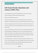
GIS Exam Practice Questions and Answers |100% Pass Why can getting points from a GPS into ArcGIS be problematic? - Answer-Poor connection - hardware and software issues; different companies/products/versions Difficult to find the specified datum/projection What is remote sensing? Give examples...

[Meer zien]
Voorbeeld 3 van de 27  pagina's

  • 5 oktober 2024
  • 27
  • 2024/2025
  • Tentamen (uitwerkingen)
  • Vragen en antwoorden
  • ArcGIS Pro Foundations
  • ArcGIS Pro Foundations
avatar-seller
EMILLYCHARLOTTE 2024/2025 ACADEMIC YAER ©2024 EMILLYCHARLOTTE. ALL RIGHTS RESERVED
FIRST PUBLISH SEPTEMBER 2024


GIS Exam Practice Questions and
Answers |100% Pass

Why can getting points from a GPS into ArcGIS be problematic? - Answer✔✔-Poor connection -

hardware and software issues; different companies/products/versions


Difficult to find the specified datum/projection


What is remote sensing? Give examples. - Answer✔✔-Collecting information from a distance; ex.

photographs or radar/LiDAR. Typically satellite or air plane. Offer great detail over a continuous surface


How is remote sensing imagery stored? - Answer✔✔-Great detail = large file sizes. Stored using raster

data models - typically, three rasters superimposed together to get color (one each for Red, Green, and

Blue value: RGB)


How can we pull information from remote sensing? - Answer✔✔-Can often be detected by the human

eye and then digitized or classified based on type; but is very time consuming and expensive. Plus,

humans can make mistakes. So we increasingly use computers to pull out the information correctly.

Computers use automatic processing, being trained to write rules to automatically pull out information.

This is hugely beneficial for large datasets. Not ideal for small areas.


What is artificial intelligence? - Answer✔✔-Show computer what to look for and it figures it out; E.g.

cancer on a brain scan, gentrification on street view. Cutting edge of computer technology - but humans

are unsure of how it actually works. Computer is literally thinking for itself (training itself). Huge

potential moving forward - perhaps someday replace all humans


Page 1/27

,EMILLYCHARLOTTE 2024/2025 ACADEMIC YAER ©2024 EMILLYCHARLOTTE. ALL RIGHTS RESERVED
FIRST PUBLISH SEPTEMBER 2024


What is LiDAR? - Answer✔✔-Light Detection and Ranging - similar to SONAR, but uses laser rather than

sound waves. Device sends out a laser pulse, and records how long it takes for it to bounce off surface

and return to detector. Benefits: Highly Accurate; can penetrate foliage


How are drones used in RS and what is their benefit - Answer✔✔-Similar to RS from air photos or

satellite. However, much cheaper to collect the information and can be collected by user at will, rather

than relying on someone else's satellite.


How can smart phones be used for data collection? - Answer✔✔-Because they are hugely powerful data

collection devices, with a large number of sensors (accelerometer, GPS, gyroscope, microphone,

barometer, thermometer). Have lots of storage for data, cloud connections, and high processing speed.

The fact that our phones are constantly collecting data about us creates massive privacy issues.


Define projections and coordinates. - Answer✔✔-Projections compensate for the earth being spherical

but being represented on a flat surface (map)


Coordinates allow us to accurately and reproducibly locate features on the earth's surface


Define geodesy - Answer✔✔-Science of measuring the shape of the earth - humans have been refining

the model for thousands of years


Describe earth's shape. - Answer✔✔-Earth is an Ellipsoid, not a perfect sphere. Two radii:


•r1, along semi-major (through Equator)


•r2, along semi-minor (through poles). More specifically, its shape is a geoid, because it is rough, not

smooth, due to differences in internal gravitational pull. This causes some areas to bulge out while

others are sunken.


Page 2/27

, EMILLYCHARLOTTE 2024/2025 ACADEMIC YAER ©2024 EMILLYCHARLOTTE. ALL RIGHTS RESERVED
FIRST PUBLISH SEPTEMBER 2024


What is essential for defining x/y coordinates? - Answer✔✔-The poles and equator


Define datum. - Answer✔✔-A model of the earth's size/shape (ie a model of the Geoid). Applied to a

specific origin/reference point. Different datums created for places around the world. Continually refined

over time (ex: NAD 27 vs 83). Not much change in recent decades. Horizontal and Vertical datums exist


With projections, is there more distortion on small scale or large scale maps? - Answer✔✔-Small scale

maps


Projections typically only maintain 1 or 2 of what following features, and must distort at least one

feature? - Answer✔✔-Area, shape, distances, and angles


Define spherical coordinates. - Answer✔✔-Use the length of a vector originating at the ellipsoid center

to define the location on the surface


Define latitude and longitude. - Answer✔✔-Latitude: Lines running parallel east to west; Equator is the

baseline


Longitude: Lines running from pole to pole; Meridians; Greenwich (Prime) Meridian is the baseline from

which measurements are made


Define UTM. - Answer✔✔-Divides the world into 60 zones (including North and South). Each zone has an

origin based on False Easting/Northing


Describe the relationship between GIS, coordinate systems, datum and projections and what happens in

GIS when they differ. - Answer✔✔-Each layer has a coordinate system, and datum (usually projection) -

even if it is not defined. All layers on the map must be in the same system to allow them to line up

Page 3/27

Voordelen van het kopen van samenvattingen bij Stuvia op een rij:

Verzekerd van kwaliteit door reviews

Verzekerd van kwaliteit door reviews

Stuvia-klanten hebben meer dan 700.000 samenvattingen beoordeeld. Zo weet je zeker dat je de beste documenten koopt!

Snel en makkelijk kopen

Snel en makkelijk kopen

Je betaalt supersnel en eenmalig met iDeal, creditcard of Stuvia-tegoed voor de samenvatting. Zonder lidmaatschap.

Focus op de essentie

Focus op de essentie

Samenvattingen worden geschreven voor en door anderen. Daarom zijn de samenvattingen altijd betrouwbaar en actueel. Zo kom je snel tot de kern!

Veelgestelde vragen

Wat krijg ik als ik dit document koop?

Je krijgt een PDF, die direct beschikbaar is na je aankoop. Het gekochte document is altijd, overal en oneindig toegankelijk via je profiel.

Tevredenheidsgarantie: hoe werkt dat?

Onze tevredenheidsgarantie zorgt ervoor dat je altijd een studiedocument vindt dat goed bij je past. Je vult een formulier in en onze klantenservice regelt de rest.

Van wie koop ik deze samenvatting?

Stuvia is een marktplaats, je koop dit document dus niet van ons, maar van verkoper EmillyCharlotte. Stuvia faciliteert de betaling aan de verkoper.

Zit ik meteen vast aan een abonnement?

Nee, je koopt alleen deze samenvatting voor €12,20. Je zit daarna nergens aan vast.

Is Stuvia te vertrouwen?

4,6 sterren op Google & Trustpilot (+1000 reviews)

Afgelopen 30 dagen zijn er 77254 samenvattingen verkocht

Opgericht in 2010, al 14 jaar dé plek om samenvattingen te kopen

Start met verkopen
€12,20
  • (0)
  Kopen