Universiteit Utrecht (UU) • Earth Surface and Water
Meest recente samenvattingen voor de opleiding Earth Surface and Water op de Universiteit Utrecht (UU). Op zoek naar een samenvatting voor Earth Surface and Water? Wij hebben diverse samenvattingen voor de opleiding Earth Surface and Water op de Universiteit Utrecht (UU).
-
11
- 0
- 0
Vakken Earth Surface and Water op de Universiteit Utrecht (UU)
Er zijn samenvattingen beschikbaar voor de volgende vakken van Earth Surface and Water op Universiteit Utrecht (UU)
- GEO4-4406 Land Surface Process Modelling GEO4-4406 1
- GEO4-4408 Remote Sensing GEO4-4408 2
- GEO4-4417 Unsaturated Zone Hydrology GEO4-4417 1
- GEO4-4423 Climate change, Hydrology & Cryosphere GEO4-4423 1
- GEO4-4425 Hazards and Risk Assessment GEO4-4425 2
- GEO4-4433 Advanced GIS for Geoscientists GEO4-4433 2
- GEO4-4436 River and Delta Systems GEO4-4436 2
Nieuwste samenvattingen Universiteit Utrecht (UU) • Earth Surface and Water
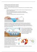
This document includes all the lectures of the course Hydrology, climate change and the cryosphere. - Climate change and the cryosphere - feedback mechanisms - Hydrological cycle - Climate modelling - Mountain meteorology - Models and measurements of the hydrological cycle - Glaciers and their response to climate change - Snow hydrology - Continental permafrost change - Mountain hydrology - Global tipping points
This document includes all the notes from the different lectures of Land Surface Process Modelling.
Summary of the articles that needed to be studied for Hazards and Risk Assessment.
This document has all the different lectures on Hazards and Risk Assessment. - Introduction - Earthquakes - Flood modelling - Drought - Debris flows - Glacial hazards - Flood forecasting - Saline water intrusion - Hazards governance - Rock weathering, rockfalls and hazards - Extreme weather predictions - Damage estimates after floods - Hazards and Insurance
These lecture notes include all the different lectures from the Unsaturated Zone Hydrology course. It consists of an introduction, soil water, richards equation, analythical solutions, transport, numerical solutions, SWAP, energy balance and soil physics.
These are the lecture notes of all the lectures of the Remote Sensing Course. - remote sensing introduction - imaging spectroscopy - spatial domain - deep learning - big data and google earth engine - temporal domain - esa - geophysics mass data processing of Landsat imagery
Summary of the articles that needed to be studied for the course Remote Sensing (GEO4-4408).
These are the lecture notes of all the lectures in the course of Advanced GIS for Geoscientists. It gives you the basics of GIS.
This document exists of different terms used in the Advanced GIS for Geoscientists course and gives a definition for each term.
Summary of articles that needed to be studied in the course River and Delta Systems.

