The road - Samenvattingen en Aantekeningen
Op zoek naar een samenvatting over The road? Op deze pagina vind je 46 samenvattingen over The road.
Populaire samengevatte studieboeken 'The road' · Toon alles (10) Sluit
The Road to Democracy in South Africa: 1970-1980
South African Democracy Education Trust
1 documenten
The Road to Social Work and Human Service Practice
Donna McAuliffe, Jennifer Boddy, Lesley Chenoweth
1 documenten
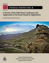
A Review of the 2001 Bonn Conference and Application to the Road Ahead in Afghanistan
Mark Fields, Ramsha Ahmed
1 documenten
Alle 46 resultaten
Sorteer op
 Populair
-
Alle literatuur en hoorcollege-aantekeningen Neuropsychology And Psychiatric Disorders
- Samenvatting • 82 pagina's • 2024
-
jhboerde
-
- €8,46
- 2x verkocht
- + meer info
De samenvatting bevat alle benodigde artikelen en leesstof voor het vak Neuropsychology And Psychiatric Disorders (dit studiejaar '24-'25). Daarnaast bevat het document ook alle hoorcollege aantekeningen: schizophrenia, mood disorders, ADHD, Tourette syndrome, ASS en identity & severe mental illness. Schizophrenia: Bora E, Yalincetin B, Akdede BB, Alptekin K. Duration of untreated psychosis and neurocognition in first-episode psychosis: A meta-analysis (2018). Green MF et al. App...
Dit rapport is een Herkansing opdracht voor het vak schriftelijk Rapporteren. kan ook gebruikt worden voor de reguliere opdracht
-
Esri Technical Certification: Sample Questions for ArcGIS Desktop Entry | Questions and Correct Answers | Latest Update 2024/2025 | 100% PASS
- Tentamen (uitwerkingen) • 20 pagina's • 2024
-
Ook in voordeelbundel
-
 AdelineJean
-
- €11,29
- + meer info
Esri Technical Certification: Sample Questions for ArcGIS Desktop Entry | Questions and Correct Answers | Latest Update 2024/2025 | 100% PASS An ArcGIS user chooses a mobile device to perform a field survey of road damage in an area. The user must obtain various types of information on the damage including surface type, damage, location, and an image of damage to the surface. Which ArcGIS platform application should be used for this task? Drone2Map for ArcGIS Collector for ArcGIS Exp...
-
Esri Technical Certification exam 2024 with 100% correct answers
- Tentamen (uitwerkingen) • 14 pagina's • 2024
-
 YANCHY
-
- €16,21
- + meer info
An ArcGIS user chooses a mobile device to perform a field survey of road damage in an area. The user must obtain various types of information on the damage including surface type, damage, location, and an image of damage to the surface. Which ArcGIS platform application should be used for this task? Drone2Map for ArcGIS Collector for ArcGIS Explorer for ArcGIS ArcGIS App - correct answer Collector for ArcGIS What is the default metadata style used by ArcGIS Pro? FGDC CSDGM m...
-
PATHOPHYSI D236 EMT FISDAP Final Test Questions and Answers 100% Correct 2022-2023
- Tentamen (uitwerkingen) • 11 pagina's • 2024
-
 TIFFACADEMICS
-
- €13,26
- + meer info
PATHOPHYSI D236 EMT FISDAP Final Test Questions and Answers 100% Correct what do you do for labored, contstriction, or lack of tidal volume Correct ans - assist ventilations with BVM What do you do for acid in eyes Correct ans - irrigate, if contacts take them out Signs and Symptoms of tension pneumothorax Correct ans - progressive shortness of breath increased altered level of consciousness neck vein distention tracheal deviation What organ could be affected by trauma to the upper ...
-
AVOP Exam – Definitions Latest Update Rated A+
- Tentamen (uitwerkingen) • 7 pagina's • 2024
-
Ook in voordeelbundel
-
 StellarScores
-
- €9,82
- + meer info
AVOP Exam – Definitions Latest Update Rated A+ Aerodrome Any area of land, water (including the frozen surface thereof), or other supporting surface used or designated, prepared, equipped, or set apart for use either in whole or in part for the arrival and departure, movement, or servicing of aircraft, and including any buildings, installations, and equipment in connection therewith. Aircraft Any machines capable of deriving support in the atmosphere from the reactions of the air....
-
YVR AVOP TEST PRACTICE MODULE 3 QUESTIONS AND ANSWERS 2024 WITH COMPLETE SOLUTION
- Tentamen (uitwerkingen) • 6 pagina's • 2024
-
Ook in voordeelbundel
-
 Wiseman
-
- €14,73
- + meer info
YVR AVOP TEST PRACTICE MODULE 3 QUESTIONS AND ANSWERS 2024 WITH COMPLETE SOLUTION Vehicle Corridor is a part of the apron identified with painted ___ lines which vehicles are authorized to travel. Ans- white ___ must be reduced when approaching Vehicle tunnels, blind corners, aircraft, apron pedestrian corridors, baggage make up areas and areas in construction zone. Ans- Speed ___ ___ must reduce their speed during poor weather conditions and low visibility. Ans- Equipment opera...
-
ESRI GIS Questions and Answers 2024/2025
- Tentamen (uitwerkingen) • 2 pagina's • 2024
-
 TestTrackers
-
- €10,31
- + meer info
If you are evaluating a road network and want to make sure that all of the roads consist of straight lines and 90-degree angles, which two data checks could you choose? The two checks that would fulfill these requirements are Nonlinear Segment and Cutbacks. The Nonlinear Segment check evaluates each segment in a polyline or polygon feature to determine whether it contains curves or arcs. With the Cutbacks check, you can specify a minimum allowable angle; any angle less than the mini...
-
ESRI Technical Certification exam 2024 with 100% correct answers
- Tentamen (uitwerkingen) • 5 pagina's • 2024
-
 YANCHY
-
- €17,19
- + meer info
An ArcGIS user chooses a mobile device to perform a field survey of road damage in an area. The user must obtain various types of information on the damage including surface type, damage, location, and an image of damage to the surface. Which ArcGIS platform application should be used for this task? - correct answer Collector for ArcGIS What is the default metadata style used by ArcGIS Pro? - correct answer Item Description An ArcGIS user is editing a parcel layer to reflect the additi...
-
PAM 3110 Final Exam Questions With Complete Questions And Answers.
- Tentamen (uitwerkingen) • 14 pagina's • 2024
-
Ook in voordeelbundel
-
 RealGrades
-
- €13,75
- + meer info
High-income countries ranked by drug spending - correct answer #1 US, Canada, Japan, France Of high income countries, the US spends the greatest percentage of its medical spending on drugs T/F - correct answer FALSE, Korea does, we are seventh What has driven higher drug spending in the US healthcare market? - correct answer Higher prices and greater usage of new more expensive dr...
-
Allesomvattende samenvatting literatuur cybercrime (inclusief artikelen)
- Samenvatting • 93 pagina's • 2024
-
berbervandermeer
-
- €10,46
- + meer info
Deze samenvatting bevat alle literatuur van het van cybercrime inclusief de hoofdstukken uit het voorgeschreven boek en de artikelen van: - Wall, D. (2014) High risk cybercrime is really a mixed bag of threats. - Kemp, S., Buil-Gil, D., Moneva, A., Miró-Llinares, F., & Díaz-Castaño, N. (2021). Empty streets, busy internet: A time-series analysis of cybercrime and fraud trends during COVID-19. - Steinmetz, K.F. (2015) craft (y) ness: An ethnographic study of hacking. The British Journal of...

Studiestress? Voor verkopers op Stuvia zijn dit juist gouden tijden. KA-CHING! Verdien ook aan je samenvattingen en begin nu met uploaden. Ontdek alles over verdienen op Stuvia


