esri
Esri
Pagina 4 van de 44 resultaten
Sorteer op
Esri Enterprise Administration Associate 10.5 Exam
Esri Technical Certification: Sample Questions for ArcGIS Desktop Entry ( Answered) Correctly!!
ESRI EXAM 1-30 QUIZZES & ANS GRADED A+
Esri Certification Practice Test 1 Questions With Complete Solutions.
-
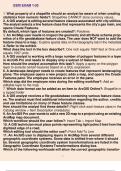
esri exam 1-30 1. What property of a shapefile should an analyst be aware of when creating statistics from numeric fields?: Shapefiles CANNOT store currency values. 2. A GIS analyst is editing several feature classes associated with city utilities. The an
- Tentamen (uitwerkingen) • 4 pagina's • 2023
-
 Millard
-
- €10,34
- + meer info
esri exam 1-30 1. What property of a shapefile should an analyst be aware of when creating statistics from numeric fields?: Shapefiles CANNOT store currency values. 2. A GIS analyst is editing several feature classes associated with city utilities. The analyst selects a line feature class that represents the city's gas main, and opens Create Features. By default, which type of features are created?: Polylines 3. An ArcMap user needs to inspect the geometry and attribute schema properties...
-
Esri Certification Practice Test 1 1. Which two spatial query operators will select point features that are surrounded by polygon features? (Select two) A. Completely Contain B. Are Completely Within C. Share a Line Segment With D. Intersect E. Touch the
- Tentamen (uitwerkingen) • 11 pagina's • 2023
-
 Millard
-
- €11,33
- + meer info
Esri Certification Practice Test 1 1. Which two spatial query operators will select point features that are surrounded by polygon features? (Select two) A. Completely Contain B. Are Completely Within C. Share a Line Segment With D. Intersect E. Touch the Boundary Of: a,d 2. Which limit is set for file geodatabase name length for ArcGIS Desktop?
-
ESRI EXAM QUESTIONS AND ANSWERS
- Tentamen (uitwerkingen) • 78 pagina's • 2023
-
 Greaterheights
-
- €15,27
- + meer info
1) SQL is a data sublanguage, not a complete programming language. - Answer- Answer: TRUE 2) When using SQL to create a table, a column is defined by declaring, in this order: data type, column name, and optional constraints. - Answer- Answer: FALSE 3) When using SQL to create a table, specifying the NULL property for a column indicates that only null values may be stored in that column. - Answer- Answer: FALSE 4) When using SQL to create a table, specifying a data type of Char(10) indi...

-
Esri Technical Certification: Sample Questions for ArcGIS Desktop Entry
- Tentamen (uitwerkingen) • 10 pagina's • 2023
-
Ook in voordeelbundel
-
 Greaterheights
-
- €12,31
- + meer info
An ArcGIS user chooses a mobile device to perform a field survey of road damage in an area. The user must obtain various types of information on the damage including surface type, damage, location, and an image of damage to the surface. Which ArcGIS platform application should be used for this task? Drone2Map for ArcGIS Collector for ArcGIS Explorer for ArcGIS ArcGIS App - Answer- Collector for ArcGIS What is the default metadata style used by ArcGIS Pro? FGDC CSDGM metadata ...
-
ESRI EXAM 1-30 QUESTIONS AN ANSWERS
- Tentamen (uitwerkingen) • 4 pagina's • 2023
-
Ook in voordeelbundel
-
 Greaterheights
-
- €10,34
- + meer info
What property of a shapefile should an analyst be aware of when creating statistics from numeric fields? - Answer- Shapefiles CANNOT store currency values. A GIS analyst is editing several feature classes associated with city utilities. The analyst selects a line feature class that represents the city's gas main, and opens Create Features. By default, which type of features are created? - Answer- Polylines An ArcMap user needs to inspect the geometry and attribute schema properties of a ...
-
Esri Certification Practice Test 1
- Tentamen (uitwerkingen) • 10 pagina's • 2023
-
Ook in voordeelbundel
-
 Greaterheights
-
- €12,81
- + meer info
Which two spatial query operators will select point features that are surrounded by polygon features? (Select two) A. Completely Contain B. Are Completely Within C. Share a Line Segment With D. Intersect E. Touch the Boundary Of - Answer- a,d Which limit is set for file geodatabase name length for ArcGIS Desktop? A. no limit B. limited to 32 characters C. limited to 255 characters D. limited to the number of characters the operating system allows in a folder name - Answer-...

Hoeveel heb je al uitgegeven op Stuvia? Stel je eens voor dat alle andere studenten JOU betalen voor je samenvatting. Ka-ching! Ontdek alles over verdienen op Stuvia

